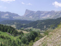
Tête de Claudel and Tête du Collier on Montagne de Faraut

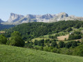
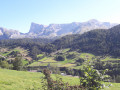
A very beautiful walk, though progress is not always swift. For experienced, well-equipped walkers who are not afraid to venture off the beaten track. The mountains in their wildest state.

(Warning): This hike includes difficult sections and is reserved for seasoned mountaineers who are not prone to vertigo.

Details

n°1313626
Creation:
Last update:
Last review:
  • Walking
    Activity: Walking
  • ↔
    Distance: 6.83 mi
  • ◔
    Duration according to the author: 10 hrs 
  • ▲
    Difficulty: Very difficult

  • ⚐
    Back to start: Yes
  • ↗
    Ascent: + 3,720 ft
  • ↘
    Descent: - 3,770 ft

  • ▲
    Highest point: 8,406 ft
  • ▼
    Lowest point: 4,875 ft

Photos

Description of the walk

Park at a place called Le Barry, on the D17T, a few dozen metres past the junction with the Route du Pin.

(S/E) Set off by taking theGR®93eastwards. Follow the Rif (a stream that is very often dry in summer) upstream. You’ll reach a Fork in the road near the Sources de Pierre Grosse.

(1) Do not head up the Combe de la Saume; leave theGR® to the left to reach a ridge line. From there, there is no marked path. Climb north then north-west (Serre du Bal) until you reach a cairn.

(2) The grass becomes sparser and the route less obvious. Continue along the ridge to another cairn.

(3) Change ridge lines to head north and pass behind the Tête de Girbault, gradually turning north-west.

(4) A tricky section, bordering on scrambling, to reach the summit ridge. The path is clearer and easier here, with a series of ascents over the various peaks and descents. Reach the Tête de Claudel.

(5) The ridge continues towards the Tête du Collier.

(6) Before climbing the Tête du Collier, note the path on the left which will provide the return route.

(7) Tête du Collier: continue towards Roc Roux.

(8) At the foot of Roc Roux, the ridge route can be continued (see § Practical Information). However, to avoid making the walk unnecessarily long, it is best to turn back towards the path noted earlier.

(6) Descend to the right, down into the ravine, avoiding the large slabs (steep slope); stick to the scree slopes instead. Continue towards the paragliding platform.

(9) This platform was used as a launch site for paragliders some time ago. To the north-west, an old forestry track begins. Take this track and follow it downhill until you rejoin theGR® at the foot of the Faraut.

(10) Turn left onto theGR® 93, skirting the fields to the south-east, and join the D17 at a place called Le Barry (S/E).

Waypoints

  1. S/E : mi 0 - alt. 4,941 ft - A place known as Le Barry
  2. 1 : mi 1.25 - alt. 5,272 ft - Pierre Grosse Springs
  3. 2 : mi 2.04 - alt. 6,591 ft - Cairn 1
  4. 3 : mi 2.34 - alt. 7,536 ft - Cairn 2: we change ridge lines
  5. 4 : mi 2.69 - alt. 7,927 ft - Foot of the gorge
  6. 5 : mi 2.83 - alt. 8,333 ft - Croix, Tête de Claudel
  7. 6 : mi 2.97 - alt. 8,212 ft - Between the Têtes Claudel and Collier
  8. 7 : mi 3.12 - alt. 8,402 ft - Tête du Collier
  9. 8 : mi 3.28 - alt. 8,235 ft - At the foot of Roc Roux.
  10. 9 : mi 4.35 - alt. 5,968 ft - Viewing platform
  11. 10 : mi 6.45 - alt. 4,911 ft - Foot of the Farraut GR
  12. S/E : mi 6.83 - alt. 4,915 ft - Le Barry

Notes

(8) The route can continue via the Roc Roux, then along the ridge of the Montagne de Faraud, before returning via the Chabournasse pass and joining theGR®93.

Proper kit is essential (footwear, clothing, possibly a rope).
There is no water, no refreshments and no shelter along the route.
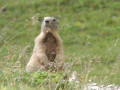
Binoculars will come in handy for spotting the abundant wildlife.
The slopes are often steep, there is one exposed section, and few marked paths.
Wild flora and fauna await you.

Always be cautious and plan ahead when you're outdoors. Visorando and the author of this route cannot be held responsible for any accidents occurring on this route.

The GR® and PR® markings are the intellectual property of the Fédération Française de Randonnée Pédestre.

Reviews and comments

4.7 / 5
Based on 1 review

Reliability of the description
5 / 5
Ease of following the route
4 / 5
Route interest
5 / 5
ed04
ed04

Overall rating : 4.7 / 5

Date of your route : Sep 09, 2024
Reliability of the description : ★★★★★ Very good
Ease of following the route : ★★★★☆ Good
Route interest : ★★★★★ Very good
Very busy route : No

very steep slopes: 1,100 metres at 44 per cent
The ‘chimney’ section at the top of Claudel isn’t actually that difficult for experienced walkers.
Impressive, breathtaking, magnificent scenery
vultures, herds of chamois
I didn’t do the circular route as described in the guidebook, but a return trip
Off-trail hike – and indeed, only suitable for experienced walkers with a head for heights

Machine-translated

Other walks in the area

For more walks, use our search engine .

The GPS track and description are the property of this route's author. Please do not copy them without permission.