Country:

 City:
City:


Park at the Fontaine du Courtil car park.
(S/E) Take the Chemin de la Charrière heading north. The tarmac soon gives way to dirt and stones. You’ll come to a cairn.
(1) Turn left onto the clearly marked path, which will lead you down through the woods. You’ll come out onto the Route des Guillards.
(2) Follow it to the right until you reach the bend, then take the wider path on the right until you come to a small Fork in the road.
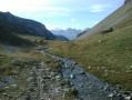
(3) Take the right-hand fork, which descends into the woods and joins the Souloise (river).
(4) Cross the river using the small footbridges and metal handrails provided for this purpose.
(5) Walk past the entrance to the Puits des Bans and continue along the Yellow route.
(6) Climb a few metres using several metal steps and a handrail. The path (exposed to the afternoon sun...) resumes and climbs quite steeply for several hectometres. Continue south-east to Les Hauts du Collet.
(7) You’ll come to a stretch of tarmac; turn right to head down into the hamlet and reach the fountain for a short break.
(8) Leave the hamlet via Rue de la Combette and turn right, just past the lodge, onto Chemin des Pommiers. Follow it southwards until you reach a junction with a wide path.
(9) At the junction, turn right to continue downhill and head towards the Souloise.
(10) Don’t miss the path that branches off to the left into the woods. It moves away from the river and rejoins the yellow (or orange) markings, which will guide you whilst keeping you close to the Souloise
(11) Cross the river via the Giersous footbridge (or by fording). Follow the path uphill; it becomes Impasse des Lotiers as you reach the hamlet of Giers. Turn left, then right onto the road for about 150 m. The Chemin de l’École on the right leads you to the Fontaine du Courtil (S/E).
 Visorando Member

 Difficult

 Association / Club / Walk leader
 Easy
Easy