Saint-Disdier from Le Courtil via La Souloise

A walk along the water’s edge, to warm up or for days when weather conditions at altitude are uncertain. Saint-Disdier can serve as a meeting point for other routes

Details

n°3030549
Creation:
Last update:
Last review:
  • Walking
    Activity: Walking
  • ↔
    Distance: 6.32 mi
  • ◔
    Average duration: 3h 45 
  • ▲
    Difficulty: Moderate

  • ⚐
    Back to start: Yes
  • ↗
    Ascent: + 938 ft
  • ↘
    Descent: - 928 ft

  • ▲
    Highest point: 4,311 ft
  • ▼
    Lowest point: 3,353 ft

Photos

Description of the walk

Car park near the chapel at Le Courtil (fountain).

(S/E) With the chapel on your left, follow the path heading south-west as you leave Le Courtil. Join the D117. Cross with care, then first turn left then right to pass through the houses in L’Auche. Further on, take a path on the right which runs parallel to the D17 before veering away from it and heading north-west.

(1) Keep to the right to stay on the yellow-marked path that runs alongside La Combette. Begin the descent, passing close to the ruins of Malmort. Continue down the slope until you reach a hairpin bend on the D117.

(2) Cross it carefully, then continue the descent towards La Souloise.

(3) Do not head towards the Puits des Bans but continue left towards Le Béal – Saint-Disdier; the route is marked in yellow (+ MTB). Stay on the left bank of the Souloise, following it as far as the Cerise bridge

(4) Cross the bridge and follow the path as it moves away from the Souloise, then rejoins the river a few metres beyond the bridge, this time on the right bank. Continue until the yellow-marked path turns into a small road and reaches the village of Saint-Disdier.

(5) The return journey follows the same route in the opposite direction as far as the hairpin bend on the D117.

(2) Turn left and follow the road with care as far as Le Courtil. Then take the first street on the left to reach the chapel car park (S/E).

Waypoints

  1. S/E : mi 0 - alt. 4,068 ft - Courtil Chapel
  2. 1 : mi 0.68 - alt. 4,265 ft - La Combette, on the right
  3. 2 : mi 1.53 - alt. 3,802 ft - Route
  4. 3 : mi 1.82 - alt. 3,596 ft - Junction with the D117 – Follow the > - Souloise (rivière)
  5. 4 : mi 2.55 - alt. 3,465 ft - Pont de la Cerise
  6. 5 : mi 3.46 - alt. 3,353 ft - Saint-Disdier – Fountain
  7. S/E : mi 6.33 - alt. 4,075 ft - Courtil Chapel

Notes

Water at the start and in Saint-Disdier; lodge in Saint-Disdier.

Worth a visit

(S/E) – “Les Chanterelles” cheese shop in Le Courtil: sheep’s cheese and lamb.
- “Interstellaire du Dévoluy” brasserie in Le Courtil, just to quench your thirst a little...
Via Ferrata at Les Etroits.

Reviews and comments

5 / 5
Based on 1 review

Reliability of the description
5 / 5
Ease of following the route
5 / 5
Route interest
5 / 5
dick le montagnard
dick le montagnard

Overall rating : 5 / 5

Date of your route : Mar 15, 2020
Reliability of the description : ★★★★★ Very good
Ease of following the route : ★★★★★ Very good
Route interest : ★★★★★ Very good

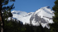
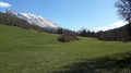
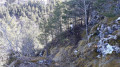
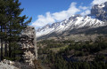
A lovely walk along the valley floor. The route is snow-free in late winter (so no need for snowshoes), following the Souloise stream during the second half of the outward journey (and the first half of the return journey, as you retrace your steps). The GPS track is very reliable, as are the route description and the map outline. The start of the walk from Le Courtil takes you through meadows and a few wooded areas. There are lovely views of the surrounding peaks. After about half an hour, you follow a ridge leading to the ruins of Malmort Castle (between points 1 and 2 on the map). A local resident from St-Disdier whom we met on the path strongly advised us to go round the castle ruins (only an old wall remains) on the left rather than on the right, to avoid causing further damage to the site. Indeed, the original route has been altered. The well-marked path at this point now bypasses the ruins to the left before descending towards the D117 via a series of hairpin bends. Several very steep sections are secured with a handrail (rope) and even metal rungs to hold on to and help you climb. Please note that after crossing the Pont de la Cerise (point 4), do not immediately take the barely visible path after the bridge pier, but follow the more clearly marked path to the left just after the rubbish bins.
There is nothing in particular to add about the rest of the walk, except that the return journey is more tiring than the outward one, as you have to climb back up to Le Courtil. The final 1,500 metres are along the D117 and present no problems, as the road is wide and offers good visibility.

Machine-translated

Other walks in the area

For more walks, use our search engine .

The GPS track and description are the property of this route's author. Please do not copy them without permission.