The small pass du Tat and the Malmort Forest

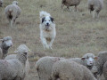
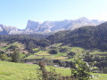
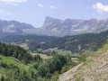
A walk that takes you through the forests of the Dévoluy, past sheepfolds and flocks, then up along the local stream.

Details

1333327
Creation:
Last update:
Last review:
  • Walking
    Activity: Walking
  • ↔
    Distance: 9.29 mi
  • ◔
    Average duration: 5h 55 
  • ▲
    Difficulty: Moderate

  • ⚐
    Back to start: Yes
  • ↗
    Ascent: + 1,923 ft
  • ↘
    Descent: - 1,909 ft

  • ▲
    Highest point: 5,289 ft
  • ▼
    Lowest point: 3,465 ft

Photos

Description of the walk

(S/E) Start from Le Courtil. Cross the D117, take the path that climbs southwards and joins the D17.

(1) Cross with care, head straight ahead and then turn immediately right, following the yellow markings. Continue first south, then south-west.

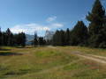
(2) Ignore a path on the left and carry straight on. Pass through Bois la Baume, at the foot of the ridge of the same name, following a series of bends.

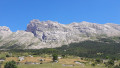
(3) On leaving the woods, head straight on to pass in front of the Roumayou and its spring. Climb the path to reach the Collet du Tat and enjoy the view. This is the highest point of your day.

(4) Turn back for a few dozen metres, then turn left onto theGR® de Pays “Tour du Dévoluy variant” towards the Joue du Loup ski resort.

(5) Ignore the path on the right and continue in the same direction to enter the resort. Join the D17c.

(6) Turn right and continue until you reach the D17 at the Col de Rioupes.

(7) Turn right, then, about fifty metres further on, turn left onto the yellow-marked path which first runs along the edge of the forest, then deep into the woods heading north-north-east.

(8) At the junction, carry on straight ahead along the path which heads due north and descends into the Bois de Malmort, taking first a right-hand bend and then a left-hand bend. The route then turns north-west to reach the D117.

(9) Cross with care to join the small D520 road opposite. At the bridge, head down to the right along the banks of the Souloise, staying on its left bank; this is the lowest point of your walk.
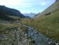
Follow the stream upstream along the path, which is marked in yellow throughout. A few hairpin bends with a steeper incline lead to the junction with the Chemin du Puits des Bans, which is on the opposite bank.

(10) Continue straight on (south) along the path until you reach the D17 road at a hairpin bend, near the houses in Malmort.

(11) Take the road on the left and follow it carefully for about 1 km to reach Le Courtil (S/E).

Waypoints

  1. S/E : mi 0 - alt. 4,042 ft - Le Courtil
  2. 1 : mi 0.3 - alt. 4,236 ft - Crossing the D17
  3. 2 : mi 0.9 - alt. 4,787 ft - Path junction: go straight on
  4. 3 : mi 1.64 - alt. 5,062 ft - Exit at Bois la Baume, go straight on
  5. 4 : mi 1.97 - alt. 5,289 ft - Small pass of Tat
  6. 5 : mi 3.03 - alt. 4,715 ft - Crossroads, go straight on
  7. 6 : mi 3.38 - alt. 4,757 ft - La Joue du Loup, on the right
  8. 7 : mi 3.87 - alt. 4,685 ft - Col de Rioupes (1428m)
  9. 8 : mi 5.08 - alt. 4,741 ft - Puy de Rioupes, crossroads
  10. 9 : mi 7.07 - alt. 3,507 ft - D117. Turn right at the Cerise bridge - Souloise (rivière)
  11. 10 : mi 8.06 - alt. 3,606 ft - Junction with the Puits des Bans path
  12. 11 : mi 8.35 - alt. 3,802 ft - Malmort bend
  13. S/E : mi 9.29 - alt. 4,045 ft - Le Courtil

Notes

No special equipment required; water is available at Le Courtil, La Fontaine du Roumayou and La Joue du Loup.
Shelter is available at La Joue du Loup and, if necessary, at Rioupes… or under the Cerise bridge.

Worth a visit

(S/E) Don’t miss the fountain and the chapel
- “Les Chanterelles” cheese shop at Le Courtil – sheep’s cheese and lamb.
- “Interstellaire du Dévoluy” brewery in Le Courtil, just to quench your thirst a little...

(10) On the left, the Puy des Bans for caving. This isn’t something you can just turn up for – specialist equipment is required.

The Via Ferrata des Étroits. Please note: specialised equipment is essential. As you follow the road, you’ll get a lovely view of it, which might just whet your appetite.

The Joue du Loup resort with its shops and mountain activities.

La Mère Église and its cemetery in Saint-Disdier.

Always be cautious and plan ahead when you're outdoors. Visorando and the author of this route cannot be held responsible for any accidents occurring on this route.

The GR® and PR® markings are the intellectual property of the Fédération Française de Randonnée Pédestre.

Reviews and comments

4.8 / 5
Based on 2 reviews

Reliability of the description
5 / 5
Ease of following the route
5 / 5
Route interest
4.5 / 5
Phasme91
Phasme91

Overall rating : 5 / 5

Date of your route : Jul 12, 2022
Reliability of the description : ★★★★★ Very good
Ease of following the route : ★★★★★ Very good
Route interest : ★★★★★ Very good
Very busy route : No

A nice walk; the climb up to the Joue du Loup is quite steep.

Machine-translated

mimiguy
mimiguy

Overall rating : 4.7 / 5

Date of your route : Aug 11, 2021
Reliability of the description : ★★★★★ Very good
Ease of following the route : ★★★★★ Very good
Route interest : ★★★★☆ Good
Very busy route : No

A superb hike – well done to the organisers

Machine-translated

Other walks in the area

For more walks, use our search engine .

The GPS track and description are the property of this route's author. Please do not copy them without permission.