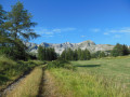
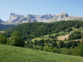
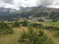
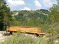
The Bois Rond as seen from Les Cypières

The route starts off steeply from Les Cypières, after which the walk presents no particular difficulties.

Details

1304104
Creation:
Last update:
Last review:
  • Walking
    Activity: Walking
  • ↔
    Distance: 4.80 mi
  • ◔
    Average duration: 3h 00 
  • ▲
    Difficulty: Easy

  • ⚐
    Back to start: Yes
  • ↗
    Ascent: + 892 ft
  • ↘
    Descent: - 919 ft

  • ▲
    Highest point: 5,121 ft
  • ▼
    Lowest point: 4,278 ft

Photos

Description of the walk

After Saint-Étienne-en-Dévoluy, head towards Les Cypières. Park in the hamlet, near the chapel.

(S/E) On foot, head up towards the Route de Superdévoluy (D17b); after the last house, at the bend, take the path to the left of the road towards “Les Vallonnettes”. The climb is steep but accessible to everyone if you take your time.

(1) At Clot des Millioux, at the fork, continue straight ahead, veering slightly to the right towards “Grotte des Baumettes”. The path descends and then climbs again to the small pass of Praperouse.

(2) At Collet du Prapérouse, head down towards a junction (at the edge of the woods), then turn right onto the forest track towards Bois Rond. Pass close to a pylon for the Pic de Bure cable car and follow the path to the left, which leads to a junction where there is a car park.

(3) Take the forest track on the left towards Bois Rond. Continue to the Pont du Villard.

(4) At the bridge, carry on along the path opposite. Continue straight on through Le Villard and then Les Nonnes; the path leads into a field with two signposts: Les Cypières or Saint-Étienne-en-Dévoluy.

(5) Turn left towards Les Cypières onto the small path through the fields. You’ll reach the Les Cypières chapel, where you’ll find the car park (S/E).

Waypoints

  1. S/E : mi 0 - alt. 4,423 ft - Les Cypières
  2. 1 : mi 1.07 - alt. 5,007 ft - Clot des Millioux
  3. 2 : mi 1.57 - alt. 5,075 ft - Small pass of Prapérouse
  4. 3 : mi 2.07 - alt. 5,036 ft - Bois Rond
  5. 4 : mi 3.73 - alt. 4,446 ft - Pont du Villard
  6. 5 : mi 4.49 - alt. 4,278 ft - Head towards Les Cypières
  7. S/E : mi 4.8 - alt. 4,423 ft - Les Cypières

Notes

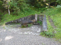
Drinking water available at the Fontaine d’Hurtillier in the Bois Rond.

Worth a visit

Please note that after the small pass du Prapérouse (2), on the descent towards a junction (start of the woodland): on the left, the path leads to the car park at the Pic de Bure cable car station. Do not take this route unless you wish to shorten the walk, as it leads back to the same point, “Pont du Villard”.

Reviews and comments

4.3 / 5
Based on 3 reviews

Reliability of the description
4.7 / 5
Ease of following the route
4 / 5
Route interest
4.3 / 5
User 11680669

Overall rating : 4 / 5

Date of your route : Jul 25, 2026
Reliability of the description : ★★★★☆ Good
Ease of following the route : ★★★★☆ Good
Route interest : ★★★★☆ Good
Very busy route : No

Hello
We were a bit unsure at the Villard bridge because the description tells us to follow the path opposite, whereas it’s actually a road. Otherwise, everything’s fine
Kind regards

Machine-translated

User 29683382

Overall rating : 4.7 / 5

Date of your route : Jun 15, 2026
Reliability of the description : ★★★★★ Very good
Ease of following the route : ★★★★☆ Good
Route interest : ★★★★★ Very good
Very busy route : No

A lovely, easy walk – make sure you follow the signs carefully towards the end of the route.

Machine-translated

User 1439945

Overall rating : 4.3 / 5

Date of your route : Sep 08, 2025
Reliability of the description : ★★★★★ Very good
Ease of following the route : ★★★★☆ Good
Route interest : ★★★★☆ Good
Very busy route : Yes

The first part is very pleasant, in the woods, but the end of the circuit is on the road, under the sun, and walking on asphalt in August is not very pleasant...

Machine-translated

Other walks in the area

For more walks, use our search engine .

The GPS track and description are the property of this route's author. Please do not copy them without permission.