Country:
 City:
City:


From Audierne, head towards “Plogoff – Pointe du Raz” via the D784 and continue for 8 km to Anse du Loc’h, where you can park on the left.
PR® marked in yellow, mainly with signposts.
(S/E) With your back to the car park, cross the D784 at the pedestrian crossing, turn right and then left, at the corner of a crêperie, onto the Route de Cléden-Cap-Sizun. After about 100 m, turn left onto Rue du Yun, which climbs towards the Loc’h housing estate. At the bend in the road, near a transformer, take a path on the right which leads to a street in the hamlet of Landrer. Look out for the small chapel
Saint-André on your left (with an Iron Age stele near the chapel).
(1) Walk through the hamlet and, at the end of the dead-end street, continue along the path that descends into the valley until you reach a junction.
(2) Turn left and walk along the hillside, ignoring the paths that lead down to the valley floor. Walk uphill to emerge in the hamlet of Trogor and cross it by turning right. In this hamlet, note the beautiful architecture, with its houses bearing inscriptions carved into the granite.
(3) On leaving the hamlet, take the path lined with cypress trees at the start, then turn left towards the west onto some lovely paths and join a small road at the entrance to Plogoff. Follow it to the left and cross the car park on your right.
(4) As you leave the car park, walk past Saint-Collodan Church (note the sculptures of ships on the south side and on the bell tower), first turn left then right to enter a dead-end road on the right before the cemetery, and continue along the path leading downhill. At the first fork, turn left twice and head back up towards the hamlet of Kerhas (at the far end of the cemetery opposite).
(5) Follow the road to the right, ignore a cul-de-sac on your left and, at the sign for Kerisbleis, turn onto a path on the right which crosses a wooded area and leads out onto the access road to the two houses at Kerguen.
(6) Go round them on the left and continue along a dirt track which passes a fountain and a wash house with a tiled floor, and, on your right, a large garden and orchard. Continue westwards, ignoring the turn-offs to the hamlet of Le Manoir. Carry on along the hillside until you reach a Fork in the road.
(7) Turn right at the sign for “viewpoint”, climb a small hill offering a view of Baie des Trépassés and Étang de Loual (bench), retrace your steps and continue uphill towards the D607.
No signposting
(8) Cross this road, pass through the hamlet of Kerherneau, then turn left to join the D784.
PR® route marked in yellow, mainly by signposts.
(9) First turn right then left to cross this departmental road with care and continue along the small road opposite. Turn right onto the first path which joins a street; follow this for about 100 metres, then turn left onto a footpath leading to the Chapelle Saint-Michel (a lovely grassy spot for a picnic, if you wish).
(10) Walk round the chapel and retrace your steps for about ten metres before turning right (signpost), passing close to the large washhouse and the Lescoff fountain (another potential picnic spot) and
follow the path which joins a small road.
(11) Follow it to the right, pass to the right of Kerhuon and continue down a track that’s passable by vehicles but closed to motorised traffic, until you reach the coastal path (GR®®34).
GR® 34 andGRP®® Tour du Cap Sizun
(12) Turn left, heading south-east, and continue towards Pointe de Feunteun Aod (note the low-growing broom).
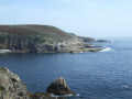
(13) Head back up along theGR®®, keeping to the path closest to the coast to discover the small sheltered harbour of Feunteun Aod (Fontaine de la Grève) (information board). Follow the access road to the harbour up to the start of a path through the moorland.
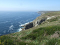
(14) Turn right onto the path closest to the coast and continue due east along the coastal path which follows the seashore at the top of the cliff, then descend into a small valley (footbridge).
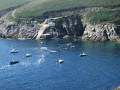
(15) Walk back up, cross two more footbridges and reach the access road to the sheltered harbour of Pors Loubous, which was, in the 1920s, the most important in Plogoff. A monument commemorates the role played by this harbour in sheltering members of the Resistance in the winter of 1940 (information panel).
No signposting
(16) Retrace your steps and head up the access road to the small harbour. Follow this road as it passes through the large hamlet of Pennéac’h. Continue uphill, ignoring the side streets, heading towards the D784, and cross a side track (cycle sign).
PR® signposted in yellow
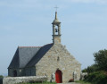
(17) Turn right onto this footpath and cycle path and join the road that runs through the hamlet of Kergroas. Take this road to the right, pass a cross in a grassy enclosure and arrive at the Chapel of Notre-Dame-de-Bon-Voyage, built between 1698 and 1703 following a vow; it offers a beautiful view over Audierne Bay.
(18) Walk round the chapel and continue along the path that leads down to the right, across the moor, to rejoin the coastal path you left earlier.
GR® 34 andGRP®® Tour du Cap Sizun
(19) Leave Pointe de Plogoff on your right and head left, following theGR®®34. Walk round a headland marked by an isolated house (view of Anse de Loc’h and the Primelin coast), turn left and walk along this cove. Cross a small pebble beach, come out onto a small road and follow it to the D784. Turn right to return to the car park near the beach (S/E).
 Visorando Member
 Difficult
 Easy
Easy