From Plogoff to the Castelmeur Oppidum

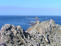
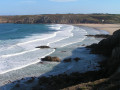
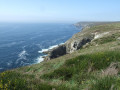
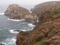
From Plogoff, head through the countryside, passing through several traditional villages, to reach the Castelmeur Oppidum on the north coast of Cap Sizun. Return via a different route.

Details

23477982
Creation:
Last update:
Last review:
  • Walking
    Activity: Walking
  • ↔
    Distance: 6.43 mi
  • ◔
    Average duration: 3h 20 
  • ▲
    Difficulty: Moderate

  • ⚐
    Back to start: Yes
  • ↗
    Ascent: + 413 ft
  • ↘
    Descent: - 400 ft

  • ▲
    Highest point: 253 ft
  • ▼
    Lowest point: 30 ft
  • ⚐ Country: France
  • ⚐ City: Plogoff (29770)
  • ⚑
    Start/End: N 48.03684° / W 4.666731°
  • ❏
    IGN map(s): Ref. 0419ET
  • Hour-by-hour weather

Description of the walk

Park at Place de Taverny in Plogoff.

(S/E) Walk down Place de Taverny, turn left up towards the church, then turn left again.
On the right, after 50 metres, between two houses, take a cul-de-sac and continue along the path lined with a dry-stone wall. Walk down into the valley, cross the stream and continue straight on towards the north.

(1) When you reach a stony track, turn left towards the village of Lézanquel. In the village, follow the tarmac road to the right until you reach the Cléden-Cap-Sizun road at Baie des Trépassés. Turn right onto this road for a few metres and continue to the left until you reach the village of Kerhermen.
Head through the village towards the left.

(2) Before the last farmhouse, take the path on the right, then turn onto the first track on the left. Follow this slightly uphill stony track. Pass a grassy path on the left and reach the D7 road, the road towards Pointe du Van. Cross it carefully (no pedestrian crossing) and head towards the village of Kerbesquerrien.

.(3) Follow the tarmac road on the left, which then becomes a stony track. Do not take the first path on the right after the tarmac road ends, but take the second one instead.

(4) After about 200 m, cross the moorland along a faint track (near a sign with faded colours), pass through a hedge of blackthorn to join theGR®34and follow this to the left until you reach the Oppidum site.

(5) It is possible to visit this promontory, although the path through the moat is quite overgrown with thorny bushes.
For the return journey, head back up to the car park (unpaved) and turn left onto a path that descends through willow trees to a stony track. Head up to the right towards the village of Kernot and continue on to the departmental road.

(6) On this road, continue carefully to the right, then, at the road sign, take the road on the left which descends towards the village of Kerléodin.

(7) Leave this road on your left and follow the gravel track to the right. At the first bend, turn left and head down to the Chapel of Saint-Tugdual at a place called Trouzent.

(8) In the village, head back up to the left, then take the first path on the right. Follow this path, cross a stream and join a cross-path not far from a campsite.

(9) Carry on along the first path on the right, which leads to the village of Le Manoir. Continue uphill, cross the D784 with care (no pedestrian crossing) and carry on along the tarmac road opposite, then straight on along a small path until you reach a road below, which you cross to reach the Kerguidy Izella farmhouse inn.

(10) Before entering the courtyard, head down towards the wash house and follow the path on the left alongside the stream.

(11) When you reach a small bridge made of large stone slabs, head back up towards the village of Kervergar and continue left along the road to Place Taverny in the village of Plogoff (S/E).

Waypoints

  1. S/E : mi 0 - alt. 190 ft - Place Taverny
  2. 1 : mi 0.75 - alt. 141 ft - Lézanquel Road
  3. 2 : mi 1.45 - alt. 194 ft - Kerhermen
  4. 3 : mi 2 - alt. 226 ft - Kerbesquerrien
  5. 4 : mi 2.47 - alt. 194 ft - GR junction
  6. 5 : mi 2.79 - alt. 187 ft - Access to the oppidum
  7. 6 : mi 3.27 - alt. 253 ft - D7
  8. 7 : mi 3.74 - alt. 164 ft - Village of Kerléodin
  9. 8 : mi 4.13 - alt. 75 ft - Saint-Tugdual Chapel in Trouzent
  10. 9 : mi 4.68 - alt. 105 ft - Chemin du Manoir
  11. 10 : mi 5.43 - alt. 190 ft - Kerguidy Izella Farm Inn
  12. 11 : mi 5.82 - alt. 138 ft - Small bridge
  13. S/E : mi 6.43 - alt. 190 ft - Place Taverny

Notes

Take care when crossing the D7 and D784, particularly during the summer months.

Worth a visit

Castelmeur Oppidum
There are numerous traces of early human settlement here. On both slopes, evidence of a very ancient presence is visible in the form of rectangular areas where the grass grows greener than elsewhere. There were 95 such dwellings in total: 44 on the western slope and 51 on the eastern slope. They were all built in the same way: rectangular, with the entrance facing the sea, following the slope but with a level floor, which meant their builders had to dig deeper at one end than the other. A thick layer of ash indicates destruction by fire.

An archaeologist named Paul Châtellier carried out an excavation of this fortified village, or oppidum, and discovered a large number of spearheads, javelin tips, swords, axes, sickles and, above all, a great deal of coarse pottery – that is to say, pottery made without the use of a potter’s wheel.

The entrance to the oppidum was defended by four lines of fortifications and three deep moats, with the final rampart measuring 4 metres high by 9 metres wide.

Saint-Tugdual Chapel.

Always be cautious and plan ahead when you're outdoors. Visorando and the author of this route cannot be held responsible for any accidents occurring on this route.

The GR® and PR® markings are the intellectual property of the Fédération Française de Randonnée Pédestre.

Reviews and comments

4.8 / 5
Based on 2 reviews

Reliability of the description
5 / 5
Ease of following the route
5 / 5
Route interest
4.5 / 5
Citron10
Citron10

Overall rating : 5 / 5

Date of your route : Jul 06, 2026
Reliability of the description : ★★★★★ Very good
Ease of following the route : ★★★★★ Very good
Route interest : ★★★★★ Very good
Very busy route : No

A lovely walk with varied scenery.

Machine-translated

kersugard
kersugard

Thank you, and here’s to many more great hikes to come!

Machine-translated

laurentlepage29
laurentlepage29

Overall rating : 4.7 / 5

Date of your route : Aug 07, 2023
Reliability of the description : ★★★★★ Very good
Ease of following the route : ★★★★★ Very good
Route interest : ★★★★☆ Good
Very busy route : No

A really interesting route, which we extended a little by heading down to Théolen beach, which is absolutely stunning in the sunshine.

Machine-translated

Other walks in the area

For more walks, use our search engine .

The GPS track and description are the property of this route's author. Please do not copy them without permission.