


 Country:
 City:


Start from the car park at Place du 19 Mars 1962.
YellowPR® signposts
(S/E) Leave the car park opposite the cemetery, turn left onto Rue de la Ville d’Ys, walk past Saint-Clet Church, turn left onto Rue du Moulin, and follow this road downhill to the start of a wide path on the left (note a wash house on the left).
(1) Follow this path uphill, which runs alongside a small valley on the left bank of a stream, before turning right and reaching a junction near Kerfeurguel. Turn left to cross the small Route de Kerfeurguel.
(2) Follow it to the right, cross a small road, continue straight ahead along a wide lane and arrive at a junction. Continue straight ahead along a small road and look out for a path on the left near the imposing farm buildings.
(3) Follow this path, which veers left then right, ignoring a track on the left, until you reach the start of a path on the right near Lanzulien.
(4) Follow it (note a fountain on the right), reach a road and follow it to the left. Turn right at the next junction, then left onto a track leading to the D7.
(5) Cross the road carefully, follow it to the right for about twenty metres, then take an inconspicuous path on the left. Follow this path, ignoring a small road on the right, until you reach the start of a path on the right.
Unmarked
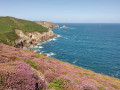
(6) Follow this path until you reach a small road; turn left to go round the village of Penharn and reach the headland of the same name and theGR®34(beautiful views over Douarnenez Bay after the village).
GR® signposting (white and red)
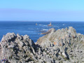
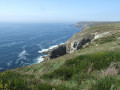
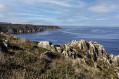
(7) Turn left onto the coastal path, which is narrow and rocky in places and features a series of sometimes steep ascents and descents along the cliff face; pass Pointe de Kerharno and reach Pointe de Brézellec.
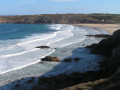
(8) Continue along the coastal path (note, on the left, the forest of antennas from a former French Navy radio-location system (TORAN), now rendered obsolete by GPS, and, on the right, an old navigation mark), cross a stream in a steep-sided valley and arrive at the small Théolen Beach, where you’ll find the Buvette de Pors Théolen, ideal for a break halfway along the route (see Practical Information).
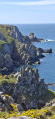
(9) Continue along the coastal path, which alternates between ascents and descents along the sides of steep cliffs, and look out for a path on the left just before reaching the Pointe du Castel Meur. You can take a round trip to the very tip of the headland, where the view over the entrance to Douarnenez Bay is splendid. Take care, however, as the path, which is lined with thorny bushes, is not really maintained.
YellowPR® signposts in the opposite direction
(10) Follow the path away from the coast, reach a car park and continue along a small road that joins the D7. Cross it carefully, follow it to the right for about twenty metres and take a small road on the left leading to the village of Kerléodin.
No signposting
(11) Take a small road on the left to leave thePR® route, cross the village (note some beautiful old houses) and carry on to the next junction.
(12) Turn right, then left, walk through the village of Kergléguer, continue straight ahead along a wide path and follow it to the end.
PR® yellow markings
(13) Turn right onto a path and reach a small road (note a cross on the right). Follow it to the left for a few metres, turn right onto a grassy path and follow it to the next junction of paths.
(14) Turn left, walk along the right bank of a stream, then turn left to reach the first houses in Lézanquel (note some beautiful old houses).
(15) Turn right onto a wide farm track, ignore the paths branching off to the right and cross a small road at Kergaradec.
(16) Carry on straight ahead to go round the village on the left (note some beautiful old houses), continue, ignore a small road on the right and reach a crossroads.
(17) Turn left, ignore the first street on the right, then turn right onto Rue de la Ville d’Ys to return to the starting car park (S/E).



 Visorando Member

 Difficult
 Easy

