


Refine your search for walks in Télécabine du Mélezet
Télécabine du Mélezet walks


 Circular via Les Marmottes and Le Pracara from the cable car
  Visorando Member
Walks near Télécabine du Mélezet
 From Valfréjus to Modane via the GR®5
 4.40 mi
 +10 ft
 -1,654 ft
 2h 00
2h 00
 Easy
Easy
 Departure from Modane (Savoie)
This is an easy, downhill hike from Valfréjus to Modane. The route follows the GR®5. It is a gentle slope, passing near the pretty Notre-Dame du Charmaix chapel, and there are many oratories in different styles along the way. Take the shuttle bus between Modane station and Valfréjus, but be sure to check the timetable.
Valfrejus - Lac des Méandes
8.66 mi
+4,816 ft
-1,306 ft
8h 10
 Difficult
Departure from Modane (Savoie)
Difficult
Departure from Modane (Savoie)
A challenging hike starting from Valfréjus resort, the first stage to reach Lac des Méandes (below Col des Méandes). The view is incredible all along the route.Be careful, there is very little shade and at an altitude of 2,700 metres, it is always a little chilly.
Refuge de l'Orgére - Refuge Peclet Polset
 5.43 mi
+2,986 ft
-1,171 ft
5h 05
Difficult
Departure from Villarodin-Bourget (Savoie)
5.43 mi
+2,986 ft
-1,171 ft
5h 05
Difficult
Departure from Villarodin-Bourget (Savoie)
The first stage takes you from the Refuge d’Orgére to the Refuge de Peclet Polset. Although short, this first stage features a significant elevation gain, helping you get into your stride for the rest of the trek. The views above the Maurienne Valley are already splendid. You’ll cross your first pass, the Col de Chaviére, at nearly 2,800 metres. Views of the Écrins and the Thabor, reminding us of the 2018 route.
From the Orgère Mountain Hut to the Granges in the Vallée Étroite
 16.10 mi
+4,564 ft
-5,131 ft
11h 25
Difficult
Departure from Villarodin-Bourget (Savoie)
16.10 mi
+4,564 ft
-5,131 ft
11h 25
Difficult
Departure from Villarodin-Bourget (Savoie)
This eleventh stage crosses the Mont Cenis massif and, in part, the Cerces massif. From the Refuge de l’Orgère, the GR®5 descends to Loutraz, crossing the River Arc via the bridge to the east of Modane. The route goes round the town hall, passes the church, follows the railway line eastwards, then westwards, and climbs the slope beneath the Fréjus Tunnel to pass under the motorway. It continues its ascent towards Notre-Dame du Charmaix. After the Valfréjus resort, it enters the Ruisseau du Charmaix valley and reaches the hamlet of Les Herbiers. Below the old Small Pass, it crosses the stream and, following the road, reaches the Lavoir Reservoir before tackling the steep climb towards La Losa, then, via the Combe de la Grande Montagne, reaches the Col de la Vallée Étroite. After a detour to the east, the descent heads due south, towards the Plaine Tavernette, then the valley of the same name. Finally, the GR®5 follows the Ruisseau de la Vallée Étroite to the Granges de la Vallée Étroite.
From the Refuge de l'Orgère to the Refuge du Fond d'Aussois via the Grand Roc
 7.42 mi
+4,787 ft
-3,412 ft
7 hrs
7.42 mi
+4,787 ft
-3,412 ft
7 hrs
 Very difficult
Departure from Villarodin-Bourget (Savoie)
Very difficult
Departure from Villarodin-Bourget (Savoie)
Starting from the Refuge Porte de l'Orgère, the route passes through the Valon de l'Orgère to reach the Col de la Masse (2,952 m) with the option of climbing the Grand Roc (3,316 m), then follows the valleys to reach the Refuge du Fond d'Aussois.
Porte de l’Ogère Mountain Hut – Plan d’Amont
 6.27 mi
+3,412 ft
-2,913 ft
5h 50
Difficult
Departure from Villarodin-Bourget (Savoie)
6.27 mi
+3,412 ft
-2,913 ft
5h 50
Difficult
Departure from Villarodin-Bourget (Savoie)
Walk in the Maurienne region from the Porte de l’Ogère mountain hut to Plan d’Amont via the Col de la Masse
Aussois - Valfréjus
 12.42 mi
+3,225 ft
-2,923 ft
8h 30
Difficult
Departure from Aussois (Savoie)
12.42 mi
+3,225 ft
-2,923 ft
8h 30
Difficult
Departure from Aussois (Savoie)
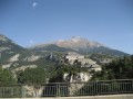
Étape de la Grande Traversée des Alpes d'Aussois (Vanoise) à Valfréjus (Maurienne).
Map of Amont – Roc de la Pêche mountain hut
 9.99 mi
+3,852 ft
-4,390 ft
7h 55
Difficult
Departure from Aussois (Savoie)
9.99 mi
+3,852 ft
-4,390 ft
7h 55
Difficult
Departure from Aussois (Savoie)
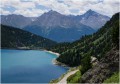
The walk begins with a gentle, rural route to the Fond de l’Aussois mountain hut, followed by a steep climb to the Col de l’Aussois.
 Moderate