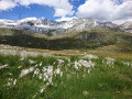
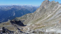
Plan d’Amont – Refuge du Repoju

Route between Aussois and Pralognan via the Col d’Aussois.

This walk is part of a multi-day hike: Tour des glaciers de Vanoise

Details

n°98104
Creation:
Last update:
Last review:
  • Walking
    Activity: Walking
  • ↔
    Distance: 9.32 mi
  • ◔
    Average duration: 6h 50 
  • ▲
    Difficulty: Difficult

  • ⚐
    Back to start: No
  • ↗
    Ascent: + 2,969 ft
  • ↘
    Descent: - 4,022 ft

  • ▲
    Highest point: 9,564 ft
  • ▼
    Lowest point: 5,620 ft

Description of the walk

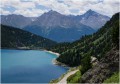
At Aussois, take the D108 northwards and park at the car park at the end of the road by Lake Plan d’Amont.
(S) Take the forest track on the left, which runs along the right bank of the Plan d’Amont reservoir.

(1) You’ll soon reach theGR®5; turn right onto it and follow it for about 200 metres until you reach the next junction.

(2) Leave theGR® and turn left onto the path heading due north.
The direction soon changes to north-west; walk past the Notre Dame des Anges chapel and, continuing in the same direction, reach the Fond d’Aussois refuge.

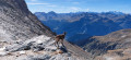
(3) Stay on the left bank of the Saint Benoit stream and tackle a steep climb through a very rocky section which ends at the Col d’Aussois.

(4) Begin the long descent along the well-marked path, reaching the Rozoire stream.

(5) Cross it and, following its right bank, head towards the Ritort chalets.

(6) Continue north and you’ll soon reach theGR®55; turn right onto it and follow the left bank of the Doron de Chavière, staying on theGR®, until you reach the Roc de la Pêche refuge.

(7) Reach the Ruelles car parks and finally the Refuge du Repoju (E), today’s destination.

Waypoints

  1. S : mi 0 - alt. 6,729 ft - Plan d’Amont car park
  2. 1 : mi 0.43 - alt. 6,913 ft - Right bank of Lake Plan d’Amont
  3. 2 : mi 1.38 - alt. 7,365 ft - 2nd junction on the GR5
  4. 3 : mi 2.42 - alt. 7,654 ft - Refuge du Fond d'Aussois
  5. 4 : mi 4.11 - alt. 9,564 ft - Col d'Aussois
  6. 5 : mi 5.22 - alt. 7,792 ft - Rozoire stream
  7. 6 : mi 6.51 - alt. 6,463 ft - Ritort chalets. Bridge over the - Doron de Bozel (rivère)
  8. 7 : mi 7.6 - alt. 6,296 ft - Refuge du Roc de la Pêche
  9. E : mi 9.32 - alt. 5,676 ft - Ripoju Mountain Hut

Notes

Water is available throughout the route in the streams and the springs that feed them.
A Micropur tablet may be required.

Worth a visit

The upper Maurienne valley with its famous villages: Aussois, Bramans, Bessans, Termignon and Bonneval-sur-Arc.
The road passes:
- the Iseran (Europe’s highest mountain pass), which links the Maurienne and the Tarentaise in summer,
- the Mont Cenis, which links France and Italy.

Always be cautious and plan ahead when you're outdoors. Visorando and the author of this route cannot be held responsible for any accidents occurring on this route.

The GR® and PR® markings are the intellectual property of the Fédération Française de Randonnée Pédestre.

Reviews and comments

5 / 5
Based on 1 review

Reliability of the description
5 / 5
Ease of following the route
5 / 5
Route interest
5 / 5
JAROSZ
JAROSZ

Overall rating : 5 / 5

Date of your route : Sep 19, 2022
Reliability of the description : ★★★★★ Very good
Ease of following the route : ★★★★★ Very good
Route interest : ★★★★★ Very good
Very busy route : Yes

A lovely family affair

Machine-translated

Other walks in the area

For more walks, use our search engine .

The GPS track and description are the property of this route's author. Please do not copy them without permission.