Country:
 City:


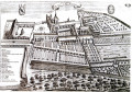
The route starts at the keep of Jouarre Abbey.
(S/E) Take Rue de la Tour, then turn left into Rue Jehan de Brie and walk alongside the abbey’s guesthouse. Take thefirst right, Rue du Stade. At the end, turn left into Rue de Jussieu. Pass the primary school and the sports hall.
(1) When the road bends to the left, take the country lane known as Rue des Murs de l’Abbaye on the right. At the T-junction, turn left onto Chemin de Jouarre à Rebais. At the next junction (marker 152), go straight on. Cross a small road and continue straight ahead for about 300 m.
(2) Turn into thefirst track on the left. Pass under a power line and emerge onto a road. Follow the road to the right and pass under the power line again. You will reach the hamlet known as Le Ru de Vrou.
(3) At the junction, turn left. Continue straight ahead along the small road, ignoring the side paths, and pass under the power line again.
(4) At the hamlet of Les Petits Montgoins, turn right and follow theGR®11(red and white markings). At the Fork in the road, veer left. Pass under a power line and arrive at the hamlet of La Chèvrie.
(5) Just before the building, take a path on the left, still following theGR®. Pass under the power line twice in quick succession and, as you do so, ignore a turn-off on the left. Then continue straight on (south-east) between the fields.
(6) Cross the D 37 road and continue straight on with theGR® along a small road. Immediately ignore a turn-off on the left. At the next junction (farmhouse on the left), head up a small road to the right towards the Butte de Doue.
(7) Continue along the road and, when it bends to the right after a few dozen metres, take a path on the left. Head downhill and continue along a narrow lane.
(8) At the T-junction, turn left (leaving the red and white markings). Cross the square (town hall) and carry on straight ahead along a small road. At the hamlet of Le Taillis, ignore a road on the right and, as you leave the hamlet, ignore another road on the left. Carry on along the road to the hamlet of Les Marchés.
(9) At the three-way junction (wash house), veer to the right and immediately ignore a small road on the right. At the next junction (marker 159), keep to the right towards Les Ormes.
(10) Cross the D 222 with care. Pass through the hamlet of Les Pleux, ignoring any side roads.
(11) At the cemetery, carry on straight ahead and, at the Fork in the road that appears immediately, ignore the right-hand branch. Pass through the hamlet of Vinot.
(12) At the hamlet of Les Jolys, carry on straight ahead. Soon, the road gives way to a track: continue eastwards, ignoring all side paths. Cross the Ru du Raboireau and reach the entrance to Rebais.
(13) Turn left onto Avenue de la Libération and cross the Ru du Resbac. Then turn right onto Rue de l’Hôtel de Ville, which leads to the square in Rebais via Rue de l’Hôtel de Ville. When the street bends to the left, veer to the right. Then turn right, then left, and follow the path leading to the Church of Saint-Jean-Baptiste.
(14) Then follow Rue de l’Abbé Rousseau. Go round Place du Marché on the left and take Rue Saint-Nicolas.
(15) At the end, turn left onto Rue du Faubourg Saint-Nicolas. Take thefirst right, Rue de l’Arquebuse.
(16) At the end, turn left onto Rue du Pré Ancel. After about 200 m, take a path on the right. Pass under a power line and you’ll come to a T-junction. Then turn right.
(17) Take thefirst track on the left (before the D 55) and head due north. Cross a small road and continue straight ahead. At the next three-way junction (elevation 187), go straight on, ignoring a turn-off to the left and then one to the right. At the three-way junction, veer to the right. You’ll return to the tarmac and come out onto a road running at right angles.
(18) Turn left onto Rue de la Maréchalerie. After about 200 m (elevation 178), turn right onto a track (ignore thefirst track further to the right).
(19) After about 250 m, take a grassy track on the left (north). Cross the D 55 and head down through the woods to the hamlet of Coton.
(20) Turn left and follow the Petit Morin on your right (yellow markings). When the road bends to the right, carry on straight ahead along the old railway line. Keep parallel to the Petit Morin, heading north-west.
(21) Carry on straight ahead and, after about a hundred metres, continue straight on (ignore the signposting leading off to the right). You’ll come out onto a small road; follow it to the left for about 75 metres.
(22) Then turn right onto Chemin du Moulin des Brus. Keep running parallel to the Petit Morin. Leave the woodland and continue across the fields.
(23) At the road, make the first turn right then left to follow Rue du Rond des Fées. Cross the D 31 (Route de la Vallée) and follow Rue des Vieux Clos. When the street bends to the right, take thefirst path on the left. Cross the Petit Morin over a small wooden bridge.
(24) At a place called Les Hameaux, turn right then immediately left to head up Rue des Nonvallés. At the end, turn left onto a grassy track (Chemin des Poncets). Join a tarmac road, follow it to the left and ignore a turn-off to the left, then one to the right.
(25) As you come out of a left-hand bend, turn right onto Rue Lucien Devos. Then take thefirst left, Rue du Chemin de Rondeau. When this turns right, turn left onto Chemin de l’Ouche.
(26) At the end, rejoin Route de Saacy and follow it to the right. Cross a small square on the right.
(27) Opposite, turn diagonally left onto Chemin de la Fontaine. Pass the wash house and enter a wooded area (site of the former Château de Saint-Ouen-sur-Morin).
(28) At the end of the lane, turn sharply right. Head up through a woodland and rejoin the tarmac road (Chemin des Sablons).
(29) At the junction, head downhill to the left onto Avenue Daniel Simon (D 31). Cross two branches of the Petit Morin in succession and reach the church at Saint-Cyr-sur-Morin.
(30) Head up to the left along Rue Eugène Daumont. At the end, cross the D 37 with care, follow it to the left for about twenty metres, then turn right onto Rue Verte.
(31) Immediately turn left (west) onto a grassy path (marked in yellow) which descends towards the D 31. Follow this road as it continues for about a hundred metres ( busy road).
(32) Turn left to head back up into a woodland. At the junction, rejoin the embankment of the old railway line and follow it to the right. Stay at the bottom of the woodland, keep heading west and ignore all the paths branching off to the left.
(33) At a three-way junction, turn left onto a stony track. Shortly afterwards, turn right to cross the Ru du Choisel (follow the red and white markings, not the yellow ones).
(34) At the crossroads on the other side of the stream, take thefirst path on the right, heading downhill. At the next junction, go straight on and walk past a campsite on your right.
(35) At the T-junction, head up to the left along a steep, rutted track. Cross the D 204 ( busy road) and continue uphill.
(36) Just before another road (D 114), take a path on the right. Stay on the main signposted path and ignore the side tracks. You’ll come out onto the D 114 and follow it to the right for about 75 m.
(37) Turn left into Rue du Cloud. Then take a path on the right (Ruelle Albert Besnard). Cross two roads, Rue du Torchon and then the D 114 ( take care).
(38) Cross Rue de la Mare and continue straight ahead along a grassy path. After a left-hand bend, at a junction directly beneath a power line, turn right.
(39) After about 150 m, turn left onto a path heading north-west. Ignore a turn-off on the left and enter Jouarre via Rue du Clos Pitou. At the crossroads, first turn right then left to follow Rue de Montmorin. Continue straight on, pass under the abbey’s portico and return to the starting point (S/E).


 Association / Club / Walk leader
 Difficult

 Moderate
 Visorando Member