Country:
 City:
City:


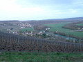
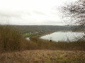
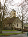
(S) Leaving Jouarre Abbey: at the corner by the town hall, turn right onto Rue du Petit-Palais, walk past the church and, at the bottom of the street, turn left onto Rue de la Fontaine Rougeau.
(1) At the first junction, take the path on the right and head straight down to the Moulin de Comporté, ignoring any side paths.
(2) At the bottom, by the mill, follow the small road to the left and walk alongside the Petit Morin on your right.
(3) At the foot of a silo, join theGR®®11(red and white markings) and continue along the road. At the T-junction that appears immediately, turn left into Rue du Petit Condetz. Then take the first street on the right, Rue du Déversoir. At the next junction, turn right into Rue du Petit Pays.
(4) At the end, follow Avenue Franklin Roosevelt to the right (D603). Go round the roundabout on the left and take the first path opposite to follow the right bank of the Petit Morin.
(5) At the mouth of the river, go under a metal footbridge and follow the left bank of the Marne. Go under a road bridge and continue along the Marne on the Quai des Anglais as far as the Pont Charles de Gaulle.
(6) Cross the bridge over the Marne, then turn right at the first junction onto Boulevard du 8 Mai 1945. After about a hundred metres, leave the boulevard and follow the Promenade de l’Île Cartier to the right, keeping as close to the river as possible. Pass the river landing stage and continue along Rue de l’Île Cartier. Just below a power line, the road gives way to a path: continue along the Marne, following theGR®®14A.
(7) At the edge of the woods, leave the banks of the Marne and head left up towards Tanqueux. Cross over the railway line and turn right at the junction.
(8) After 50m, take theGR®®14Aon the left, which climbs between the houses. The grassy path overlooks the valley and the tennis courts. Ignore the paths branching off to the right and left and you’ll come to a T-junction on Rue de la Sonnette.
(9) Turn right and walk past the foot of Chamigny church, then straight on along Rue de l’Église. At the end, turn right. At the next junction, follow Rue Roubineau to the left for about a hundred metres.
(10) Then head left up a path between houses and gardens (still following theGR®®14A). At the T-junction, turn right, cross the stream, and ignore a path branching off to the right. At the next junction, turn right. At the T-junction, turn left and head slightly uphill. At the next junction, turn left again and continue uphill for about 50 metres.
(11) Turn right onto a forest track. Continue climbing, heading north-east. You’ll come out onto a road; follow it to the left for 20 metres. Immediately turn right onto a path that cuts across a bend in the road, rejoin the road and follow it to the right.
(12) At the hamlet of Les Gâcheux, turn right at the corner of the farm and follow a path. At the T-junction, turn right. At the next junction, continue straight ahead (north-north-east).
(13) At the end of the path, follow a small road to the right. At the hamlet of Les Chanois, cross a road and continue along the path opposite. Head down into a wood along a stony path. You’ll emerge onto Rue André Mirat, on the outskirts of Saint-Aulde, and follow it to the left.
(14) At the Fork in the road, take the Chemin au-dessus des Montagnes to the left. Ignore a path branching off to the left and, at the next junction, continue straight ahead. Follow this path, heading east-northeast, overlooking a circular bend in the Marne valley.
(15) At another Fork in the road, turn right, still on the Chemin de Cramaille. Cross the Chemin de Friande Fontaine and then Rue de Vernets, and head down the Chemin de Charly. At the junction that appears immediately, continue along the same path, heading downhill. Cross the small bridge over the Ru du Monbertoin (Ru de Caumont on the map).
(16) Cross the D80 and head up the grassy path that starts on the other side, sloping diagonally to the right. At the first houses in Caumont, you’ll come out onto a road; follow it to the left for about 40 metres. Then leave the road and take a stony path to the left. At the first junction, turn right onto a path at the edge of the forest.
(17) Return to the tarmac road but, immediately on the left, head up into the woods along the Sentier de la Messe. Ignore a path branching off to the left, then, at a T-junction, turn right.
(18) At the next junction, turn right. Immediately after the Frouet ruins, at a fork in the road, head diagonally left onto the red/white-marked path. Head straight on, southwards, and ignore all the paths branching off to the left. You’ll come to a small road (with aerial masts) and follow it to the right.
(19) Leave the road for the Sente des Plantes at the first turn-off on the left. At the next junction, take the path on the left through the bushes, marked red and white, and cross the Bois Chapron. Then walk alongside the vineyards on the Marne hillside (AOP Champagne).
(20) At the junction, continue along the path which descends slightly, and walk above the vineyards with a panoramic view of the Marne valley. Ignore the turnings to the right and left and go straight on.
(21) At the end of the path, take a small road on the right, Rue de la Charrière, and ignore all the side roads to enter the village of Nanteuil-sur-Marne. After a sharp left-hand bend, turn right then left to follow Rue A. Morlot. At the end, turn right onto Rue du Bac.
(22) Take the Pont de Nanteuil to cross the Marne, then cross the railway line.
(E) Turn immediately right to return to Nanteuil-Saâcy station on the Paris/Château-Thierry line.

 Association / Club / Walk leader
 Very difficult
 Moderate
  Visorando Member