Country:
 City:
City:


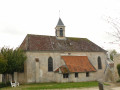
Park in the car park by the community hall on Rue de la Chapelle.
(S/E) From the car park, follow this street to the junction with Rue de Rebais, cross over and continue to Rue du Clos Pitou, which you take on the right.
(1) Turn left onto Rue des Huguenots, then follow Rue du Marteroy. Turn right off this road at the entrance to a farm to follow the Chemin de Vanry (marked with red and white signs).
(2) At the junction, turn left, then, after 100 m, turn right onto the steep descent of La Dhuys. Take care when crossing several roads before reaching the village centre (cross Rue Pierreuse, which leads to Jouarre, then, 200 m further on, the D204, a busy road).
(3) Turn right into Rue du Pressoir, then, after 100 m, turn left onto Rue du Pont, which crosses the Petit Morin.
(4) In the square, take Rue Gaston Solvet, almost directly opposite, and after 70 metres, turn right onto the footpath, which you follow – after crossing the D407 – onto Avenue de Chalons. Continue along a narrow path until you reach a farm track; watch out for the slope.
(5) Turn right onto Chemin de la Bitorderie and follow the yellow markings for about 5 km until you reach the Dhuis; cross the D70 leading to Montménard, then leave the Dhuis via the first path on the left. After 200 m, turn right to descend to the hamlet of La Charbonnière, which you pass through.
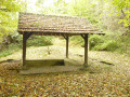
(6) Head back up to Le Tillet, a hamlet of Reuil, via a path that passes by the wash house and climbs back up to the D70a, which you take on the right.
(7) Cross the village square and follow the D70a. Pass through the hamlet of Vauharlin.
(8) After 500 m, leave the D70a and turn left onto a farm track. Continue towards the D402.
(9) Before reaching the road, at the Bois de l’Hermitage, take a farm track on the left, which leads into the woods and climbs up to the Bréau farm.
(10) Turn right, head back down the road which passes in front of the Château du Bréau, leave the road and follow the path opposite to the cemetery (beware of the stony path through the woods).
(11) At the corner of the Reuil-en-Brie cemetery, turn left onto a grassy path, then follow the narrow streets to reach the church.
(12) Cross the pedestrian crossing on the D402, near the town hall, then continue to the left, leaving the yellow markings, and make your way through the car parks to the path on the right, which runs alongside the school’s fence to the Marne.
(13) Turn left to follow the left bank of the Marne, which you follow all the way to the town centre of La Ferté-sous-Jouarre.
(14) Carry on straight ahead along the Marne, passing Quai A Planson and then Quai des Anglais (red and white markings). Stay as close to the river as possible and pass under the Pont de l’Europe. Reach the point where the Petit Morin flows into the Marne.
(15) Turn sharply left, go under the footbridge spanning the Petit Morin and follow the path which leads up onto the D603 bridge at the roundabout. Cross at the pedestrian crossing and follow the D603 to the right.
(16) Turn left immediately onto Rue du Petit Pays. Follow this street, then Rue du Déversoir, and then, turning left again, Rue du Petit Condetz.
(17) Turn right past the silos and take the small road that runs alongside the Petit Morin towards the old Comporté Mill.
(18) Turn right onto the stony path leading up towards Jouarre (yellow markings), then turn left at the first junction. The path climbs up via the Ruelle de la Prévode towards the Rue de la Pierre, which you take on the right, then immediately left into the Rue du Petit Palais.
(19) When you reach the corner by the town hall, turn left into Rue Montmorin, pass through the abbey gateway, then turn right onto Avenue de Rebais.
(20) Cross the junction by the park, Rue Jehan de Brie, then continue for 200 metres until you reach Rue de la Chapelle on your right. Follow this street to the car park (S/E).

 Association / Club / Walk leader

 Very difficult
  Visorando Member
 Moderate