In the footsteps of the Impressionists: from the Pont de Bezons to Chatou

A linear walk that takes place mainly along the banks of the Seine, with very few tarmac roads. You can stroll through two “Impressionist Parks”, the one in Rueil-Malmaison and the one in Chatou.

This walk is part of a multi-day hike: En suivant la Seine à travers l'Ile-de-France

Details

3557117
Creation:
Last update:
Last review:
  • Walking
    Activity: Walking
  • ↔
    Distance: 5.52 mi
  • ◔
    Average duration: 2h 35 
  • ▲
    Difficulty: Easy

  • ⚐
    Back to start: No
  • ↗
    Ascent: + 43 ft
  • ↘
    Descent: - 26 ft

  • ▲
    Highest point: 112 ft
  • ▼
    Lowest point: 69 ft
  • ⚐ Country: France
  • ⚐ City: Bezons (95870)
  • ⚑
    Start: N 48.923466° / E 2.217689°
  • ⚑
    End: N 48.885269° / E 2.15623°
  • ❏
    IGN map(s): Ref. 2214ET, 2314OT
  • Hour-by-hour weather

Photos

Description of the walk

Starting point and access: Bezons Bridge, right bank.
- Tram – Line T2, terminus.
Get off at the rear of the tram.

No signposting

(S) At the rear of the tram, turn right, cross the tracks and then a road at the traffic lights. Turn left immediately to cross the D308 (Rue Émile Zola). Then veer left, cross two slip roads and take the bridge over the Seine.

(1) As you come off the Pont de Bezons, turn right and head down a concrete path, passing a petrol station on your left. Continue straight on along a wide gravel path through the Parc Départemental du Chemin de l’Ile, towards the Pavillon des Berges. Keep the Seine on your right.

(2) At a Fork in the road just past Marker 50, take the small concrete path on the right which leads down towards the Seine. Follow the river as closely as possible, then head back up and continue along the wide gravel path. Keep going straight ahead and pass under a railway bridge (Pont des Anglais on the map). Carry on straight ahead and pass under a second railway bridge, then under a motorway bridge (Viaduc de Carrières-sur-Seine).

Yellow signposting

(3) Keep to the right to stay as close as possible to the river. Ignore a road on the left and carry on along the riverbank on a gravel path between two hedges (bus depot on the left-hand side).

When you reach a fuel tank, you can turn right down a narrow concrete path along the banks of the Seine and then head back up (otherwise, carry on straight ahead along the wide path). Shortly afterwards, pass a chicane and follow a tarmac road to the left. Immediately, at a cobbled crossing, turn right, go through a metal barrier and follow a gravel path alongside a cement works on your right.

(4) Take the metal footbridge spanning the access channel to the port of Nanterre. On the other side, continue straight on for a long way along a gravel path (the Promenade Bleue). Note the sign marking the entrance to Rueil-Malmaison.

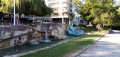
(5) Shortly afterwards, on your left, walk alongside the Parc des Impressionnistes (the one in Rueil; you can take a detour here if you wish). Further on, follow the signs for the Collège des Martinets and pass between a school on the left and a pumping station on the right. Then turn right to stay as close as possible to the river. Cross an esplanade (with a fountain and sculpture) and walk along the Quai Adolphe Gicquel.

(6) Directly opposite the Pont de Chatou, cross the quay at the pedestrian crossing and climb the winding ramp on the right, interspersed with steps. At the top, turn right and cross the bridge over the Seine. Halfway across, head down to the right towards the Île des Impressionnistes. At the bottom, take a sharp right-hand bend to pass under the bridge. Pass between two car parks and take a sharp left-hand bend.

(7) As you come out of the bend, leave the road to the right, go under a metal gantry (no entry) and follow a small tarmac path. Ride past an old stadium on your right, then go under a railway bridge.

No signposting

(8) Go through a gate opposite and enter the Parc des Impressionnistes in Chatou. Walk past a riding arena on your right. Carry straight on and ignore all turn-offs to the right. At a three-way junction, turn right. Carry straight on again, ignoring the turn-offs to the right, and walk past a playground on your right. Leave the park through a gate.

Yellow markings

(9) Take the staircase opposite, which leads up to the level of the railway bridge. Then follow the footpath to the left, which runs alongside the railway line (no danger – there is a wide safety barrier between the two). Cross the Seine this way. On the other side, go down a flight of steps on the left. Continue along a small street which joins the Avenue des Tilleuls.

Take thefirst right onto Avenue Aristide Briand. At the end, turn right twice and you’ll soon reach Chatou-Croissy station (E).

To get back home:
- RER – Line A, towards Saint-Germain-en-Laye or La Défense and Paris.

Waypoints

  1. S : mi 0 - alt. 95 ft - Tram stop - Pont de Bezons
  2. 1 : mi 0.35 - alt. 105 ft - Towpath - Seine [la]
  3. 2 : mi 0.58 - alt. 95 ft - Fork
  4. 3 : mi 1.93 - alt. 89 ft - Viaduc de Carrières-sur-Seine
  5. 4 : mi 2.74 - alt. 85 ft - Passerelle du Port de Nanterre
  6. 5 : mi 3.43 - alt. 89 ft - Parc des Impressionnistes (Rueil-Malmaison)
  7. 6 : mi 3.94 - alt. 85 ft - Pont de Chatou
  8. 7 : mi 4.3 - alt. 92 ft - Start on a tarmac path
  9. 8 : mi 4.47 - alt. 89 ft - Parc des Impressionnistes (Chatou) – Entrance
  10. 9 : mi 5.11 - alt. 89 ft - Parc des Impressionnistes (Chatou) – Outing
  11. E : mi 5.52 - alt. 112 ft - Gare de Chatou-Croissy

Notes

Train timetables: see the Transilien website.

A good pair of trainers is sufficient for this route, which mainly follows compacted or gravel paths.

Bars and restaurants on the esplanade along the Seine in Rueil-Malmaison, just before (6).

A detailed map is required (at the very least, the one accompanying this description).

Opening hours of public parks:
Parc des Impressionnistes (Rueil-Malmaison)
- October to April: 09.30–18.00.
- From May to September: 9.30 am–8.00 pm.
Parc des Impressionnistes (Chatou)
- November to March: 7.00 am–6.30 pm.
- April to October: 7.00 am–9.30 pm.

Recommendation:
Adjust your route according to the water level of the Seine. In the event of flooding, the lower level of the towpath is usually submerged: stay on the upper level.

Shorter alternative:
At point (8), the loop around the Parc des Impressionnistes is optional, and you can follow the tarmac on the right to reach, 150 metres further on, the steps leading up to the RER bridge.

Additional information:
You can combine this walk with the‘From Chatou to Le Vésinet along a circular loop of the Seine’ walk. After the waypoint (9), at the junction with Avenue Aristide Briand, go down a flight of steps on the left. At the bottom, follow Quai Maxime Laubeuf to the right and rejoin the second walk shortly after its waypoint (1). The total distance is around 17 km.

Walk completed by the author on 11 July 2020.

Worth a visit

- Beautiful views over the Seine.
- The Parc des Impressionnistes in Rueil-Malmaison, a lovely park full of flowers.
- The Parc des Impressionnistes in Chatou, a lovely spot for a break.

Reviews and comments

5 / 5
Based on 2 reviews

Reliability of the description
5 / 5
Ease of following the route
5 / 5
Route interest
5 / 5
User 6907385

Overall rating : 5 / 5

Date of your route : Apr 20, 2026
Reliability of the description : ★★★★★ Very good
Ease of following the route : ★★★★★ Very good
Route interest : ★★★★★ Very good
Very busy route : No

It was lovely exploring the banks of the Seine, even though the left bank is quite industrial. I didn’t come across many people, but then it was Friday, the day before the Easter holidays began; even the lovely park at the flower-filled end of the island was practically deserted… but I imagine it’ll be busy for the next fortnight – it’s such a pleasant walk. I saw a donkey and some sheep grazing below the metro! I loved this walk!

Machine-translated

isamarche
isamarche

Overall rating : 5 / 5

Date of your route : Mar 30, 2025
Reliability of the description : ★★★★★ Very good
Ease of following the route : ★★★★★ Very good
Route interest : ★★★★★ Very good
Very busy route : Yes

A lovely walk on a sunny afternoon. It’s lovely to stroll along the banks of the Seine from Bezons to Chatou, leaving the traffic behind. And to discover two beautiful parks in Nanterre and Rueil.

Machine-translated

Other walks in the area

For more walks, use our search engine .

The GPS track and description are the property of this route's author. Please do not copy them without permission.