Country:
 City:


Starting point and access: Faubourg de l’Arche station.
- Tram – Line T2.
Take the Rue Alexis Séon exit, in the middle of the tram, on the platform heading towards Pont de Bezons at Porte de Versailles. If arriving from the opposite direction, cross the tracks carefully at the designated crossing.
The route crosses or briefly follows signposted routes. In the description below, signposting is only mentioned where necessary.
(S) Follow Rue Alexis Séon, passing a bar-restaurant on your right and walking alongside a square on your left. At the end, go round the roundabout to the left and follow Avenue Léonard de Vinci to the left (not signposted here). Cross a street on the right-hand side and pass a chemist’s. Take thefirst right onto Allée Botticelli (pedestrian-only). At the junction, turn right onto Allée Véronèse.
At the end, enter the Parc du Millénaire (if it is closed, go round it on the left via the promenade of the same name). Pass a table tennis table on your right, go down a flight of steps and walk along the right-hand side of a playground, then a lawn. Take the exit on the left, before the end of the park, and walk along a square on your left (yellow marker). Atthe first junction with the Promenade des Pins (which has two branches), go straight on.
(1) At the junction immediately ahead, turn right onto thesecond branch of the Promenade des Pins and walk alongside a public garden on your right. At the end, cross at the pedestrian crossing and first turn left then right to follow the Allée Rodin, walking alongside the school of the same name on your right. At the end, walk down a slope and follow a wide avenue to the left. At the traffic lights, turn right and cross the avenue and the tram tracks. Carry straight on along Rue Émile Deschanel until it ends (with the Marceau market opposite).
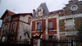
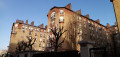
First turn right then left onto Rue Blondel, a quiet street lined with brick buildings. At the end, turn left into Rue Jean-Pierre Timbaud. Then take thefirst right, Rue Pierre Brosollette. Turn into thefirst right, Allée Hoche, a private cul-de-sac. Retrace your steps and continue to the right for about twenty metres.
(2) Turn right onto Rue Hoche, lined with a few beautiful houses. At the end, turn right onto Avenue de la République. At the traffic lights, go straight on. Then turn left into Rue des Vieilles Vignes. At the end, turn right into Rue Barbès. At the next junction, turn left into Avenue Marceau. Continue straight on until you reach Courbevoie station (on the left-hand side of the avenue).
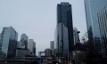
(3) Go under the railway bridge and take thefirst right, Rue du Capitaine Guynemer. Then take thefirst left, Rue de Bitche. Cross Rue Ségoffin and continue straight on (note the La Défense towers on the right). Cross Rue de Belfort on the right-hand side, turn right onto Rue de Bitche and go under a portico. Cross Rue de Colmar on the right-hand side and, at the junction immediately ahead, turn right. Go straight on between two blocks of flats.
(4) At the end, cross Avenue Gambetta in two stages and follow it to the right. Cross Avenue d’Esilng on the left-hand side. About 150 metres further on, turn left into Place des Vosges at the foot of a hemispherical tower. Climb a flight of steps and follow a cobbled path, which is flat at first and then slopes downwards.
At the bottom (small waterfall), take a very short first turn right then left to enter Parc Diderot through thefirst gate you come to. Walk down, alternating between steps and cobbled paths, whilst keeping an artificial waterfall on your right. At the bottom, look for a discreet exit gate on the left and emerge onto Allée Sainte-Odile.
(5) Then turn left (do not go under the archway opposite). Shortly afterwards, veer left towards the billiards club and climb a flight of steps. After a landing, climb a few more steps, emerge into a courtyard (yellow marker) and pass under an archway. Then go down a flight of steps on the right and emerge onto Place de Saverne. At the traffic lights, cross the avenue in two stages and first turn left then right to cross Place des Pléiades towards the town hall (yellow signposting). Pass the police station on your left, then a nursery on your right, and head downhill.
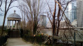
Cross a street and enter Parc des Pléiades. At a fork in the road, take the left-hand paved path. Walk past a small wooden dovecote and then turn right. Go round a detached house on the right to leave the park. At the corner of the town hall, cross an avenue (D106) at the traffic lights in two stages. Then follow the avenue to the left, uphill. At the next set of traffic lights, cross the D9, climb a flight of steps and cross the church forecourt to the entrance.
(6) Opposite the church, turn left. Cross Rue des Boudoux and continue along the avenue, which is not signposted here (heading due north). Take thefirst right, Rue de Lambrechts. Go straight on and cross Rue Jules Lefèvre and Rue Parmentier in turn. Cross Boulevard de Verdun and continue along Rue Armand Silvestre. Then turn right into Rue du Cayla and walk past the school of the same name on your left.
(7) At the next junction, turn left into Rue Hudri. At the end, turn left and, when the street bends to the right, carry on straight ahead to pass between the local council offices (on the left) and a square (on the right). Then cross Rue Armand Silvestre and carry on opposite into Rue Franklin. Cross Boulevard de la Paix in two stages and carry on opposite, still on Rue Franklin.
At the next junction, turn right onto Rue de Louvain. At the end of the street, go up a flight of steps. First turn left then right to cross Rue de Bois-Colombes at the pedestrian crossing. Turn left and then right again to go down a flight of steps. You’ll come out onto a street; follow it to the left. The street immediately turns right, runs alongside a railway line and quickly leads to Bécon-les-Bruyères station (E).
To get back home:
- Transilien – Line L towards Paris Saint-Lazare, La Défense (connections) and Saint-Nom-la-Bretèche, or Cergy.

 Visorando Member
 Moderate