Country:
 City:
City:


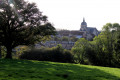
Park in the church square, by the FFRP sign where the route is marked. Follow the yellow markings.
(S/E) With your back to the church, follow the D21 to the left, then the D30 towards Éguzon. Carry on straight ahead until you reach the junction of the departmental roads. Turn left towards Saint-Plantaire (D30, Rue des Étangs).
(1) After the bend, once you’ve passed number 9 on the street, cross a car park to the left towards the pond, which you’ll walk alongside on the left. Then follow a gravel path north-eastwards. Cross the square to the right until you reach the D21.
(2) Walk along it on the right-hand side. Turn right onto Rue de la Ganne. Continue straight on along the road and pass through the hamlet of La Ganne. You’ll come to a stony track opposite.
(3) At the four-way junction, carry on straight ahead, then turn left onto a small road. Pass between the water tower and the cemetery.
(4) Cross the D91 and continue straight ahead along a track. At the top of the hill, take the road on the right. At the Fork in the road, opposite the cross, turn left onto a road towards Bressolle.
(5) As you come out of the bend, turn left and head down the track on the right. At the bottom of the track, turn right (elevation 301) and walk along the edge overlooking the Bouzantin stream.
(6) Cross the D21a and take the gravel path opposite. Cross the Bouzantin and continue uphill. At the entrance to Chardy, carry on along the road.
(7) At the T-junction, take the road on the left. Below the road, climb the track on the left. Cross the D21 and take the track opposite (waymarker). Walk alongside a farm and pass under a power line. At the crossroads, carry on straight ahead to the Colombier farm.
(8) Turn left onto the tree-lined path. Follow the small road to the right until you reach the junction with the D39 and La Rouillère. Cross the road and take the small road opposite. Continue straight on along a path and then onto a track.
(9) At the end of the track, turn right onto a road. Pass through the hamlet of La Salle, staying on the main road. On leaving the hamlet, continue along the road to the left. Pass through the Forêt de la Bouige to reach the D72.
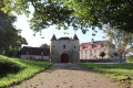
(10) Turn left onto it towards Le Breuil. After about 250 m, you’ll soon reach the gate of the Château de Breuil-Yvain (a lovely view of the château and its pond).
(11) Retrace your steps and, at the previous junction, follow the D72 to the right. Ignore another road on the right.
(12) At the top of a hill, leave the D72 and take the sunken lane on the left, continuing uphill. At the top, opposite a cross, carry on along the small road to the right. Pass through the hamlet of Chantemerle.
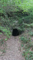
(13) About 400 m further on, turn right onto a path that descends into a small valley. At the bottom, follow a stream for a few metres (Caution: narrow passage). Take the footbridge and continue to the D72, turning left onto it. Just before the church, turn right onto Rue des Jonquilles and emerge onto the church square (S/E)

 Visorando Member
 Easy
Easy