On the heights of Trépail

Walk through the Montagne de Reims Forest, half through the woodland and half along a track suitable for vehicles.

Details

3087816
Creation:
Last update:
Last review:
  • Walking
    Activity: Walking
  • ↔
    Distance: 4.21 mi
  • ◔
    Average duration: 2h 10 
  • ▲
    Difficulty: Easy

  • ⚐
    Back to start: Yes
  • ↗
    Ascent: + 285 ft
  • ↘
    Descent: - 276 ft

  • ▲
    Highest point: 938 ft
  • ▼
    Lowest point: 630 ft
  • ⚐ Country: France
  • ⚐ City: Trépail (51380)
  • ⚑
    Start/End: N 49.110263° / E 4.180035°
  • ❏
    IGN map(s): Ref. 2813O
  • Hour-by-hour weather

Photos

Description of the walk

Park in the car park by the football pitch on the hills above Trépail.

(S/E) With your back to the football pitch, take the wide path at the edge of the woods. Walk past the caves carved into the cliff face, keep to the right at the Fork in the road and continue for a few metres.

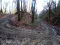
(1) Turn right and continue uphill, ignoring the paths branching off to the left: the ground can be very muddy for about 1 km in wet weather. You’ll come to a well-graveled track.

(2) Carry on to the left until you reach the junction with the Route Forestière du Grippet.

(3) Turn left and carry on to the next junction.

(4) Turn left again to follow the Route Forestière des Pins. Veer left along it at the 275 mark.

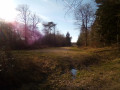
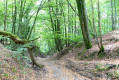
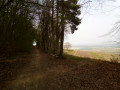
(5) Cross a ditch and turn right to begin the final section of the route (see photo), which can be muddy in wet weather.

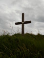
(6) Turn right and carry on straight ahead, heading south-west, ignoring the paths on either side. You’ll come to a crossroads (with a cross). Turn left and carry on straight ahead (east) until you reach another junction.

(7) Continue downhill to the right, then keep left after about fifty metres. At the vineyards, turn sharply left to walk along the top of them. At a clump of trees, turn left again and follow the vineyard path as it winds its way before rejoining the original path. Then turn right to return to the car park (S/E).

Waypoints

  1. S/E : mi 0 - alt. 676 ft - Football ground car park
  2. 1 : mi 0.2 - alt. 814 ft - Turn right at the fork
  3. 2 : mi 0.68 - alt. 892 ft - Gravel path
  4. 3 : mi 1.63 - alt. 938 ft - Route Forestière du Grippet, on the left
  5. 4 : mi 2.19 - alt. 919 ft - Route Forestière des Pins, on the left
  6. 5 : mi 3.12 - alt. 906 ft - Ditch
  7. 6 : mi 3.31 - alt. 823 ft - Junction, turn right
  8. 7 : mi 3.73 - alt. 781 ft - Turn right at the fork
  9. S/E : mi 4.21 - alt. 676 ft - Football ground car park

Notes

Whilst most of this route follows a stony path, the first and last sections – where the steepest gradients are found – can be very muddy in wet weather.

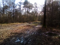
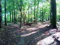
(7) At this junction (see photo), you can turn left to join (1) directly, and then (S/E).

Worth a visit

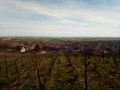
As you climb after setting off, there is a view of the village of Trépail and the plain below.
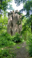
Caves carved into the cliff face.

Reviews and comments

4.4 / 5
Based on 3 reviews

Reliability of the description
4.3 / 5
Ease of following the route
4.7 / 5
Route interest
4.3 / 5
GILLET
GILLET

Overall rating : 5 / 5

Date of your route : Apr 14, 2025
Reliability of the description : ★★★★★ Very good
Ease of following the route : ★★★★★ Very good
Route interest : ★★★★★ Very good
Very busy route : No

A pleasant walk.

Machine-translated

marianita
marianita

Overall rating : 4.3 / 5

Date of your route : Sep 08, 2024
Reliability of the description : ★★★★☆ Good
Ease of following the route : ★★★★★ Very good
Route interest : ★★★★☆ Good
Very busy route : No

Machine-translated

jocelyne DESGRIPPES
jocelyne DESGRIPPES

Overall rating : 4 / 5

Date of your route : May 27, 2022
Reliability of the description : ★★★★☆ Good
Ease of following the route : ★★★★☆ Good
Route interest : ★★★★☆ Good
Very busy route : No

Keep an eye out for the caves at the start – you might miss them because of the vegetation – but otherwise it’s a pleasant route through the forest

Machine-translated

virgule
virgule

A very pleasant spot

Machine-translated

Other walks in the area

For more walks, use our search engine .

The GPS track and description are the property of this route's author. Please do not copy them without permission.