On the Way of St James via the CBR cliff path

A short historical walk through the woods along the old CBR (Reims Suburban Railways) line and part of the Way of St James.
After a good warm-up, you’ll encounter the walk’s only challenging section, which will take you up to the Montagne de Reims plateau, where the rest of the walk is then an easy stroll.

Details

7238495
Creation:
Last update:
Last review:
  • Walking
    Activity: Walking
  • ↔
    Distance: 7.85 mi
  • ◔
    Average duration: 3h 55 
  • ▲
    Difficulty: Moderate

  • ⚐
    Back to start: Yes
  • ↗
    Ascent: + 384 ft
  • ↘
    Descent: - 364 ft

  • ▲
    Highest point: 925 ft
  • ▼
    Lowest point: 591 ft
  • ⚐ Country: France
  • ⚐ City: Verzenay (51360)
  • ⚑
    Start/End: N 49.161132° / E 4.135616°
  • ❏
    IGN map(s): Ref. 2812E, 2812O, 2813O
  • Hour-by-hour weather

Photos

Description of the walk

Start from the Moulin de Verzenay car park.

(S/E) Cross the D26 with care and take the path opposite. At the cross, turn left, cut across a road and continue straight on.

(1) Leave the woodland and take Avenue de Champagne, where you’ll find the old CBR station (renamed La Villa des Renards) on your right.

(2) Continue straight on along the path through the woodland (see alternative route in the practical information) until you reach a road.

(3) Turn right and continue towards the car park for the tree-top adventure park, which you cross, then continue along the path over the wooden walkway (stairs).

(4) Once at the top of the ascending path and the steps, turn left, then follow this path to cross through the treetop adventure park and exit it.

(5) Take the path on the left through the woodland (there is a small yellow sign) and follow it to reach the Mont Sinaï bunker and orientation table.

(6) Continue along this path to rejoin the main track; follow it to the left to quickly reach the road, which you cross. Continue straight ahead along the Chemin des Faux.

(7) Turn left onto the Route Forestière du Coutron.

(8) Continue along the main path, which eventually descends steeply (new alternative route in the practical information).

(9) Turn left onto theGRP® 145 / 654 and theGRP® Montagne de Reims, which here follows the old CBR path, and follow this cliff-top path until you reach a road.

(10) Cross this road and continue straight ahead to the junction from the outward leg.

(3) Then follow the path back in the opposite direction to the start to complete the route (S/E).

Waypoints

  1. S/E : mi 0 - alt. 699 ft - Moulin de Verzenay car park
  2. 1 : mi 0.44 - alt. 702 ft - Avenue de Champagne
  3. 2 : mi 0.6 - alt. 705 ft - Alternative route
  4. 3 : mi 1 - alt. 735 ft - Crossroads of the circular loop
  5. 4 : mi 1.33 - alt. 909 ft - Top of the stairs
  6. 5 : mi 1.81 - alt. 899 ft - Path on the left through the woodland
  7. 6 : mi 1.98 - alt. 896 ft - Casemate and orientation board - Observatoire du Sinaï
  8. 7 : mi 2.55 - alt. 925 ft - Coutron Forest Road
  9. 8 : mi 3.61 - alt. 781 ft - Second alternative route
  10. 9 : mi 4.15 - alt. 591 ft - GR 145-654 and GRP Montagne de Reims
  11. 10 : mi 6.03 - alt. 679 ft - Cross the road
  12. S/E : mi 7.85 - alt. 699 ft - Moulin de Verzenay car park

Notes

There isn’t really a reliable source of water. You do cross a stream that runs across the old CBR path, but its flow, which is already low in spring, is unlikely to be much greater in summer.

Almost the entire route runs through or near the forest, so watch out for mosquitoes once the warmer weather returns.

Lightweight shoes (such as trainers) are sufficient for this walk, the only difficulty being crossing the path leading up to the treetop adventure park (steps have been fitted in the steepest sections).

(2) Alternative route: in dry weather only (otherwise it’s very muddy and slippery), you can take the path on the right, which climbs steeply and leads directly onto the plateau, where you’ll come out onto the Chemin de la Serre; take this to the left to reach the point (5)

(8) Alternative route: if the weather is dry, you can take the path on the left which descends steeply through the woodland and reaches the cliff ledge.

Worth a visit

- Tree-top adventure park.
- The viewpoint from Mont Sinaï and its orientation table.
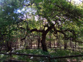
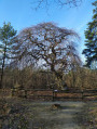
- The twisted trees (Faux de Verzy).
- The champagne houses in the surrounding villages.

Reviews and comments

5 / 5
Based on 2 reviews

Reliability of the description
5 / 5
Ease of following the route
5 / 5
Route interest
5 / 5
Bressan44
Bressan44

Overall rating : 5 / 5

Date of your route : Feb 21, 2024
Reliability of the description : ★★★★★ Very good
Ease of following the route : ★★★★★ Very good
Route interest : ★★★★★ Very good
Very busy route : No

Thank you for this very interesting route through the Verzenay vineyards and along the forest tracks at the top of the hillside. We completed it in mid-February in very damp weather (though without rain), and it remains very walkable and presents no serious difficulties. The view from the Verzenay mill (which you reach at the end of the route) is well worth a detour before heading back down into the village itself.

Machine-translated

BrunoFlyman
BrunoFlyman

Hello Sidonie51,
Thank you for your comment

Machine-translated

Sidonie51
Sidonie51
• Edited:

Overall rating : 5 / 5

Date of your route : Sep 12, 2021
Reliability of the description : ★★★★★ Very good
Ease of following the route : ★★★★★ Very good
Route interest : ★★★★★ Very good
Very busy route : No

A lovely walk, with paths that are easy to walk on even when damp, passing through charming villages. No difficulties, and plenty of shade.

Machine-translated

Other walks in the area

For more walks, use our search engine .

The GPS track and description are the property of this route's author. Please do not copy them without permission.