Route des Faux de Verzy starting from Verzenay

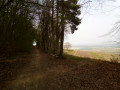
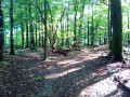
A walk through forests, vineyards and villages to discover the Montagne de Reims and its Faux de Verzy. The route is a bit winding, but the idea was to include a good elevation gain. Please note that some sections may be blocked by fallen trees. The Visorando app is recommended.

Details

74340272
Creation:
Last update:
Last review:
  • Walking
    Activity: Walking
  • ↔
    Distance: 11.37 mi
  • ◔
    Average duration: 6h 20 
  • ▲
    Difficulty: Moderate

  • ⚐
    Back to start: Yes
  • ↗
    Ascent: + 1,243 ft
  • ↘
    Descent: - 1,234 ft

  • ▲
    Highest point: 1,096 ft
  • ▼
    Lowest point: 581 ft
  • ⚐ Country: France
  • ⚐ City: Verzy (51380)
  • ⚑
    Start/End: N 49.156261° / E 4.150621°
  • ❏
    IGN map(s): Ref. 2812E, 2813O
  • Hour-by-hour weather

Description of the walk

The starting point is at the Verzenay Lighthouse car park.

(S/E) Set off straight ahead, crossing the D26 with care . Immediately afterwards, take the path leading off to the left into the forest. Turn right at the junction by the vineyards.

(1) Leave the return path on your right, then carry on straight ahead.

(2) Keep to the right at this junction and carry on to the next junction.

(3) Turn left (Route Forestière de Brise-Charette), then ignore the side tracks.

(4) At the junction where several tracks meet, turn left towards Mont SinaÏ.

(5) At the Mont SinaÏ Observatory, take the track opposite, then carry on straight ahead.

(6) Cross the road carefully, then pass the Faux de Verzy car park. Shortly afterwards, turn left onto the path that descends to the junction with the GRP® Tour de la Montagne de Reims.

(7) Follow it to the right for about 300 m. Take the path branching off to the right, then follow it up to the right until you reach the Route Forestière du Coutron. Turn left onto this forest road and follow it for about 70 m.

(8) Ignore the return path on the right and carry on straight ahead along the forest track.

(9) After following this track for a good kilometre, take the path branching off to the left into the forest and, at the junction with the GRP® Tour de la Montagne de Reims, carry on straight ahead.

(10) Turn right, walk alongside the vineyards, then enter the village of Villers-Marmery. At the Nécropole Nationale cemetery, follow the D26 to the right.

(11) When you reach another cemetery, take the lane on the right, continue for a few dozen metres, then turn left and immediately right.

(12) Turn right at the junction, then a few metres further on, turn left to rejoin the GRP® Tour de la Montagne de Reims.

(13) About 200 m further on, turn right, then left shortly afterwards and head into the forest.

(14) At the Fork in the road, take the path on the left, then, 100 metres further on, turn left. Continue along this path until you rejoin the Tour de la Montagne de Reims.

(15) Turn right onto the GRP® and follow it for a few hundred metres.

(16) Take the hairpin bend to the right until you come out onto a forest track.

(17) Follow it to the right.

(18) After more than 500 m, take the track on the left and continue straight on. Turn right (the path is not signposted) and continue to the Route Forestière du Grippet.

(19) Follow it to the left until you reach a multi-way junction.

(20) Take the track on the right, then carry on straight ahead for 500 m.

(21) Turn right and carry on straight ahead, passing Les Faux de Verzy.

(22) At the crossroads, take the path opposite, then turn left shortly afterwards onto the ‘Balade des Faux’ trail, continuing to the Route Forestière du Coutron and returning to an intersection you passed on the way there.

(8) Turn left, then, a few dozen metres further on, turn right onto the path in the opposite direction to the outward journey until you reach the GRP® Tour de la Montagne de Reims, and follow it to the left until you reach a fork in the path, which you also passed on the outward journey

(7) Leave the path you took on the way out to your left and continue straight on along the GRP®. Cross a road and continue straight ahead on the GRP®. Then turn left just before leaving the forest and you’ll soon come to another junction you passed on the way out.

(2) Turn left, taking the route in the opposite direction to the outward journey, until you reach a junction you passed on the way out.

(3) Take the track on the right and continue along the path which leads back to the original junction you passed on the way out, near the sports grounds.

(1) Continue to the right along the route in the opposite direction to the outward journey to return to the car park (S/E).


Waypoints

  1. S/E : mi 0 - alt. 843 ft - Verzenay Lighthouse car park
  2. 1 : mi 0.2 - alt. 909 ft - Junction common to both the outward and return journeys
  3. 2 : mi 0.31 - alt. 945 ft - Junction common to both the outward and return journeys
  4. 3 : mi 0.44 - alt. 1,020 ft - Turn left
  5. 4 : mi 0.92 - alt. 1,056 ft - Mont Sinaï junction
  6. 5 : mi 1.1 - alt. 1,073 ft - Mount Sinai - Observatoire du Sinaï
  7. 6 : mi 1.36 - alt. 1,063 ft - Route/Car park at Les Faux
  8. 7 : mi 1.93 - alt. 846 ft - Junction common to both the outward and return journeys
  9. 8 : mi 2.46 - alt. 1,053 ft - Junction common to both the outward and return journeys
  10. 9 : mi 3.35 - alt. 925 ft - Path on the left
  11. 10 : mi 3.93 - alt. 669 ft - Vineyards
  12. 11 : mi 4.32 - alt. 581 ft - Alleyway on the right
  13. 12 : mi 4.6 - alt. 673 ft - Turn right at the fork
  14. 13 : mi 4.82 - alt. 732 ft - Entrance to the Forest
  15. 14 : mi 5.3 - alt. 955 ft - Fork in the road
  16. 15 : mi 5.7 - alt. 807 ft - Return to the Tour de la Montagne de Reims
  17. 16 : mi 6.08 - alt. 804 ft - Turn back
  18. 17 : mi 6.69 - alt. 1,056 ft - Forest Track
  19. 18 : mi 7.1 - alt. 1,079 ft - To the left
  20. 19 : mi 7.51 - alt. 1,076 ft - Forest Track
  21. 20 : mi 7.85 - alt. 1,073 ft - Crossroads
  22. 21 : mi 8.22 - alt. 1,070 ft - Turn right
  23. 22 : mi 8.63 - alt. 1,093 ft - Opposite, then the Balade des Faux
  24. S/E : mi 11.37 - alt. 853 ft - Verzenay Lighthouse car park

Worth a visit

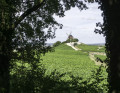
On this walk, you’ll be able to enjoy the views as well as the vineyards.

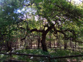
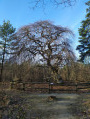
You’ll also have the chance to see the Faux de Verzy.

Reviews and comments

4.7 / 5
Based on 2 reviews

Reliability of the description
4.5 / 5
Ease of following the route
4.5 / 5
Route interest
5 / 5
jinox51
jinox51

Overall rating : 5 / 5

Date of your route : Jun 06, 2026
Reliability of the description : ★★★★★ Very good
Ease of following the route : ★★★★★ Very good
Route interest : ★★★★★ Very good
Very busy route : No

Hello everyone,

A hike suitable for moderate hikers during the wet season – be careful on the slopes with the stones, but otherwise a magnificent hike worth doing again
Be careful at point 21 – there’s no mobile signal, so it can be confusing; make sure you get your bearings at point 20

If you need any help, please don’t hesitate to ask
I’d love to share some photos – it’s a shame we can’t

Enjoy the hike, everyone
Jérémy

Machine-translated

Calou51
Calou51

Overall rating : 4.3 / 5

Date of your route : Mar 09, 2026
Reliability of the description : ★★★★☆ Good
Ease of following the route : ★★★★☆ Good
Route interest : ★★★★★ Very good
Very busy route : No

An interesting route because it is quite long and allows you to discover the main sites in this area (mainly the Verzy forest and the Verzenay lighthouse). There is a lot of forest, alternating between well-covered paths and wide, open forest roads, allowing you to enjoy the gentle early spring sunshine or, conversely, to stay in the shade most of the time. Vineyards are also part of the landscape, of course, as the author of this route clearly wanted to highlight the different facets of the area.
Two sections proved difficult to interpret on the ground: from point 12 to point 15, it was not easy to spot the turnings, especially as marker 13 unfortunately obscures the route. I would therefore recommend continuing straight on from point 13 to point 15. The same applies to points 1, 2 and 3 for me, as I started from Verzy: from point 3 coming from 4, it's a good thing I have a good "sense of direction", as they say, because the map is hidden there too and there are multiple junctions.
A lovely walk, thanks to its creator.

Machine-translated

Other walks in the area

For more walks, use our search engine .

The GPS track and description are the property of this route's author. Please do not copy them without permission.