Country:
 City:
City:



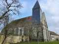
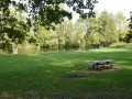
Park behind the church.
(S/E) Return to the Grande Rue and follow it to the right. Then turn right onto the D116 towards the water sports centre, then follow the path on the left which climbs up the hillside.
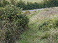
(1) At the top of the hill, carry on straight ahead, taking in the view over the lake and the valley, then walk along the edge of the woodland for 200 m. Head into the woodland via thefirst path on the left. Follow it for about 500 m as it winds through the undergrowth before reaching the edge of the woodland. Walk along the edge to the right until you reach the D308.
(2) Cross the road and take the path opposite for about 300 m. Take the path on the right for 1 km.
(3) At the edge of the small Morainville copse, turn right. The path runs alongside the copse, then past some orchards. When you reach the tarmac road, turn right. At the junction with the D308, take the path opposite, which veers slightly to the right. Walk downhill to the road junction and take a short first turn right then left to follow Rue des Bouviers. Pass the cemetery and arrive at the junction by the church.
(4) Head straight on along Rue Sainte-Agnès, then turn right to cross the River Eure via two successive bridges. After the bend, turn right onto Rue Saint-Hilaire, continue along a path between the gardens, then at the end, turn right onto Rue de la Forgerie and follow it to the D929. Cross at the pedestrian crossing, walk about twenty metres to the right, then turn left into the first street.
(5) Carry on straight ahead, then take the first right to head up towards the hillside, negotiating a bend.
(6) At the top, at a three-way junction, take the path on the left. At the next junction, take the path on the right, which goes round the woods along the edge.
(7) Take the path on the right which descends towards the valley for about 150 m. Turn left and walk past a reservoir.
(8) Follow the D3094 to the right (view of the valley and the lake) for 300 m, heading down towards the valley. Turn left. The path runs alongside an old railway line for 800 m.
(9) Turn right and immediately join the D309.5. Turn left, cross the D929 and immediately turn right onto the stony track towards the river. Turn left and follow the River Eure on your right. The track passes close to the ruins of the old village of Luray.
(10) Near the Mézières mill, take the D152 on the right and cross the bridge over the Eure to reach the church (S/E).

 Thank you for sharing this hike. We did it in 2 hours and 15 minutes.
 Tourism professional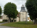

 Association / Club / Walk leader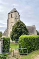
 Easy
Easy  Visorando Member