


 Country:
 City:
City:


Park at the town hall car park on Rue des Sablons.
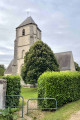
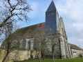
(S/E) Facing the hiking signpost, turn right along Rue des Sablons. Turn right onto Rue de Morainville and head towards the Church of Saint-Cyr and Sainte-Julitte.
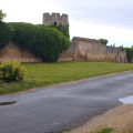
(1) Turn left and walk past the school. At the Fork in the road, turn left, following the stream along the Chemin des Écoliers (“La Grimpette”). Take the path on the left which climbs up to Prémont. Turn right at the Fork in the road and continue to the crossroads in the centre near the castle.
(2) Turn left along Rue du Château. Then keep to the right on the track. At the first junction, turn right onto the track through the fields. When you reach the area near Mérangle, take the track on the right heading towards the woods. On the valley road (RD136b), turn left and then right into the woods.
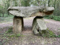
(3) Follow the path to the left to see some dolmens and carry on straight ahead until you reach the edge of the woods.
(4) Turn right until you reach the road.
(5) Cross the road before the Pont du Livier, turn left and head down to the right onto the path alongside the river. Continue to the small bridge on the left.
(6) Cross it and head up towards the woods (the climb is a bit steep). At the first junction, turn right (following the pink markings). Walk down the street leading to Ouerre to return to the junction you passed on the way out.
(1) Follow the path back in the opposite direction to return to the car park (S/E).


 Association / Club / Walk leader
 Moderate
 Tourist office
 Tourism professional
 Visorando Member
