The route of the hamlets of Saint-Laurent-la-Gâtine

Our village has a population of 452. Situated in the Eure-et-Loir department, it is close to Dreux, Chartres and Rambouillet, and it is easy to reach the Paris region by train or via the N12 road.
Our village comprises three hamlets: L’Aumône, Boissy and Saint-Laurent. The route allows visitors to discover the tranquillity of the countryside and the surrounding forests, as well as the remarkable heritage that is worthy of interest and preservation, thereby ensuring it is passed down from one generation to the next.

Details

47351797
Creation:
Last update:
Last review:
  • Walking
    Activity: Walking
  • ↔
    Distance: 4.54 mi
  • ◔
    Average duration: 2h 05 
  • ▲
    Difficulty: Easy

  • ⚐
    Back to start: Yes
  • ↗
    Ascent: + 23 ft
  • ↘
    Descent: - 20 ft

  • ▲
    Highest point: 443 ft
  • ▼
    Lowest point: 413 ft

Photos

Description of the walk

Start from Boissy Town Hall.

(S/E) With your back to the town hall, take the Allée du Château to the junction near the inter-municipal ditch.

(1) Turn left onto Rue du Moulin à Vent, then immediately right along the ditch and continue until you reach the D113.3.

(2) Keep left and cross the D21 at the junction.

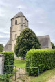
(3) Carry on straight ahead, passing the Croix des Pèlerins, until you reach the cemetery at Saint-Laurent-la-Gâtine. Take a moment to explore the burial place of the Lords of Boissy. Continue along the road to the hamlet of Saint-Laurent and its church.

(4) Take a moment to admire its pediment and leaning bell tower, then turn right and continue straight on along the D306.5 to L’Aumône. Pass the solitary oak tree and reach a Fork in the road.

(5) Carry on along Rue de la Madeleine, passing the oratory of the same name.

(6) Head opposite towards the farm to take the Sente de la Petite Mare on the right. Turn left onto the road and carry on until you reach Rue de la Croix de Fer.

(7) Turn left, continue along the D306.6 and keep to the right until you reach the Croix de Fer.

(8) Turn right, taking care, onto the D21 for 30 metres, cross it and keep left onto the track. Turn onto the first track on the right and, at the next junction, turn left and continue until you reach Rue du Gland.

(9) Carry on straight ahead, alongside the woodland, and turn left onto the Chemin de Croisilles to reach a junction. Turn left onto the Rue des Grandes Vignes.

(10) Turn right and, once you reach the main street in Amfreville, first turn right then left to rejoin the Allée des Trembles, which leads to the town hall. (S/E)

Waypoints

  1. S/E : mi 0 - alt. 420 ft - Mairie de Saint-Laurent-La-Gâtine
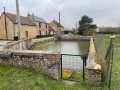
  2. 1 : mi 0.13 - alt. 420 ft - A network of inter-municipal ditches stretching 120 km
  3. 2 : mi 0.6 - alt. 430 ft - D113 – crossing towards the - Croix des pèlerins de Saint-Laurent-La-Gâtine
  4. 3 : mi 0.79 - alt. 440 ft - The cemetery at Saint-Laurent-La-Gâtine
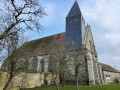
  5. 4 : mi 1.07 - alt. 440 ft - Eglise Saint-Laurent-la-Gâtine
  6. 5 : mi 2.09 - alt. 436 ft - The solitary oak tree in Saint-Laurent-La-Gâtine
  7. 6 : mi 2.37 - alt. 440 ft - Oratory - Vestiges de l'hospice de l'Abbaye de Coulombs
  8. 7 : mi 2.64 - alt. 440 ft - Rue de la Croix de Fer – Aumône exit
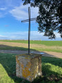
  9. 8 : mi 2.99 - alt. 440 ft - Croix de fer de Saint-Laurent-La-Gâtine
  10. 9 : mi 3.95 - alt. 433 ft - Rue et Bois du Gland
  11. 10 : mi 4.24 - alt. 420 ft - Crossroads, wells in Saint-Laurent-La-Gâtine
  12. S/E : mi 4.54 - alt. 423 ft - Mairie de Saint-Laurent-La-Gâtine

Notes

(S/E) The car park at the town hall in Boissy has around ten spaces

Worth a visit

(1) The 120 km SIFAM inter-municipal network of ditches, dug by Moroccan prisoners during the German occupation of 1941, to reclaim uncultivated land and channel rainwater.
(3) At the junction of the D21 and the D113.3 lie the Pilgrims’ Cross and the cemetery, which was once adjacent to the church for health reasons; it is the burial place of the lords of Boissy, the d’Amfreville–Chambrun family
(4) The12th-century Church of Saint Laurent was enlarged inthe 16th century; it was given a new bell tower inthe 17th century to house the Charlotte-Louise bell of 1663, donated by Charles d’Harcourt de Beuvron
Its woodwork, furnishings (the rood screen, the pews…), paintings and stained-glass windows lend the church its charming character.
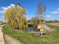
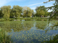
(4) The Saint-Laurent pond with its flora and fauna, notably including the protected species the ‘midwife toad’ and the ‘crested newt’
(6) The Oratoire de la Madeleine, with its statue from the Chapelle de l’Aumône and the remains of the hospice of Coulombs Abbey, founded inthe 12th century by Abbé Roger: the former chapel and dovecote.
(8) The Iron Cross, erected in 1995 by a group of villagers in memory of an old cross that had disappeared; this cross had previously served as the destination each year for the procession on the feast of Saint Lawrence, which set out from the Church of Saint-Laurent and passed by the statue of the Madeleine.
(10) A well 14–17 metres deep, which supplied water to every farm until a water mains network was installed in the 1960s
On Rue d’Amfreville, La Mare de la République, built in the late19th century to provide water for the village’s livestock.

Reviews and comments

4.6 / 5
Based on 3 reviews

Reliability of the description
5 / 5
Ease of following the route
4.7 / 5
Route interest
4 / 5
waiwaite
waiwaite

Overall rating : 4.3 / 5

Date of your route : Sep 28, 2025
Reliability of the description : ★★★★★ Very good
Ease of following the route : ★★★★★ Very good
Route interest : ★★★☆☆ Average
Very busy route : No

Very easy hike. Very long stretches on roads, which are convenient in case of mud and rain, but rather monotonous. Note that the oak tree is not really solitary; a beautiful walnut tree grows right next to it.

Machine-translated

EH
EH

Overall rating : 4.3 / 5

Date of your route : Jun 09, 2025
Reliability of the description : ★★★★★ Very good
Ease of following the route : ★★★★☆ Good
Route interest : ★★★★☆ Good
Very busy route : No

Very pleasant hike.

Machine-translated

Régis H
Régis H

Overall rating : 5 / 5

Date of your route : Apr 07, 2024
Reliability of the description : ★★★★★ Very good
Ease of following the route : ★★★★★ Very good
Route interest : ★★★★★ Very good
Very busy route : No

A lovely new route through the countryside, taking you to a simple village where life is good.

Machine-translated

Other walks in the area

For more walks, use our search engine .

The GPS track and description are the property of this route's author. Please do not copy them without permission.