Country:
 City:
City:


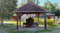
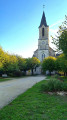


(S/E) The start is at the car park by the war memorial near Notre-Dame Church (definitely worth a visit at the start or end of the walk) and take Rue Jorge Carrasco (signposted for FFRP walks).
Follow the yellow markings for the route called “Le vignoble retrouvé” (see a shorter version on Visorandono. 2565493).
Walk round the church and head down Rue Jorge Carrasco (a workshop dedicated to the street is signposted) until you reach Rue Basse (wash house). Follow it to the right (yellow markings and GRP®).
(1) Leave the Route des Bignaux straight ahead and follow the bend down to the right for 25 metres. Turn left onto Allée Saint-Antoine, which descends to the Ruisseau de Font Perrine and then climbs back up between two houses. The lane becomes a grassy path.
(2) Pass a path leading down to the right, then turn left. Join a path running above the ground; follow it to the right. It bends left twice as it climbs alongside a copse.
(3) At the junction, take the path on the right and join a small road. Follow it to the right, passing the Ferme de la Borde on your right, and before Les Bignaux, turn left to cross a bridge over the old railway line, which has been converted into a cycle path.
(4) Follow the path to the left, passing a path on the left leading to the cycle path, then, 400 metres further on, turn right. The path winds its way uphill through the fields.
(5) At the T-junction, turn right, ignore a path on the right and continue to Princoureau. Follow the access road to the hamlet to reach the D54.
(6) Follow it to the right for 20 m, then head up to the left towards Les Moreaux. At the first house, turn onto a grassy track on the left. At the first junction, carry on straight ahead.
(7) At the second junction, take the path on the left and carry on straight ahead towards the north-west. You’ll reach a track; follow it to the left until you reach the hamlet known as La Balicave.
(8) Follow the small road, carry on round the bend at the junction, then take the path on the right as it heads downhill. Turn onto the path on the right at the next junction.
(9) Turn sharply left to begin the descent into Bois Buret. Then take the hairpin bend to the right to climb slightly. At the next junction, head down to the left (witha more or less well-tended vineyard on the right) and reach the greenway.
(10) Follow it to the left. At the fork (with vineyards on the left), take the small road on the right to head back down to the village.
(11) At the road junction, turn left onto Rue de la Croix Rouge. When you reach a wash house, turn right to reach this Red Cross and then turn sharply left. Pass under an old railway bridge and turn right onto Allée du Stade.
(12) Follow the D54 to the right until you reach the car park by the war memorial (S/E).
 Visorando Member
 Easy
Easy