Country:
 City:
City:




Park in the car park at the football ground or the cemetery in Ceaulmont-Les Granges, on the D913, near a restaurant.
(S/E) The starting point is at the foot of the sign showing the walks available in Ceaulmont, in front of the restaurant, near the football pitch.
Yellow markings
With your back to the sign, walk up the D913 for 30 metres towards the south-east, then turn right onto a track leading to the car park behind the restaurant. The track then becomes grassy.
Cross the road and take the Impasse de la Pierre à la Marthe opposite. The tarmac road turns into a track. At the barrier, continue straight ahead along a farm track. Ignore the two tracks on your left.
(1) Carry on straight ahead at the next junction and you’ll see the Pierre à la Marthe dolmen on your right, in a field. The track then descends to the D54d. Follow it to the left, then turn right towards Le Champ Vert. Cross a bridge over the Ris.
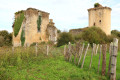
(2) 50 m further on, turn left onto a farm track that climbs gently southwards to a pond. Turn left to join the D5. Follow it to the left as far as the ruins of the Château de la Prune. You can access them via a small flight of steps on the left.
(3) Turn right onto a farm track. Then take a path on the left which leads back down to a small road; follow this to the left to reach Les Martinets. Pass a small road on your left and, 100 m further on, at a bend to the left, turn right onto a grassy path.
(4) Cross the D913 with care and continue straight ahead along the small road towards Renault. Turn left onto theGRP® Val de Creuse, which leads to the village of Ceaulmont. Follow the D5 to the right as far as the pond.
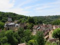
(5) Walk down Rue Saint-Saturnin straight ahead, then turn right onto Impasse de l’Église; to the right of Saint-Saturnin Church, you’ll reach the viewpoint overlooking the Creuse and the village of Le Pin. Turn back towards the pond and take the street on the right. This becomes a track suitable for vehicles, leading down to the D5b. Continue straight on, passing the access road to Beauvais on the right, then a track on the left. At the three-way junction, turn left into Châtaigne until you reach a small clearing with a cross.
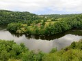
(6) Turn right, towards Chenet. At the T-junction, leave theGRP® on your left and head down the farm track opposite. It becomes a footpath as you approach the Creuse, and you’ll need to take care as the path to the riverbank can be slippery. Reach the riverbank, opposite Moulin Lasnier.
(7) Walk alongside the Creuse on the left, then head back up for 20 metres and follow the path to the right, which overlooks the river, through the coppice. You’ll need to head slightly downhill to the right to reach, via a small flight of steps, a footbridge over a stream. Head back up and walk alongside some private plots. Head down the Route du Moulin to the right, leaving the Allée des Tilleuls on your left. You’ll reach Chenet beach, from where you can once again admire the banks of the Creuse.
(8) Turn back and rejoin the Route du Moulin, continuing uphill until you leave Chenet. Leave the road, following theGRP® trail once more, along a grassy path leading uphill to the right. This leads onto a tarmac lane: follow it for 150 m, keeping the GRP® trail on your right.
(9) At the road junction, turn right onto the D5b, then turn left. Follow the farm track. At the T-junction, head left up the tree-lined track.
(10) At La Grande Barre, take the road on the right; then, at the Stop sign, carefully cross the D913 to take, opposite, a grassy path flanked by hedges. Head down a farm track to the right for 200 m, then turn onto the path on the left.
(11) At a bend on a steep descent, turn left. The track climbs, then descends again to reach a small road. Follow it uphill to the left until you reach Le Pierret. At the junction with the Impasse de la Pierre à la Marthe, take the grassy track you followed on the way out to the left, which leads back to the restaurant and the car park where you started (S/E).


 Visorando Member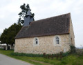
 Easy
Easy