Country:
 City:


The route starts on the square in front of the municipal library, opposite the church.
(S/E) Leave the car park heading towards Place de Verdun.
Cross the road and take the steps on the right leading up to the old town.
At the first junction, carry on straight ahead. Take the first street on the left, then the first on the right. Turn left twice, then right twice. Follow Rue des Treillages to the end.
(1) Take the road on the left, then the first left towards Les Petites Chaumes. The road turns sharply right. Cross the grassy square to the right and walk past the wash house to join the path. The path turns sharply right.
(2) At the road, turn left. At the next junction, veer right towards Les Grandes Chaumes.
(3) Cross the road to walk round the pond (please note that in winter the grassy area may be wet).
After walking round the pond, rejoin the road on the left.
(4) Cross the road leading back down towards the village and head towards Les Noëls opposite. At the next junction, before the water tower, take the road on the right, then the first left to return to the other side of the water tower.
(5) Turn slightly to the left, then immediately to the right (there is an old well here). After the last houses, the road becomes a track. At the road, turn right and follow this road. Just before entering Le Grand Vilaine, turn right onto the road leading down towards Les Neuraux.
(6) Shortly after starting the descent, turn right towards the Fontaine Durand washhouse. Retrace your steps.
(6) Carry on along the road and pass Les Neuraux.
(7) A little further on, take the wide path on the left towards another washhouse, the one at Fontrouille. After a few metres, the path turns sharply to the right. Retrace your steps.
::7: Continue along the road and turn right with it. At the 204 mark, take the path leading down to the right. Continue downhill towards the greenway, turning left. Take the greenway on the left.
(8) At the first junction, leave the greenway and take the path on the right. At the next junction, by the shooting range, turn left. Walk past the shooting range, then take the first path on the right.
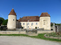
(9) A few metres further on, take the path on the right. This path runs along the edge of a meadow and leads to the Château du Courbas. Leave the castle grounds and take the road opposite, which leads back up towards the church, passing the cemetery. Walk along Place de Verdun and return to the car park (S/E).

 Visorando Member
 Moderate