Country:
 City:
City:


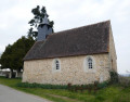
The route starts near the Church of Notre-Dame, next to the sign for walks organised by the FFRP®.
The suggested route is a combination of the existing Blue and Yellow trails; therefore, pay attention to the signposting!
(S/E) With the church behind you, follow the D54 towards Chavin. At the second junction, turn left onto Rue de la Red Cross. Once you reach the cross, take the right-hand track and cross a stone-paved structure 100 metres further on.
Blue route in the opposite direction
(1) Then turn right, walk past the stadium, then turn left back onto the Route de Chavin (D54) to cross through the village.
(2) About a hundred metres past the sign marking the exit from Le Menoux, take the path on the left across the fields until you reach a wooded area. There is a bench at the first junction. Take a moment to turn round and admire the view before heading into the woodland on the left. Resume the climb on the right 250 m further on. Leave the woodland, then continue across the fields, ignoring the first junction, bearing in mind that this path will then turn left of its own accord before joining a wider track.
(3) Then turn left. Repeat this once you reach a gravel track. This track later becomes tarmac and takes you through the Balicave. Carry on like this until the next junction. Follow the road downwards for about 50 metres.
Yellow markings
(4) Take the small path on the right, then turn right again and continue between the forest edges and fields.
(5) Then turn left, cross the Bois Buret and continue downhill to the next junction.
(6) Turn off and take the path that climbs to the right. At the next junction, turn left and continue along the edge of the woodland and vineyards until you reach a cycle and footpath, which is none other than the GR® trail of the Pays du Val de Creuse.
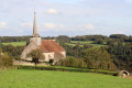
(7) Follow it to the left until you return to Le Menoux. Follow Rue de la Gare, then Avenue des Marronniers to return to the church (S/E).

 Visorando Member
 Moderate