Following the trail of the 1914–18 trenches in the Bois de Champenoux

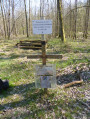
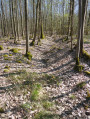
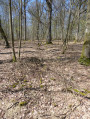
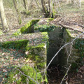
The Battle of the Grand Couronné in September 1914 in the Bois de Champenoux. On the lookout for shell holes and trenches at the edge of the woods.
A walk partly along paths and partly off-track through the heart of the forest; best undertaken with a GPS or a good sense of direction.
This walk can be complemented by exploring other remains from the Battle of the Grand Couronné.

Details

7285964
Creation:
Last update:
Last review:
  • Walking
    Activity: Walking
  • ↔
    Distance: 6.86 mi
  • ◔
    Average duration: 3h 20 
  • ▲
    Difficulty: Difficult

  • ⚐
    Back to start: Yes
  • ↗
    Ascent: + 236 ft
  • ↘
    Descent: - 243 ft

  • ▲
    Highest point: 879 ft
  • ▼
    Lowest point: 741 ft

Photos

Description of the walk

This walk is classified as “Difficult” due to the challenges of finding your way. The app (or a GPS) is strongly recommended.

The walk starts at the beginning of the Grande Bouzule forest road on the edge of the Bois de Champenoux. To reach the starting point by car, take the D674 and, before the village of Champenoux (coming from Laneuvelotte), after the two bends, take a small road on the right towards the Maison Forestière de Champelle, then turn immediately right to reach the starting point at the car park before thefirst house.

(S/E) Set off along the forest road, then turn into thefirst path on the left and, atthe first T-junction, turn right. Continue to the next junction.

(1) Turn left towards the north-east and head for the edge of the woodland near the village. Under the high-voltage power line, turn right. At the next junction, turn right, then after about 50 m, leave the track and follow the trace of a trench on the left.

(2) Follow this track through the heart of the forest, pass a junction of trenches and continue straight on until the end of the trench.

(3) Turn left towards the edge of the woodland and the village. Join the path at the edge of the woodland and turn right, heading south-west. 30 m before the next junction, turn right into the woodland, walking a few dozen metres parallel to the path. You’ll come to a trench.

(4) Turn 90° to the left to join a track, then turn left towards the north-east to rejoin the path at the edge of the woodland. Turn right onto it and continue along this track. At the T-junction, continue straight ahead. After about 30 metres, leave the track and turn right into the woodland to find the start of a new trench.

(5) Follow this trench. You’ll come out onto a path; turn right, then, a few metres further on, turn left to continue along the trench to the end.

(6) At the end of the trench, turn almost completely round and head back along the path you crossed earlier. At the path, turn right to rejoin the path at the edge of the woodland. At the junction, turn right and, after 50 m, turn right again into the woodland, heading due south, to reach the start of the next trench.

(7) Continue along the trench. At the two junctions with other trenches, carry on straight ahead to reach the Velaine road. Cross the road straight ahead and continue along the trench for a few dozen metres.

(8) End of the trench. Continue straight on towards the east through the woods to reach the path at the edge of the woods. Turn right towards the south-east and follow the path. At the X-junction between plots 7 and 12, continue straight ahead; further on, the path turns north-east until it reaches the T-junction at elevation 242.

(9) Turn right and continue straight on towards the south-east to rejoin a wide track at elevation 248. Turn 90° to the right (south-west). At the end of the track, take another track on the left opposite plot 20. At the Y-junction 150 metres further on, turn right opposite plot 18. At the top of the hill, turn right and walk about 50 metres into the woods until you reach a trench.

(10) Start of a trench and the outline of a shell hole. Follow the trench southwards and join the Tranchée de Saint-Paul forest track at elevation 266. Cross the track and continue to follow the trench, which heads eastwards and then gradually southwards. You’ll reach a wide grassy track, marking the end of the trench.

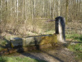
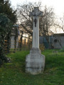
(11) Turn right, heading due west, and join the forest road. At the junction, turn right onto the Tranchée Saint-Paul for about 150 m to reach the ‘Poilu’ fountain and the military grave. See possible alternative route under ‘During the walk or nearby’.

(12) Return to the junction with the forest track and turn right onto the Tranchée de la Grande Bouzule. After several wide bends, continue straight on (north-north-east) to reach the car park and the Grande Bouzule forest lodge (S/E).


Waypoints

  1. S/E : mi 0 - alt. 787 ft - Grande Bouzule forest road. Near the - Nécropole nationale (Champenoux)
  2. 1 : mi 0.42 - alt. 774 ft - Start of the trench
  3. 2 : mi 0.81 - alt. 781 ft - End of the trench
  4. 3 : mi 0.87 - alt. 778 ft - End of the trench
  5. 4 : mi 0.99 - alt. 781 ft - A trench
  6. 5 : mi 1.21 - alt. 801 ft - Start of the trench
  7. 6 : mi 1.32 - alt. 820 ft - End of the trench
  8. 7 : mi 1.48 - alt. 791 ft - Start of the trench
  9. 8 : mi 1.71 - alt. 784 ft - End of the trench
  10. 9 : mi 2.32 - alt. 791 ft - T-junction
  11. 10 : mi 3.16 - alt. 840 ft - Start of the trench
  12. 11 : mi 3.81 - alt. 784 ft - End of the trench
  13. 12 : mi 4.42 - alt. 771 ft - Fontaine des Poilus
  14. S/E : mi 6.86 - alt. 787 ft - Grande Bouzule Forest Lodge

Worth a visit

(12) After visiting the ‘Fontaine du Poilu’, and on your return to the crossroads, you can continue straight ahead along the track towards the west, pass the 245-metre mark and, at the edge of the woods, reach the remains of an old railway line used for supply purposes.
You can follow this railway line along a narrow path to reach the Route de Velaine at the sign for the “Battle of Grand Couronné”; turn right to reach the large trench and left to reach the car park.

Reviews and comments

3.7 / 5
Based on 4 reviews

Reliability of the description
3.7 / 5
Ease of following the route
3.5 / 5
Route interest
4 / 5
fanfan
fanfan

Overall rating : 2 / 5

Date of your route : Mar 24, 2026
Reliability of the description : ★★★☆☆ Average
Ease of following the route : ★☆☆☆☆ Very disappointing
Route interest : ★★☆☆☆ Disappointing
Very busy route : No

Hello.
We found this walk rather uninteresting.
Apart from the fact that in the first section you spend your time trying to find your way through woods and thickets, and that the trenches mentioned are difficult to distinguish from streams, administrative boundaries and other features, we found no pleasure in this part of the walk.
Finally, we reached the ‘Fontaine du Poilu’, the only truly tangible remnant of the past, but then there were 4 km of almost straight road on tarmac before we finally reached the starting point.
What a shame!

I can confirm that without a GPS and precise knowledge of the route, it becomes impossible; we always made our way by orienting ourselves as best we could towards the next point.

Machine-translated

giro5763
giro5763

Overall rating : 5 / 5

Date of your route : May 14, 2022
Reliability of the description : ★★★★★ Very good
Ease of following the route : ★★★★★ Very good
Route interest : ★★★★★ Very good
Very busy route : No

A beautiful forest well worth visiting time and time again, especially in lovely weather.

Highly recommended:

Machine-translated

nolive73
nolive73

Overall rating : 4.5 / 5

Date of your route : Sep 24, 2021
Reliability of the description : Not used / Not applicable
Ease of following the route : ★★★★☆ Good
Route interest : ★★★★★ Very good
Very busy route : No

A very pleasant walk through a beautiful forest (Champenoux).
However, it’s true that it’s impossible to do without a GPS...
The end of the route is indeed a bit monotonous as it follows a long forest track, but you should focus on the first section through the woodland, which is unique and offers a real change of scenery
Thanks to Laurent François for sharing this.

Machine-translated

strong54
strong54

Overall rating : 3.7 / 5

Date of your route : May 01, 2021
Reliability of the description : ★★★☆☆ Average
Ease of following the route : ★★★★☆ Good
Route interest : ★★★★☆ Good
Very busy route : No

Hello,

A lovely walk in the forest. The route is tricky at the start – there’s no proper path, and it’s hard to follow even with the GPX track.
Best avoided in summer because of the ticks.
Towards the end, it’s the opposite; the long forest road is a bit monotonous.
Overall, it’s lovely to walk in the beautiful Champenoux forest.

Machine-translated

Other walks in the area

For more walks, use our search engine .

The GPS track and description are the property of this route's author. Please do not copy them without permission.