In the footsteps of the pilgrims in Ordan-Larroque

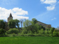
This circular walk starts in Ordan-Larroque, a picturesque, flower-filled and well-maintained village. It’s well worth a visit before or after the walk. With a packed lunch, you’re in for a lovely day out.

Details

5932034
Creation:
Last update:
Last review:
  • Walking
    Activity: Walking
  • ↔
    Distance: 5.49 mi
  • ◔
    Average duration: 2h 55 
  • ▲
    Difficulty: Easy

  • ⚐
    Back to start: Yes
  • ↗
    Ascent: + 433 ft
  • ↘
    Descent: - 427 ft

  • ▲
    Highest point: 846 ft
  • ▼
    Lowest point: 505 ft

Photos

Description of the walk

Start from the car park in front of the church (bell tower side).

(S/E) Head down Route de l’Ambre and, after the junction with Route du Bois d’Auch and Chemin de la Périssère, take the stony path branching off to the right.

(1) Continue along this stone path, passing the hamlet of Le Cancellé, and carry on straight ahead along a dirt track until you reach the hamlet of Mauhourat. Ignore the path branching off to the left and take the one opposite. Pass the hamlet of Monplaisir, then the hamlet of Le Merle. Stay on this path and pass the hamlet of En Carrère.

(2) Ignore the road branching off to the left and take the dirt track opposite until you reach the hamlet of Hargues. On the tarmac road, turn left.

(3) Continue along this road until you reach the hamlet of En Guillot.

(4) At the junction, turn right for a few metres, then turn left. Stay on this road until you reach the hamlet of Tègle.

(5) Take the stony path branching off to the right to go round a property. Please note that the arrow indicating the route is the wrong way round. Continue down this path and carry on straight ahead, ignoring a path coming from your left. Stay on this road, which runs alongside the Ruisseau de l’Auloue, until you reach Ordan-Larroque. Pass the cemetery and continue up this road towards the village.

(6) At the three-way junction, turn left towards the village centre. Carry on straight ahead, pass the post office, then go round the church and arrive at the car park in front of the church (S/E).

Waypoints

  1. S/E : mi 0 - alt. 620 ft - Car park in front of the church. Near the - Auloue (rivière)
  2. 1 : mi 0.16 - alt. 571 ft - Stone path
  3. 2 : mi 1.73 - alt. 581 ft - En Carrère hamlet
  4. 3 : mi 2.28 - alt. 794 ft - Crossroads at the hamlet of Hargues
  5. 4 : mi 2.97 - alt. 846 ft - Cross the road at the hamlet of En Guillot
  6. 5 : mi 3.65 - alt. 666 ft - Crossroads at a place called Tègle
  7. 6 : mi 5.33 - alt. 594 ft - Côte des Erigerons junction
  8. S/E : mi 5.49 - alt. 620 ft - Car park in front of the church

Notes

- A map of the route is essential
- Signposts along the route are few and far between

Worth a visit

Reviews and comments

4.7 / 5
Based on 2 reviews

Reliability of the description
5 / 5
Ease of following the route
5 / 5
Route interest
4 / 5
les sisters
les sisters

Overall rating : 4.7 / 5

Date of your route : Nov 25, 2024
Reliability of the description : ★★★★★ Very good
Ease of following the route : ★★★★★ Very good
Route interest : ★★★★☆ Good
Very busy route : No

A lovely walk in glorious sunshine… beautiful Gers countryside with views of the Pyrenees… the village of Ordans is well worth a stop…

Machine-translated

ChristianQ
ChristianQ

Overall rating : 4.7 / 5

Date of your route : May 26, 2022
Reliability of the description : ★★★★★ Very good
Ease of following the route : ★★★★★ Very good
Route interest : ★★★★☆ Good
Very busy route : No

A nice circular route, although there’s a long, monotonous stretch of road halfway through the route....
Perhaps best avoided in very hot weather....

Machine-translated

Other walks in the area

For more walks, use our search engine .

The GPS track and description are the property of this route's author. Please do not copy them without permission.