The Bois de la Peur path in Peyrusse-Massas

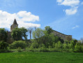
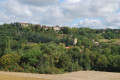
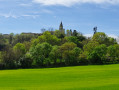
Peyrusse-Massas is a charming little hilltop village. A very pleasant circular walk through the valleys and along small streams, passing through the Bois de la Peur.

Details

5879378
Creation:
Last update:
Last review:
  • Walking
    Activity: Walking
  • ↔
    Distance: 5.92 mi
  • ◔
    Average duration: 3h 05 
  • ▲
    Difficulty: Moderate

  • ⚐
    Back to start: Yes
  • ↗
    Ascent: + 423 ft
  • ↘
    Descent: - 433 ft

  • ▲
    Highest point: 725 ft
  • ▼
    Lowest point: 410 ft

Photos

Description of the walk

Starting point: the car park by the town hall and the church.

(S/E) Set off to the right along the ridge path (lake below on the left).

(1) At a right-hand bend in the road, follow a track on the left. Go round the hamlet of Nasque on the left.

(2) Turn left onto a track suitable for vehicles. Pass the hamlet of Le Coustau and continue eastwards to a crossroads (cross).

(3) Turn left and continue downhill to the bridge over the Ruisseau de Rabin. Before the bridge, turn right and take the path that runs alongside the stream. Pass a pond on your left, then turn right (east). Pass another pond on your right.

(4) Turn left onto the track and head uphill. Then turn right. At the far end of a pond, turn left and head uphill. You will reach the hamlet of Lacroix.

(5) Turn left. Walk round the back of the house at Lacroix and continue to the hamlet of Les Tucoulets. Turn right.

(6) Take the first path on your left leading out of the hamlet. Stay on this path until you reach the Ourlan stream.

(7) Then turn left and follow the stream until you reach the junction with the D148 road.

(8) Turn left and continue along the road for a few hundred metres, then take the path that branches off to the right and climbs up to the village’s main street.

(9) Turn right and continue along the main street to the town hall (S/E).

Waypoints

  1. S/E : mi 0 - alt. 692 ft - Town hall car park - Église Saint-Gilles (Peyrusse-Massas)
  2. 1 : mi 0.5 - alt. 712 ft - Start of the path on the left
  3. 2 : mi 0.91 - alt. 669 ft - Nasque
  4. 3 : mi 1.4 - alt. 574 ft - Junction with the road to Auch
  5. 4 : mi 2.35 - alt. 456 ft - Fork in the path
  6. 5 : mi 2.98 - alt. 525 ft - Lacroix hamlet
  7. 6 : mi 3.54 - alt. 538 ft - The hamlet of Les Tucoulets
  8. 7 : mi 3.99 - alt. 410 ft - Junction
  9. 8 : mi 5.18 - alt. 469 ft - Junction with the D148 road
  10. 9 : mi 5.69 - alt. 607 ft - Junction on the village’s main street
  11. S/E : mi 5.92 - alt. 696 ft - Town hall car park - Église Saint-Gilles (Peyrusse-Massas)

Worth a visit

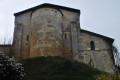
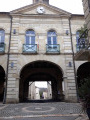
The church at Peyrusse-Massas.

Waterhole where the European pond turtle can be found.

Reviews and comments

3.4 / 5
Based on 4 reviews

Reliability of the description
3.8 / 5
Ease of following the route
3 / 5
Route interest
3.5 / 5
Pascal Routel
Pascal Routel

Overall rating : 4 / 5

Date of your route : Oct 18, 2025
Reliability of the description : ★★★★☆ Good
Ease of following the route : ★★★★☆ Good
Route interest : ★★★★☆ Good
Very busy route : No

Overall, it's a beautiful hike, with the first part being better than the second because there are fewer panoramic views. The section between 6 and 7 is almost entirely in a field and therefore quite chaotic, especially as the farmer had ploughed it in the previous days. The same applies after 7, where the path is a real field because this area has been redeveloped with trees recently planted. The Gers countryside is so authentic and undulating that you have a wonderful time.

Machine-translated

tommy56
tommy56

Overall rating : 2.3 / 5

Date of your route : Jul 10, 2025
Reliability of the description : ★★★☆☆ Average
Ease of following the route : ★★☆☆☆ Disappointing
Route interest : ★★☆☆☆ Disappointing
Very busy route : No

I completed this route on the morning of 10 July 2025, starting at 8:30 a.m.
I think it's essential to start early in the morning during a heatwave because the route is open to the sky (there's not much forest).
Otherwise, there is little to see: ploughed fields and sunflowers.
There is a big problem between 6 and 7: it is difficult to find the path. It winds its way between two fields of crops. Between 7 and 8, it is a disaster: the path is not maintained, so you spend your time fighting with thistles and not knowing where to put your feet..
I do not recommend this hike.

Machine-translated

Dany32
Dany32

Overall rating : 3.7 / 5

Date of your route : Feb 13, 2023
Reliability of the description : ★★★★☆ Good
Ease of following the route : ★★★☆☆ Average
Route interest : ★★★★☆ Good
Very busy route : No

Two important markers are missing.

Machine-translated

Jclupi
Jclupi

Overall rating : 4 / 5

Date of your route : Jul 26, 2021
Reliability of the description : ★★★★☆ Good
Ease of following the route : Not used / Not applicable
Route interest : ★★★★☆ Good
Very busy route : No

A lovely, varied walk; you pass through fields, woods and small ponds – it’s very pleasant.

Machine-translated

Other walks in the area

For more walks, use our search engine .

The GPS track and description are the property of this route's author. Please do not copy them without permission.