The Snail Trail in Barran

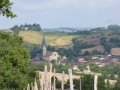
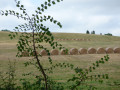
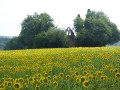
The ‘sentier des limacs’ or ‘sentier des limaces’ trail. A circular walk through rolling countryside with varied landscapes and beautiful views of the Pyrenees on a clear day. Half of the walk is on tarmac roads with very little traffic.

Details

28125816
Creation:
Last update:
Last review:
  • Walking
    Activity: Walking
  • ↔
    Distance: 8.85 mi
  • ◔
    Average duration: 4h 40 
  • ▲
    Difficulty: Moderate

  • ⚐
    Back to start: Yes
  • ↗
    Ascent: + 699 ft
  • ↘
    Descent: - 689 ft

  • ▲
    Highest point: 915 ft
  • ▼
    Lowest point: 531 ft
  • ⚐ Country: France
  • ⚐ City: Barran (32350)
  • ⚑
    Start/End: N 43.618593° / E 0.443974°
  • ❏
    IGN map(s): Ref. 1843SB
  • Hour-by-hour weather

Photos

Description of the walk

(S/E) Start on the main street of the village of Barran, Rue du Docteur Demandes. Head towards the fortified gate to the north. Go through the gate and over the bridge, then turn right onto the path that runs alongside the moat and continue straight on up this path until you reach the junction with a dirt track on the left.

(1) Take this dirt track to the left and stay on it until you reach a junction with a tarmac road.

(2) Head straight ahead, walk alongside the farm shed and cross the Ruisseau de Monsourbé. Cross the field and follow the edge of the woodland to find the path (which is barely visible) leading into the woods. Please note that the path has become somewhat overgrown due to farming activities. As you emerge from the woods, turn right and stay on this path until you reach a junction with a track near a chapel.

(3) Turn right and continue along this country lane until you reach the junction with a road near the hamlet of Perruc.

(4) Turn right onto the downhill road, cross the bridge over the Ruisseau de Monsourbé and carry on to the Thil junction.

(5) Turn left at the fork and go up this track, passing the Mongran lodge, and carry on to the crossroads.

(6) Turn right, then right again 300 metres further on. Carry on straight ahead, leaving a path on your right, pass close to a water tower and arrive at a right-angled bend.

(7) Leave the road to the right and immediately take the country lane on the left which runs alongside the forest, continuing to the crossroads near the hamlet of La Tuilerie.

(8) At this T-junction, turn right, cross the woodland and then the countryside until you reach the lake at the hamlet of Sainte-Anne.

(9) Turn right, follow the lake and then take the track that goes round the farm in the hamlet of Sainte-Anne. Continue to the D943.

(10) Cross the D 943 – take care, it’s dangerous – and turn right. Follow this road to the village.
Please take great care on this section.

(11) At the junction marking the entrance to the village of Barran, head straight on along Rue du Docteur Demandes to reach the starting point (S/E).


Waypoints

  1. S/E : mi 0 - alt. 548 ft - Rue Dct Demandes in the village of Barran
  2. 1 : mi 1.15 - alt. 801 ft - Crossroads after Monplaisir
  3. 2 : mi 1.87 - alt. 630 ft - Crossing the road
  4. 3 : mi 2.49 - alt. 751 ft - Crossroads at the chapel
  5. 4 : mi 3.47 - alt. 807 ft - Perruc junction
  6. 5 : mi 3.91 - alt. 712 ft - Thil junction
  7. 6 : mi 5.09 - alt. 902 ft - Crossroads after Mongran
  8. 7 : mi 6.1 - alt. 889 ft - Multi-way junction near Chapitre
  9. 8 : mi 6.63 - alt. 823 ft - T-junction before La Tuilerie
  10. 9 : mi 7.61 - alt. 659 ft - Junction at Lake Sainte-Anne
  11. 10 : mi 7.98 - alt. 617 ft - Junction. D 943
  12. 11 : mi 8.59 - alt. 568 ft - Entrance to the village
  13. S/E : mi 8.85 - alt. 548 ft - Rue Dct Demandes in the village of Barran

Notes

- Please ensure you close the gates properly after passing through between points (1) and (2).

Worth a visit

Visit the village of Barran.

Reviews and comments

4 / 5
Based on 3 reviews

Reliability of the description
4.7 / 5
Ease of following the route
4 / 5
Route interest
3.3 / 5
skargo
skargo

Overall rating : 4 / 5

Date of your route : Jul 13, 2025
Reliability of the description : ★★★★☆ Good
Ease of following the route : ★★★★☆ Good
Route interest : ★★★★☆ Good
Very busy route : No

Nice walk, not recommended in hot weather
there are no more holes in the paths...
++Problem on No. 2: crossing the field is tricky due to wheat crops, so you lose your way. The farmers don't like hikers very much
The field had just been mowed but there were few signs and we found ourselves in the woods with the sign pointing down to the right
we retraced our steps, but where?
Enjoy your walks

Skargomically

Machine-translated

Spigolo
Spigolo

Overall rating : 3.3 / 5

Date of your route : Mar 01, 2025
Reliability of the description : ★★★★★ Very good
Ease of following the route : ★★★★☆ Good
Route interest : ★☆☆☆☆ Very disappointing
Very busy route : No

All in all, rather uninteresting. Lots of road walking, and when you do go through the fields, it’s mostly along paths between cultivated fields with no hedgerows at all. Even the section along the Route d’Artagnan – which is also the GR 653 – runs alongside a hideous agricultural shed, with paths that are completely rutted. In short, you can give this one a miss!
Ah, such a lovely view of the Pyrenees – it’s a shame there wasn’t a bench in such a perfect spot; it would have been very welcome.

Machine-translated

philippetalenton
philippetalenton

Overall rating : 4.7 / 5

Date of your route : Jan 21, 2024
Reliability of the description : ★★★★★ Very good
Ease of following the route : ★★★★☆ Good
Route interest : ★★★★★ Very good
Very busy route : Yes

A very pleasant walk with panoramic views of the Baïse Valley and a magnificent view of the Pyrenees, which I’d never seen like this before. I’d love to do it again in late spring.

Machine-translated

Other walks in the area

For more walks, use our search engine .

The GPS track and description are the property of this route's author. Please do not copy them without permission.