Through the woods of Castillon-Massas

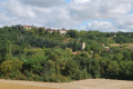
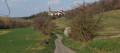
A lovely circular route through the Gers valleys with their varied crops – sunflower fields, flax fields, and passing through fields of wheat and alfalfa – starting from Castillon-Massas, a charming little village perched proudly on its rocky outcrop.

Details

3507514
Creation:
Last update:
Last review:
  • Walking
    Activity: Walking
  • ↔
    Distance: 7.99 mi
  • ◔
    Average duration: 4h 20 
  • ▲
    Difficulty: Moderate

  • ⚐
    Back to start: Yes
  • ↗
    Ascent: + 715 ft
  • ↘
    Descent: - 715 ft

  • ▲
    Highest point: 866 ft
  • ▼
    Lowest point: 495 ft

Photos

Description of the walk

The route starts in front of Castillon-Massas Town Hall on the square opposite the town hall

(S/E) Take the path on the left until you reach the Fork in the road.

(1) After the Fork in the road, head down the small road on the right towards Lalanne.

(2) In front of the Lalanne farm, turn right and take the dirt track to En Pélat.

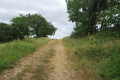
(3) At the four-way junction at the top of the hill, turn right, heading west, and stay on this track until you reach Chemin de Moussas.

(4) Turn left, follow this track until you reach the T-junction, turn left and continue until you come to a crossroads where a track branches off to the right.

(5) Turn right and continue to the hamlet of Larrama. Turn right at the fork and carry on to the four-way crossroads. Follow the road straight ahead, which goes round Haubéou Farm and continues as a dirt track. Stay on this track and pass through the hamlet of La Julian. After La Julian, stay on this stony track until you reach the junction with the Route de Castillon.

(6) Turn right and stay on this road. At the La Guzerde stream, take the footpath on the left. At the end of the footpath, turn right onto the track, then continue until you reach a tarmac road.

(7) Continue left along the tarmac road until you reach a junction with a dirt track on the right. Take this track and continue uphill until you reach a junction with a tarmac road.

(8) Turn left and follow the road. At the next junction, turn right and carry on straight ahead until you reach a right-angled bend.

(9) Leave the road and take the dirt track. Continue along this track until you reach the edge of the Larrama State Forest. Stay on this track, which turns right after running alongside the forest.

(10) At the crossroads at a place called Cap du Bosc, turn right and follow the dirt track downhill, cross a stream, then veer slightly to the right and join the track that heads straight uphill towards the Route de Castillon.

(11) On the Route de Castillon, turn right and continue along the road to the village of Castillon-Massas. Head for the car park near the village town hall (S/E).

Waypoints

  1. S/E : mi 0 - alt. 722 ft - Car park 50 m from the Town Hall
  2. 1 : mi 0.17 - alt. 666 ft - Junction of the circular loop
  3. 2 : mi 0.46 - alt. 607 ft - Crossroads at the hamlet of Lalanne
  4. 3 : mi 1 - alt. 630 ft - Crossroads at the hamlet of En Pélat
  5. 4 : mi 1.9 - alt. 784 ft - Moussas Path
  6. 5 : mi 2.25 - alt. 830 ft - Junction towards the hamlet of Larrama
  7. 6 : mi 3.73 - alt. 794 ft - Junction with Route de Castillon
  8. 7 : mi 4.46 - alt. 676 ft - Crossing the La Guzerde stream
  9. 8 : mi 5.24 - alt. 768 ft - Junction with Route de Castillon
  10. 9 : mi 5.74 - alt. 801 ft - Crossroads near the hamlet of Monsigu
  11. 10 : mi 6.93 - alt. 545 ft - Crossroads at the hamlet of Le Cap du Basc
  12. 11 : mi 7.34 - alt. 571 ft - Junction with the Castillon road at a place called Larrouquet
  13. S/E : mi 7.99 - alt. 722 ft - Car park 50 m from the Town Hall

Notes

This circular trail is aPR® trail marked in yellow. Please note that the markers are very widely spaced and are sometimes missing at key points. It is essential to set off with a map of the route.

Worth a visit

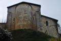
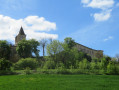
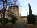
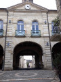
Don’t miss the small village of Castillon-Massas.
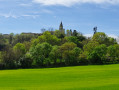
A beautiful panoramic view of the Pyrenees mountain range on a clear day between (3) and (4).

Always be cautious and plan ahead when you're outdoors. Visorando and the author of this route cannot be held responsible for any accidents occurring on this route.

The GR® and PR® markings are the intellectual property of the Fédération Française de Randonnée Pédestre.

Reviews and comments

4.4 / 5
Based on 3 reviews

Reliability of the description
4.7 / 5
Ease of following the route
4.7 / 5
Route interest
4 / 5
pierreb04
pierreb04

Overall rating : 4.7 / 5

Date of your route : Apr 13, 2026
Reliability of the description : ★★★★★ Very good
Ease of following the route : ★★★★★ Very good
Route interest : ★★★★☆ Good
Very busy route : No

A pleasant walk to enjoy in spring; easy to follow with the map and route description, offering beautiful views of the countryside and a few stretches of narrow but quiet roads in the Gers. Note: the signposting has been completely renewed, making it easy to follow the route.

Machine-translated

moguyonnet
moguyonnet

Overall rating : 4 / 5

Date of your route : Jul 01, 2021
Reliability of the description : ★★★★☆ Good
Ease of following the route : ★★★★☆ Good
Route interest : ★★★★☆ Good
Very busy route : No

Undertaken with a group of 16 walkers, the route offers lovely views of the Pyrenees and the surrounding countryside. There are some welcome shaded areas during this sunny spell, and the elevation changes are steady. One slight downside: the sections on tarmac roads, particularly the final stretch back to the village. Overall, the walk was thoroughly enjoyed by the group.

Machine-translated

Big foot
Big foot

Overall rating : 4.7 / 5

Date of your route : Mar 21, 2021
Reliability of the description : ★★★★★ Very good
Ease of following the route : ★★★★★ Very good
Route interest : ★★★★☆ Good
Very busy route : No

Hello,
The route is quite pleasant, with stunning views over the Gers countryside.
Unfortunately, I came across a rather aggressive dog on the Chemin de la Jullian (just before point 6), which forced me to take a detour across the fields to let it defend its territory. Apologies for having to cross some landowners’ fields.

Otherwise, the route is lovely, though perhaps a bit repetitive with its long straight stretches.

Machine-translated

Other walks in the area

For more walks, use our search engine .

The GPS track and description are the property of this route's author. Please do not copy them without permission.