Country:
 City:
City:


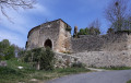
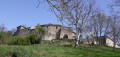
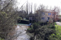
Park in the car park by the town hall.
(S/E) Take the street that runs between the town hall (on the left) and the school (on the right). You’ll come out onto the D34; follow it to the right. Take thefirst road on the left, taking care when crossing the D34. Immediately ignore a turn-off on the right and you’ll soon reach a three-way junction at a place called Petit-Jean.
Keep left and head uphill to Pédantin. Continue along a dirt track. Stay on this west-facing track and ignore any turn-offs to the sides. The track turns south and reaches the junction at the hamlet of La Coume.
(1) Leave this hamlet on your right and continue southwards along a track suitable for vehicles. At the junction in the hamlet of Carsicot, turn right onto the tarmac road. Ignore a road on the right and pass the hamlets of Maillau and Molère to reach the crossroads at Hontrède.
(2) Also leave the hamlet of Hontrède on your right and carry straight on along a track suitable for vehicles. Enter the forest and head uphill. Continue to a clearing situated just before the Chêne du Juge.
(3) Turn left, heading south-east. You’ll soon reach a track and should follow it to the left. Head eastwards. You’ll come out onto a road; follow it to the left until you reach a T-junction.
(4) Then turn left, heading due north, and pass the hamlet of Raguet. Immediately take the first right and continue to the hamlet of Panepan. Reach the corner of the barn, then turn right. Be careful here: the path is not marked on the ground.
(5) Walk past the small cottage and find a path on the right leading downhill. At the small copse, on the flat stretch, turn left towards Baron. Continue straight on until you reach the D34. Turn right and follow it to the next junction.
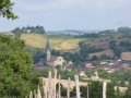
(6) Turn left towards the village of Saint-Arailles, leaving a road on your left at the first junction and turning left at the next junction. Head towards the fortified gate.
(7) Take a circular tour through the old village to explore this very picturesque hamlet, climbing up to the second fortified gate and coming back down via a street running parallel to the ascent.
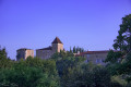
Leave the village via the winding road; at the junction, turn right, ignore a road branching off to your right and cross the bridge over the Doussine stream. Carry on straight ahead along a track suitable for vehicles, then a dirt track, ignoring any paths branching off to the right or left. The track runs along the edge of the Bois de Pitron and then heads back up into the forest to go round Pitron Castle, until you reach the castle’s carriage road.
(8) Take the downhill track to the junction with the road leading to the village of Riguepeu. Cross the mill bridge and continue to the village school, then head for the car park (S/E).

 Tourism professional
 Easy
Easy 
 Visorando Member