Baïse Valley at Saint-Jean-Poutge

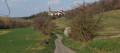
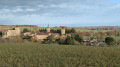
This lovely circular hike follows the old towpath along the Baïse, passing in front of Herrebouc Castle, then climbs up onto the ridges to offer beautiful panoramic views of the Gers countryside. A hike varied enough to be thoroughly enjoyable.

Details

3857795
Creation:
Last update:
Last review:
  • Walking
    Activity: Walking
  • ↔
    Distance: 10.77 mi
  • ◔
    Average duration: 5h 30 
  • ▲
    Difficulty: Moderate

  • ⚐
    Back to start: Yes
  • ↗
    Ascent: + 659 ft
  • ↘
    Descent: - 627 ft

  • ▲
    Highest point: 732 ft
  • ▼
    Lowest point: 344 ft
  • ⚐ Country: France
  • ⚐ City: Saint-Jean-Poutge (32190)
  • ⚑
    Start/End: N 43.724014° / E 0.380894°
  • ❏
    IGN map(s): Ref. 1742SB, 1743SB, 1842SB, 1843SB
  • Hour-by-hour weather

Photos

Description of the walk

Start on the right bank of the Baïse at the N124 bridge.

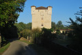
(S/E) Follow the old towpath due north to Herrebouc Castle. When you reach the tarmac road, take a moment to admire the castle and turn right.

(1) Continue straight ahead for a few metres and turn left onto the stony track, then take the path that branches off to your left and continue along the River Baïse. Follow this path alongside the river for a good distance before reaching a stone track; continue straight ahead until you reach the junction with the Route de Vic (the D103). Take care when crossing this road.

(2) Ignore the path leading straight ahead and take the path almost directly opposite, on the far right. Pass in front of the village’s rubbish collection point and continue along this dirt track, which still runs alongside the River Baïse. Pass the Lajean farm and carry on along this path until you reach the three-way junction.

(3) Turn right and stay on this uphill path which goes round the Lajean farm and climbs up to the Route du Midi.

(4) Turn right onto the tarmac road and stay on it as it runs alongside the vineyards until you reach the junction with the D103.

(5) Carry on straight ahead. Take care when crossing. Continue along this tarmac road along the ridge until you reach Lahouche Farm; the road goes round the farm and climbs further up the ridge.

(6) At the top of the hill, take the dirt track branching off to your left. Stay on this track until it crosses a tarmac road; take the road straight ahead and stay on it until the junction after the bridge over the Larranchélan Stream.

(7) Turn right and continue along this road until the next junction with a track branching off to your right. Turn right and cross the bridge over the Larranchélan Stream. Stay on this track, pass the hamlet known as La Lébé, and continue up the road.

(8) Take the stony track branching off to the right, which runs alongside a small cottage. Continue straight on along this track until you reach a junction with a tarmac road. You are now in the hamlet of Herrebouc.

(9) Turn right, walk through the hamlet of Herrebouc and continue along this path until you reach the bridge spanning the River Baïse opposite Herrebouc Castle. Before the bridge, turn left and rejoin the old towpath which runs alongside the river and will take you back to the starting point of the circular route (S/E).

(S/E) Arrival at the starting point in St-Jean-Poutge.

Waypoints

  1. S/E : mi 0 - alt. 344 ft - Right bank of the Baïse alongside the N124 - Baïse (rivière)
  2. 1 : mi 1.33 - alt. 354 ft - Junction with the Chemin de Herrebouc
  3. 2 : mi 2.53 - alt. 364 ft - Junction with Route de Vic
  4. 3 : mi 3.33 - alt. 348 ft - Path junction near the Lajean farm
  5. 4 : mi 4.01 - alt. 479 ft - Chemin du Midi junction
  6. 5 : mi 4.51 - alt. 541 ft - D103 junction
  7. 6 : mi 5.55 - alt. 650 ft - Junction after the Lahouche farm
  8. 7 : mi 6.36 - alt. 453 ft - Crossroads after the Larranchélan stream
  9. 8 : mi 7.95 - alt. 725 ft - Junction after the hamlet of La Lébé
  10. 9 : mi 9.23 - alt. 440 ft - Crossroads at the entrance to Herrebouc
  11. S/E : mi 10.77 - alt. 351 ft - Right bank of the Baïse alongside the N124

Notes

Take care when crossing the D103 on two occasions

(6) Alternative route for a 12 km circular route: continue along the tarmac road which turns right downhill, and you will reach (1) opposite Herrebouc Castle. Return to the path along the River Baïse to the starting point.

Worth a visit

Herrebouc Castle

Reviews and comments

4.3 / 5
Based on 3 reviews

Reliability of the description
4.3 / 5
Ease of following the route
4.3 / 5
Route interest
4.3 / 5
gi
gi

A lovely walk

Machine-translated

yvesrégine
yvesrégine

Overall rating : 4.7 / 5

Date of your route : May 13, 2024
Reliability of the description : ★★★★★ Very good
Ease of following the route : ★★★★★ Very good
Route interest : ★★★★☆ Good
Very busy route : No

A varied and enjoyable walk. Shaded along the Baïse river as far as Herrebouc Castle, then along the ridges, offering beautiful panoramic views of the Gers countryside. Best avoided in the height of summer.

Machine-translated

gi
gi

Overall rating : 4 / 5

Date of your route : Feb 16, 2023
Reliability of the description : ★★★★☆ Good
Ease of following the route : ★★★☆☆ Average
Route interest : ★★★★★ Very good
Very busy route : No

We had a bit of a problem with that section, but otherwise it’s a lovely route to cycle, even in winter

Machine-translated

egres34
egres34

Overall rating : 4.3 / 5

Date of your route : Nov 11, 2021
Reliability of the description : ★★★★☆ Good
Ease of following the route : ★★★★★ Very good
Route interest : ★★★★☆ Good
Very busy route : No

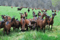
A pleasant walk along a path that’s shaded for almost the entire route, surrounded by farmland and grazing sheep. At the start, we followed the Baïse Canal and took a short detour to visit a castle estate where there was an exhibition of paintings on the theme of Halloween.

Machine-translated

Other walks in the area

For more walks, use our search engine .

The GPS track and description are the property of this route's author. Please do not copy them without permission.