Country:

 City:
City:


Coming from Munster via the D417, at the cemetery and war memorial, the road forms a hairpin bend. Turn left towards Ampfersbach. After about 800 metres, take the left-hand lane until you reach the Schmelzwasen car park, where the walk begins.
(S/E) Return to the main road for a few metres, then take thesecond lane on the left, known as the Chemin du Schmelzwasen, marked with a Yellow Triangle. A few metres past the fountain on the left, follow the route as it turns left onto a grassy path. Follow this until you reach the Abswald path. Take this to the left for 20 metres (marked with a red Rectangle, a White Rectangle, and a red Rectangle).
(1) Ignore the return path on the right and continue straight on until you meet the path coming from the right which leads to the “Les Sources” holiday camp. Continue straight on for a few metres and leave the path.
(2) Take the small path on the right. The path climbs gently through a well-shaded area and forms a large zigzag before crossing a forest track.
(3) Carry on straight ahead, passing two more large zigzags and a series of smaller ones, until you reach the D417.
(4) Turn right onto it for a few metres and take the path on the left, which continues as a track to the Altenberg (former sanatorium). Go round the building to the north, following the old boundary wall. It forms a right angle and further on reaches an old, moss-covered reservoir. Turn right again, continuing along a well-shaded route to the crossroads.
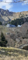
(5) From there, take the path on the right downhill via the Yellow Triangle towards the Hirschsteine. With a bit of luck, you might spot some chamois there! A series of ladders and exposed sections – though well equipped with handrails – lead the walker to a magnificent viewpoint with a bench.
(6) From the viewpoint, head back the way you came and turn right twice before turning left, whilst following the same markings. The path winds its way through stones and rocks to reach the ridge via a series of tight zigzags (elevation 1230).
(7) Follow the ridge to the right, following the Red Rectangle (GR®5). Pass successively by the Petit and Grand Wurzelstein (elevation 1,270) and reach the Tanet.
(8) Continue along the ridge until you reach the Dreieck (altitude 1,230), where there is a car park. The D61, known as the Route des Crêtes, runs alongside the path.
(9) Carry on straight ahead, then turn right, following the Red Rectangle/White Rectangle/Red Rectangle markings along the so-called “panoramic” route to reach the Gazon de Faîte.
(10) Following the GR®5 ridge route, continue to the right towards the Taubenklangfelsen and finally the Gazon du Faing.
(11) Keep to the right to descend towards Lac du Forlet, following the Yellow Triangle markings.
(12) After 250 metres, at a wooden boardwalk, take the steep and very stony path on the right towards Lac du Forlet (also known as Lac des Truites). Go round it on the right (west) and continue along the path marked with a Yellow Disc to climb up to Chalet Erichson.
(13) Follow the Yellow Disc markings downhill to the left, towards the Gaertelsrain farm. Continue downhill until you reach Lac de Soultzeren, also known as Lac Vert. Walk along its left-hand side, still following the Yellow Disc markings, until you reach the dam.
(14) Take the track on the left, then follow the left-hand path known as the Chemin Forestier du Rappenkopf, marked with Red Discs and Yellow Discs, for about 150 metres. Then, at the T-junction, turn right onto a wide path marked with Yellow Discs for 200 metres. Stay on this route to the left, then keep to the right to take the pleasant forest path marked with a Yellow Triangle as far as Boden.
(15) Turn right for 50 metres, then keep left, following the Blue Rectangle markings for 200 metres. Cross the track and continue straight ahead, following the Yellow Triangle markings along a well-shaded path. (This final section is subject to forestry work as of 25/05/2026.)
(16) Cross the D417 with care and continue straight ahead towards Brennaeckerle along a forest track. At the sharp bend to the left, continue straight ahead, still following the Yellow Triangle markings. Stay on this route and cut across a track until you reach the next junction.
(17) Turn right and head back to the junction you passed on the way out.
(1) Keep left, then right, following the path in the opposite direction to the outward journey to reach the car park (S/E).
 Visorando Member
 Moderate
 Easy
Easy 
 Difficult
 Association / Club / Walk leader