Country:

 City:


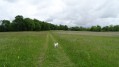
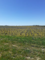
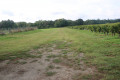
(S/E) Leave the car park heading north-east along Rue du Huit Mai. After passing Rue du Stade on the left, the road gives way to a farm track that winds its way between vineyards and fields. Further on, cross Route de Boyentran with care and continue straight ahead until you reach Route de Barbehère.
(1) Turn right and follow this quiet little road. Just at the edge of a small wood, on the left-hand side, you can visit the megalithic monument known as the Dolmen de Barbehère, about 150 metres from the road. Otherwise, continue along the road, passing Barbehère, then carry on towards Boyentran.
(2) At the junction with the Route de Boyentran, turn left and drive through the hamlet.
(3) Take the Route de Muret on the right for 100 metres, then turn right onto the Route de Brion.
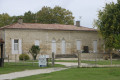
(4) In the village of Brion, keep to the right as you pass the Château Haut Queyran, heading towards the archaeological site. Keep to the right at the junction and you’ll reach the site.
(5) On arrival at the site, a sign points to the medieval settlement and the Roman theatre. Head towards the amphitheatre and go down the steps to reach the stony farm track. Then turn back and head off to the right to rejoin and follow the white track.
(6) When you reach the Route de Gouat, turn left onto it, then after 250 metres, turn right onto the vineyard paths leading to the village of Miqueu.
(7) Cross the Route de Miqueu D4, then turn right and join the Chemin de la Gravette on the left.
(8) Turn right onto the Allée du Château Livran. Walk alongside the walls of the wine cellars, then turn left to cross the courtyard – taking care not to disturb the wine-making activities – and join the Route de la Mouline. 200 metres past the houses, turn right onto the vineyard paths.
(9) Turn right at the junction; at the end, cross the road and walk alongside the cemetery. Take the path on the left to return to the starting point (S/E).
 Visorando Member

 Easy