Cime de Linière, starting from Mont Agaisen

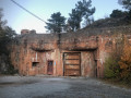
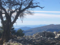
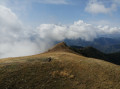
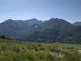
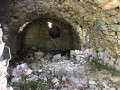
A very beautiful hike, mainly through woodland. The Cime de Linière is a pleasant grassy plateau offering a stunning view stretching as far as the Estérel. The return journey past the bunkers brings to life the history of these fortifications, which opened fire during the Italian attack in June 1940.

Details

42957000
Creation:
Last update:
Last review:
  • Walking
    Activity: Walking
  • ↔
    Distance: 6.71 mi
  • ◔
    Average duration: 5h 10 
  • ▲
    Difficulty: Moderate

  • ⚐
    Back to start: Yes
  • ↗
    Ascent: + 2,421 ft
  • ↘
    Descent: - 2,408 ft

  • ▲
    Highest point: 4,462 ft
  • ▼
    Lowest point: 2,172 ft

Photos

Description of the walk

From Sospel, take the Mont Agaisen road; after numerous bends, park near marker 82.
Please note, however: when leaving from Sospel during term time, this access road to Mont Agaisen is open to traffic in the morning after 8.30 am.

(S/E) By road, head from marker 82 to marker 83 at the Col de l’Agaisen.

(1) Turn left towards La Baisse de Fighièra. This path, which starts on the left with a gentle incline, is lined with hectometre markers dating from the 1930s. Continue uphill to reach marker 84.

(2) Turn left at marker 84 and you’ll immediately reach a crossroads (elevation 698); continue straight ahead.

(3) Carry on straight ahead to join theGR®52(marked in white and red).

(4) Follow the path overlooking the road to reach the Baisse de Fighièra, at marker 76.

(5) Cross the tarmac road and take the path opposite towards the Cime de Linière. Continue the climb through the woods until you reach the junction at marker 77. Please note: the map shows the marker before this junction; this is an error.

(6) Turn right onto theGR® at marker 77 to enter the Mercantour National Park here. Continue to the edge of the forest to reach the Baisse de Linière.

(7) Leave theGR® here and turn left. The path winds through the trees, then crosses a flat stretch to reach a clearing. After a final short climb, you’ll reach the Cime de Linière.

(8) Descend south-west off the beaten track. Use the Visorando app to find the path below the summit.
Follow this path, stepping over a few fallen trees from the October 2023 storm which occasionally block the route. Follow the path, which runs along the edge of the woodland. Take care here: there are no markings, but there are cairns. You’ll reach a crossroads with several directions (alt. 1,240 m).

(9) Turn left, heading south, and descend, following the cairns and, in places, faint yellow markings. You’ll reach a stream with a spring.

(10) Cross this stream and head straight on to reach the grassy peak of Calvièra.

(11) Continue left along the path leading downwards, skirting the boundary of the Mercantour National Park. You’ll come back to the junction you passed on the way out and marker 77.

(6) Turn right and retrace your steps along theGR®52. Head for the Baisse de Fighièra.

(5) Leave theGR® here, cross the tarmac road and take the path leading uphill opposite, slightly to the left. Then head downhill to reach the second junction, which is somewhat hidden by vegetation (elevation 698).

(3) Continue straight ahead, passing close to a blockhouse, until you reach the tarmac road.

(1) There are two marker posts numbered 83 in this clearing. Head straight towards the furthest marker post 83 and turn right to reach the car park below (S/E).

Waypoints

  1. S/E : mi 0 - alt. 2,175 ft - Car park marker 82
  2. 1 : mi 0.11 - alt. 2,192 ft - Marker 83 – Starting junction of the circular route - Col de l'Agaisen
  3. 2 : mi 0.38 - alt. 2,264 ft - Marker 84
  4. 3 : mi 0.43 - alt. 2,290 ft - Second junction on the circular loop
  5. 4 : mi 0.61 - alt. 2,198 ft - GR°°®°°52 trail
  6. 5 : mi 1 - alt. 2,448 ft - Marker 76 - Baisse de Figuiéra
  7. 6 : mi 1.92 - alt. 3,228 ft - Marker 77 – Junction of the Cime de Linière circular loop
  8. 7 : mi 3 - alt. 4,416 ft - Junction - Baisse de Linière
  9. 8 : mi 3.38 - alt. 4,367 ft - Cime de Linière
  10. 9 : mi 3.7 - alt. 4,091 ft - Trail junction
  11. 10 : mi 4.05 - alt. 3,619 ft - Spring – Fork in the path
  12. 11 : mi 4.32 - alt. 3,632 ft - Pointe Calvièra (1108 m)
  13. S/E : mi 6.71 - alt. 2,182 ft - Car park marker 82

Notes

Hike suitable all year round.
A GPS or the Visorando app is required after the Cime de la Linière.
The mobile app will be a very useful addition.
Hiking boots and walking poles recommended. Stony terrain.
(10) There is just one water source: a spring.
From (6) to (10) in the Mercantour National Park. Regulations must be observed.
The Cime de Linière is an open area offering a stunning view stretching as far as the Estérel. An excellent spot for lunch,

This route passes through a protected area, which may be subject to special regulations:

Worth a visit

Visit Sospel, a town steeped in history.
Visit the magnificent Agaisen fortification, part of the Maginot Line.

Always be cautious and plan ahead when you're outdoors. Visorando and the author of this route cannot be held responsible for any accidents occurring on this route.

The GR® and PR® markings are the intellectual property of the Fédération Française de Randonnée Pédestre.

Reviews and comments

5 / 5
Based on 2 reviews

Reliability of the description
5 / 5
Ease of following the route
5 / 5
Route interest
5 / 5
bernard bb
bernard bb

Simply thank you, User 5893378, for this review
It couldn't be clearer.
Best regards, b

Machine-translated

User 5893378
• Edited:

Overall rating : 5 / 5

Date of your route : Feb 28, 2026
Reliability of the description : ★★★★★ Very good
Ease of following the route : ★★★★★ Very good
Route interest : ★★★★★ Very good
Very busy route : No

A beautiful hike with explanations and a route that are 100% accurate, offering lovely scenery that changes as you progress. Follow in the footsteps of the Second World War. Thank you for the information.

Machine-translated

bernard bb
bernard bb

Thanks, Antoine, for this review
Best regards, Bernard BB

Machine-translated

L'Antoine
L'Antoine

Overall rating : 5 / 5

Date of your route : Feb 24, 2024
Reliability of the description : ★★★★★ Very good
Ease of following the route : ★★★★★ Very good
Route interest : ★★★★★ Very good
Very busy route : No

Hello,
Here is an alternative route starting from Sospel to make the climb more challenging. Set off from the Jean Médecin secondary school (plenty of parking spaces) and marker 81, then head up the GR52A to marker 82, followed by the GR52 to the Linière pass. From there, there’s another option: either climb to the summit and follow the circular path, or head back down to marker 77, where you’ll turn immediately right onto a good, scenic path (shown as a dotted line on the map) which takes you back to marker 75. Then take the GR 52 to marker 73, follow the Chemin de Cantamerlo to the left for 500 metres to the Impasse du Soleil (at the bend), where on the right there is a lovely concrete staircase leading straight back to the Jean Médecin secondary school. A very lovely hike with plenty of elevation gain (+1,000 metres) and distance covered (however, we didn’t climb Mont Agaisen and stopped at the Linière descent). Enjoy the hike. L’ANTOINE.

Machine-translated

Other walks in the area

For more walks, use our search engine .

The GPS track and description are the property of this route's author. Please do not copy them without permission.