Mont Agaisen and Baisse de Fighièra

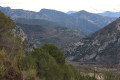
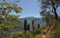
A walk above the River Bévéra, with some lovely views of Sospel and its valley. Mont Agaisen offers a fine example of the region’s military defences. This route, which is often shaded, offers more varied scenery than the classic round trip to Mont Agaisen.

Details

68209568
Creation:
Last update:
Last review:
  • Walking
    Activity: Walking
  • ↔
    Distance: 5.23 mi
  • ◔
    Average duration: 3h 55 
  • ▲
    Difficulty: Moderate

  • ⚐
    Back to start: Yes
  • ↗
    Ascent: + 1,732 ft
  • ↘
    Descent: - 1,722 ft

  • ▲
    Highest point: 2,451 ft
  • ▼
    Lowest point: 1,119 ft

Photos

Description of the walk

Park in the large car park near the bridge over the Bévéra.

(S/E) As you leave the car park, turn left to cross the bridge, and head up into the village via Boulevard Charles de Gaulle.

(1) Look out for the cul-de-sac on the left – you’ll take this on the way back – and continue along the boulevard for a few dozen metres. Then take the steps on the left leading to the Chemin du Vier, which you should follow to the right until you reach the bend (marker 81).

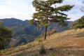
(2) Follow the GR®52A (red and white markings) by taking the path on the left, which climbs steadily and offers some lovely views over the valley. On the right, you’ll pass several buildings in varying states of repair . Join the Route de l’Agaisen.

(3) Turn right and follow the road for about a hundred metres before rejoining the path on the left. At the second junction where the path crosses the road, cross over and continue straight on. You’ll reach an inconspicuous crossroads, marked by a mountain bike trail sign.

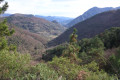
(4) Turn onto the path on the left, which climbs steadily through the forest towards the Fort du Mont Agaisen.

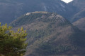
(5) Once on the Mont Agaisen plateau, take the time to read the information boards about the site and to look out for the Fort du Barbonnet on the other side of the Bévéra valley. You may also have the chance to watch paragliders taking off. Then follow a path downhill to the right, which leads to marker 83 at the Col de l’Agaisen.

(6) Head due north towards the Baisse de Levens and the Baisse de Fighièra until you reach marker 84.

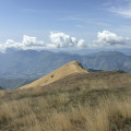
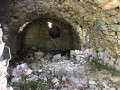
(7) At this marker, turn right onto the path which continues towards the Baisse de Levens, leaving the path leading to the Baisse de Fighièra on your left. This path offers lovely views over the Fighetta valley. You’ll reach a large ruined building.

(8) Just after this, a path on the left leads back up to the Baisse de Fighièra (marker 76) to rejoin the GR®52.

(9) Turn left and head for marker 75, situated at the junction with the Route de Berrins.

(10) Turn left and follow this road to the hairpin bend.

(11) Leave the road, take the path opposite, and begin a series of hairpin bends. Keep heading south, ignoring any side paths, and rejoin the Route de l’Agaisen at a hairpin bend and marker 74.

(12) Go straight on and follow this road until you reach the junction with the Chemin du Vier, near the nursery school.

(13) Take the steps opposite, which lead to Boulevard Charles de Gaulle, the road you took at the start.

(1) Turn right and cross the bridge to return to the car park (S/E).

Waypoints

  1. S/E : mi 0 - alt. 1,135 ft - Car park near the bridge over the - Bévéra (rivière)
  2. 1 : mi 0.12 - alt. 1,148 ft - Junction of the circular loop
  3. 2 : mi 0.31 - alt. 1,220 ft - Waymark 81
  4. 3 : mi 0.69 - alt. 1,647 ft - Route de l’Agaisen
  5. 4 : mi 1.34 - alt. 2,136 ft - Mountain bike signpost
  6. 5 : mi 1.74 - alt. 2,451 ft - Fort du Mont Agaisen - Ouvrage de l'Agaisen de la ligne Maginot
  7. 6 : mi 1.94 - alt. 2,192 ft - Waymark 83, Col de l’Agaisen
  8. 7 : mi 2.21 - alt. 2,267 ft - Waymark 84
  9. 8 : mi 2.73 - alt. 2,149 ft - Ruins, on the left
  10. 9 : mi 2.99 - alt. 2,444 ft - GR®52 - Baisse de Figuiéra
  11. 10 : mi 3.4 - alt. 2,162 ft - Route de Berrins
  12. 11 : mi 3.52 - alt. 2,126 ft - Junction on the footpath
  13. 12 : mi 4.78 - alt. 1,352 ft - Waymark 74
  14. 13 : mi 5.04 - alt. 1,184 ft - Nursery school
  15. S/E : mi 5.23 - alt. 1,135 ft - Car park near the bridge over the Bévéra

Worth a visit

A tour of Sospel on the way back, taking in the arcades of the Route Royale, the old bridge and Saint-Michel Cathedral, will be a lovely way to round off the day.

Always be cautious and plan ahead when you're outdoors. Visorando and the author of this route cannot be held responsible for any accidents occurring on this route.

The GR® and PR® markings are the intellectual property of the Fédération Française de Randonnée Pédestre.

Reviews and comments

4.7 / 5
Based on 2 reviews

Reliability of the description
4.5 / 5
Ease of following the route
4.5 / 5
Route interest
5 / 5
engrandl
engrandl

Overall rating : 4.3 / 5

Date of your route : Jan 10, 2026
Reliability of the description : ★★★★☆ Good
Ease of following the route : ★★★★☆ Good
Route interest : ★★★★★ Very good
Very busy route : No

A very beautiful walk without much difficulty, completed in 4.5 hours including a lunch break. We ended up doing it in the opposite direction unintentionally. And actually, we think it was better that way, probably easier.

Machine-translated

EmmaRB
EmmaRB

Overall rating : 5 / 5

Date of your route : Jun 22, 2025
Reliability of the description : ★★★★★ Very good
Ease of following the route : ★★★★★ Very good
Route interest : ★★★★★ Very good
Very busy route : No

A lovely walk with magnificent views of Sospel and the surrounding area. A very interesting viewpoint at the summit, featuring bunkers and a periscope that still works. This walk was perfect for a very hot, sunny day as it was almost entirely in the shade of a lovely forest. There were a few steep climbs at the start, but through a very pretty woodland. At this time of year, the abundance of wildflowers was magnificent. A lovely walk!

Machine-translated

Other walks in the area

For more walks, use our search engine .

The GPS track and description are the property of this route's author. Please do not copy them without permission.