Circuit of Mont Panard from Col Saint-Jean

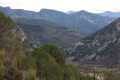
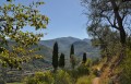
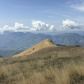
A walk around Mont Panard, suitable for experienced walkers on good forest paths.

Details

n°27434547
Creation:
Last update:
Last review:
  • Walking
    Activity: Walking
  • ↔
    Distance: 7.50 mi
  • ◔
    Average duration: 5h 20 
  • ▲
    Difficulty: Moderate

  • ⚐
    Back to start: Yes
  • ↗
    Ascent: + 2,175 ft
  • ↘
    Descent: - 2,182 ft

  • ▲
    Highest point: 3,386 ft
  • ▼
    Lowest point: 2,110 ft

Description of the walk

Parking is difficult; it may be possible to park one car in front of marker 112 on Route du Barbonnet.

(S/E) Head for Col Saint-Jean and marker 113. Cross the road and take the path opposite, which leads onto the Route du Col de Braus. Cross the road again and rejoin the path opposite, which cuts across two hairpin bends. Back on the road, follow it for about 250 metres to marker 114.

(1) Turn left onto the path that forms part of theGR®510(marked in white and red). Continue to the Baisse du Pape (marker 115).

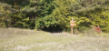
(2) Turn onto the track on the left and keep to the right immediately. Pass an abandoned greenhouse and continue to marker 155.

(3) Take the path on the right and rejoin the track (cairn). Continue to the right until you reach marker 154.

(4) Carry on straight ahead, following the ridge, until you reach a three-way junction. Ignore the track opposite which climbs up to Mont Panard and take the path on the right until you reach another track.

(5) Turn left, then keep left at the three-way junction near marker 148. Reach the junction at marker 153.

(6) Turn left and head uphill to the track at marker 154.

(4) Turn right for about 50 metres, then turn left onto the path you took on the way up.

(3) Follow the same route back down to reach the Col Saint-Jean and the car park (S/E).

Waypoints

  1. S/E : mi 0 - alt. 2,126 ft - Marker 112 before the - Col Saint-Jean (642m)
  2. 1 : mi 0.37 - alt. 2,264 ft - Marker 114 (Baisse du Pape)
  3. 2 : mi 1.54 - alt. 3,360 ft - Marker 115
  4. 3 : mi 1.78 - alt. 3,373 ft - Marker 155
  5. 4 : mi 2.49 - alt. 3,245 ft - Marker 154
  6. 5 : mi 3.47 - alt. 2,621 ft - Path – Track
  7. 6 : mi 4.43 - alt. 2,635 ft - Marker 153
  8. S/E : mi 7.5 - alt. 2,110 ft - Col Saint-Jean

Notes

No water source.

Always be cautious and plan ahead when you're outdoors. Visorando and the author of this route cannot be held responsible for any accidents occurring on this route.

The GR® and PR® markings are the intellectual property of the Fédération Française de Randonnée Pédestre.

Reviews and comments

4.7 / 5
Based on 1 review

Reliability of the description
5 / 5
Ease of following the route
5 / 5
Route interest
4 / 5
Espedaillac
Espedaillac

Overall rating : 4.7 / 5

Date of your route : Dec 08, 2022
Reliability of the description : ★★★★★ Very good
Ease of following the route : ★★★★★ Very good
Route interest : ★★★★☆ Good
Very busy route : No

Hello,

A lovely walk with no particular difficulties. At the start at the Col St Jean, it’s difficult to park due to a lack of parking spaces. A lovely climb in the shade up to the Baisse du Pape through the forest. Then you’re back in the sunshine to complete the circular walk. It was a lovely day in early December, but it’s cold – be careful on the descent as the ground is damp and the leaves make it slippery. Thank you

Machine-translated

Other walks in the area

For more walks, use our search engine .

The GPS track and description are the property of this route's author. Please do not copy them without permission.