Country:

 City:
City:


Park in the car park in the centre of Sospel, alongside the River Bévéra. There are several spaces where you can leave your car for the day.
(S/E) Start at marker 70 – Baisse de Fighièra – GR®52 / Col de l’Agaisen, next to the Pont de la Libération, following Avenue du Général de Gaulle. Walk past marker 71, continuing to follow the Baisse de Fighièra – GR®52 and the Col de l’Agaisen by turning left. Carry on past marker 72 and take the uphill road that runs alongside Sospel Primary School. The red and white markings of the GR®52 begin here.
(1) At marker 73, do not take the return path on your right, but continue along the tarmac road towards the Baisse de Fighièra. Pass marker 74 and continue along the stony track below.
(2) At the junction, carry on along the ascending stony track. After a few hairpin bends and a gradual climb, you’ll rejoin the road at marker 75.
(3) Carry on along the tarmac road as it climbs.
(4) You’ll pass a second, then a third marker 75. Follow the signs for the GR®52. You’ll arrive at the Baisse de Fighièra (750 m).
(5) Follow marker 76 and the GR®52 signposting ahead of you.
(6) At marker 77, head towards the Baisse de Linière on the right. You’ll enter the Mercantour National Park.
(7) At marker 22 – Baisse de Linière (1,342 m), continue to the right on the GR®52 towards the Baisse de la Déa.
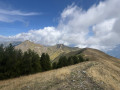
(8) At the unnumbered marker, do not take the tricky path towards Baisse de la Déa. Continue to the right on the GR®52, which climbs to the right. You will then reach the ridges, which you follow to the summit of Mangiabo.
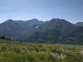
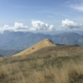
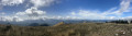
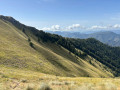
(9) Summit of Mangiabo (1,821 m). Enjoy the view of the surrounding peaks of the Mercantour. You can see the route you’ve taken and, behind you, the Pointe de Ventabren (1,977 m). After a rest, set off again heading north. Descend to marker 144, a few dozen metres below.
(10) Leave the GR®52 and head towards Baisse de Levens on the right; from here, follow the yellow markers.
(11) At marker 139 – Baisse de Levens (1,106 m), turn right towards Sospel (signposted as a 2-hour walk).
(12) Cross the damaged tarmac road and continue along the path.
(13) Cross the Callecastagne stream and continue along the signposted path.
(14) Walk past marker 84 and continue straight ahead towards the Col de l’Agaisen. You’ll reach the Col de l’Agaisen (666 m) at marker 83.
(15) Continue straight ahead along the path towards Sospel via Cantamerlo. Head down to the right onto the tarmac road, passing marker 82.
(16) Walk past the dog training centre and continue along the tarmac road before taking the path signposted ‘Itinéraire pédestre’ on the right. Cross two tarmac roads and reach marker 73, which you passed on the way out.
(1) Retrace your steps along the route you took on the way there, turning left until you reach the Sospel car park (S/E).
 Visorando Member
 Moderate
 Difficult