Country:
 City:
City:


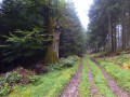
Start: Hiking car park on the L 242 between Argenthal and Dörresbach
(S) From the hiking car park on the L 242 between Argenthal and Dörresbach, we hike up to the second highest mountain in the Soonwald, the 643-metre-high Schanzerkopf. We first follow the L242 to the right and then turn left, then left again at the next junction.
(1) Then turn right and you will reach the Schanzerkopf. From here, you can enjoy great views over the northern Soonwald. Then we continue hiking towards the Katzenkopf. The route takes us through deciduous and coniferous woods. Natural paths and wide forest trails characterise the route.
(2) We cross the L239 and continue to follow the signs.
(3) At a crossroads, we pass the Eichberghütte and can now see some wind turbines at the side of the path.
(4) We reach a crossroads and keep to the right, arriving at the 637-metre-high Katzenkopf. A natural forest reserve has been established here. With a bit of luck, you may catch a glimpse of the shy wildcat at the Katzenkopf.
We turn left and pass a tiny biotope pond and follow bumpy paths made of quartzite, which require careful hiking.
(5) Our path then leads to the left and then to the right, and we arrive at the refuge hut at the 648-metre-high Hochsteinchen, a rock formation on the eastern edge of the Soon. Here you can climb an 18-metre-high steel observation tower, which is a listed building. From the top, you can enjoy panoramic views over the Middle Rhine Valley and far into the Taunus mountains.
From the Hochsteinchen, wide, straight gravel forest paths often lead over the Soonwald ridge. Soon, the trail descends steeply from the wooded heights, past the Rheinböller Hütte hut and into the third valley of the Soonwald, the Guldenbachtal.
(6) In the Guldenbachtal, we hike to the left and then to the right through the Rheinböller industrial estate and cross the Guldenbach at a sewage treatment plant. A little later, the Soonwaldsteig trail passes under the A 61 motorway and climbs quite steeply up wide forest paths to the former Emmerichshütte forest lodge, which is now open to the public.
(7) Here we are already in the Binger Wald, the eastern part of the Soonwald. Continue uphill towards Kandrich. At the botanical garden, keep right and turn left at the next intersection, then right again.
(8) On Kandrich, we come across another wind farm with a whole row of wind turbines. We continue towards Ohligsberg along wide forest paths. We turn right at the next crossroads, then left in a right-hand bend and reach the mountain. We follow the path to the right and keep left at the fork.
(9) After a while through the forest, we reach the Lauschhütte, where you can also stop for refreshments.
(10) From the nearby observation tower on the 627-metre-high Salzkopf, you can once again enjoy the view over the Hunsrück. The Rhine and Nahe valleys, the Taunus heights beyond the Rhine and parts of the Palatinate are also clearly visible from the wooden structure.
The Soonwaldsteig then descends into the upper Morgenbach Valley. We follow it to the right and continue straight ahead across the next two crossroads. Our hiking trail then takes a right turn.
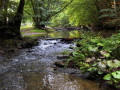
(11) We turn left and now walk along the Morgenbach stream. Here we soon come across natural forest and riverside paths again.
(E) The long-distance hiking trail leads us along the water, gradually descending to the hospitable Jägerhaus forest lodge, the end of today's stage.
 Visorando Member
 Moderate