


 Country:
 City:
City:


The Soonwaldsteig trail mainly follows natural paths and trails.
It is marked throughout.
The start and end points of the hike in Kirn and Bingen can be reached by public transport. However, there are only a few accommodation options in Lützelsoon and Großer Soon. You may have to use signposted access routes to reach nearby accommodation.
Soonwaldsteig


The Soonwaldsteig trail runs for 85 km from Kirn on the Nahe river, right through the Soonwald-Nahe Nature Park to Bingen am Rhein. We first hike parallel to the Hahnenbach valley to Schmidtburg and then tackle the Lützelsoon hills. The trail then leads through the Kellenbach valley into the Soonwald forest. At Rheinböllen, we cross the Guldenbach Valley and finally pass through the Binger Forest to the Rhine at Bingen am Rhein.
Details
Creation:
Last update:
–
–
Last review:
–
–
-
 Activity: Walking
 -
 Distance: 57.17 mi
 -
 Average duration: 5 days
 -
 Difficulty: Moderate
 -
-
 Back to start: No
 -
 Ascent: + 9,396 ft
 -
 Descent: - 9,738 ft
 -
-
 Highest point: 2,178 ft
 -
 Lowest point: 282 ft
Photos
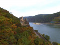
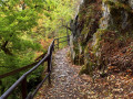
Stages of the route
This route needs several days, find the details below:
Notes
Worth a visit
See descriptions of the individual hiking tours.
Other walks in the area
Soonwaldsteig 1st stage Kirn - Rudolfshaus
 Visorando Member
 10.24 mi
+2,352 ft
-2,110 ft
6h 45
Moderate
10.24 mi
+2,352 ft
-2,110 ft
6h 45
Moderate
 Departure from Kirn (Landkreis Bad Kreuznach)
Gentle adventure meets evidence of the exciting Middle Ages
"Off on a gentle adventure" is the motto of the 84-kilometre-long Soonwaldsteig trail. It runs across the densely wooded quartzite ridges of Lützelsoon and Großer Soon from Kirn on the Nahe to Bingen on the Rhine. The long-distance hiking trail is very peaceful on its five (possibly six) stages, and we do not pass any human settlements for more than forty kilometres. The trail follows many paths past several medieval ruins, a series of observation towers with some outstanding views, and finally, the romantic Rhine.
The very first stage of the Soonwaldsteig shows that this long-distance hiking trail is full of surprises and will not disappoint nature-loving hikers.
Soonwaldsteig Stage 2 Rudolfshaus – Koppenstein
 12.32 mi
+2,674 ft
-1,926 ft
8h 00
12.32 mi
+2,674 ft
-1,926 ft
8h 00
 Difficult
Departure from Bundenbach (Landkreis Birkenfeld)
Difficult
Departure from Bundenbach (Landkreis Birkenfeld)
This stage of the Soonwaldsteig trail leads through the Hahnenbach Valley and over the quartzite ridge of the Lützelsoon. It follows idyllic riverside paths and wild trails from Rudolfshaus to the ruins of Koppenstein Castle. It passes a visitor mine, a reconstruction of a Celtic hilltop settlement, the historic Schmidtburg castle and the Hahnenbach Valley water adventure trail. Sure-footedness is essential on this stage.
Soonwaldsteig 3rd stage – Koppenstein – Schanzerkopf
12.18 mi
+1,499 ft
-1,119 ft
6h 55
Moderate
Departure from Henau (Rhein-Hunsrück-Kreis)
Through beech forests and nature reserves in the Großer Soon
On the third stage of the Soonwaldsteig trail, from the Koppenstein hiking car park to the Schanzerkopf hiking car park, the long-distance hiking trail plunges into the total seclusion of the Greater and Middle Soon. It passes through a primeval forest, two marshy nature reserves and quiet beech forests. Wild paths over bumpy quartzite rock, natural forest trails and soft meadow paths are part of the route profile, which takes us over the highest point of the Soonwald, the 658-metre-high Ellerspring.
Soonwaldsteig 4th stage Schanzerkopf - Jägerhaus
14.23 mi
+1,532 ft
-2,536 ft
7h 55
Difficult
Departure from Argenthal (Rhein-Hunsrück-Kreis)
From the panoramic Schanzerkopf in the Mittlerer Soon to the Binger Wald
The fourth stage also takes us through the unspoilt, almost untouched landscape of the Soonwald forest. However, we are noticeably closer to civilisation again. We pass through the village of Rheinböllen, walk through a wind farm and come across two former foresters' houses where we can stop for refreshments. On the section from Schanzerkopf to the Jägerhaus foresters' house, we can enjoy magnificent views and, in addition to the panoramic Soonwald ridge, we pass two viewing towers.
For more walks, use our search engine .
The GPS track and description are the property of this route's author. Please do not copy them without permission.

