Country:
 City:
City:


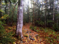
The walk starts in Heyweiler, at the car park outside the village designated for walkers.
From the village centre, follow the signs marked ‘P’ with the hikers’ pictogram.
Purple rectangular SH markings
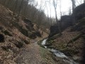
(S/E) Go through the entrance gate to Baybachklamm and, at the next signpost, turn left. Follow the main path to Schinkaul.
(1) Continue along the path on your left, which winds down to the River Buchbach. Turn right and then take the path leading uphill to the left. At the junction, take the path on the right. Climb up to the next path.
(2) Turn left, then turn right onto the path and follow the switchbacks uphill. At the track, turn left. Walk alongside a cultivated field until you reach the crossroads at the entrance to Steffenshof. Turn left. (Go straight on if you’d like to see the chapel, then retrace your steps).
(3) At the edge of the forest, turn right and walk along the back of the hamlet’s houses. Cross the road and carry on straight ahead. Continue straight ahead after crossing a second road.
(4) Enter the woodland on your left. Cross the stream, walk alongside the fence, then further on, cross the stream again and continue to the left.
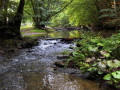
(5) Take the bridge on your left and climb the steps. At the top, turn right. Walk to the cave. Go down the path opposite the cave, cross the stream and continue to the left. At the junction further on, carry straight on. Now follow the Baybach and you’ll come to sections fitted with cables. Wade across the stream.
Walk past the Chauve Souris cave. Cross the pontoon, then turn left and cross the bridge. Continue to the Schmausemühle.
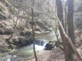
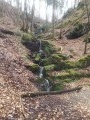
(6) Turn right and cross the bridge, then head up the path. At the Fork in the road, take the right-hand path. Leave the signposted route for a short while. Head uphill, keep to the left, go straight on at the junction, then turn left. There’s a beautiful waterfall; head down to the path and continue to the right. You’ll rejoin the signposted route.
(7) Pass Bauernmühle and carry on straight ahead. Keep following the river; there’s another paved section. Cross one bridge, then a second, and then a third.
(8) There’s a shelter on your right just before the climb. Follow the signposted path uphill to the wider track, which you’ll follow, this time with the Frankweiler Bach on your left. At the bend, turn left to head down towards the bridge, which you’ll cross. Continue to the right. Further on, cross another bridge.
(9) Then turn right and take the path. Walk uphill; there is a bench halfway up. Continue along the path, leave the forest and turn right. At the junction, carry straight on. Cross the cultivated fields. At the end of the field on your left, turn right. At the T-junction, turn right and then left. Turn right at the first path. Walk downhill to the picnic table.
(10) Barreterley viewpoint. Retrace your steps and carry on to the right. Leave the forest, turn right and walk alongside the cultivated plot. Enter the forest again, keeping to your left. Further on, at the pond in the bend, take the path straight ahead. Then turn right. Stay in the forest with a view of the fields on your left.
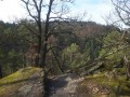
(11) Head off to your right and walk downhill to the viewpoint overlooking Schmausemühle. Retrace your steps and continue to the right. At the junction, go straight on and return to the starting gate and its car park (S/E).

 Visorando Member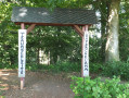

 Difficult