Country:
 City:
City:


Start: Forellenhof-Reinhartsmühle restaurant (Reinhardtsmühle 1, 55626 Bundenbach)
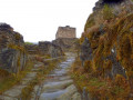
(S) We start the second stage of the Soonwaldsteig trail at the Forellenhof-Reinhartsmühle restaurant in the small hamlet of Rudolfshaus. The trail immediately climbs steeply uphill along narrow forest paths and rocky steps. While slate rock rises up on the left, the terrain drops almost vertically down to the Hahnenbach valley on the right. Shortly afterwards, you pass through two tunnels blasted into the rock.
These date back to the Friedrichsfeld mine, where lead and zinc ore was mined until the middle of the last century. Rails from a mine railway and the remains of a mine cart can still be seen at the side of the path today.
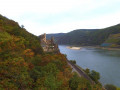
From small rock platforms, we can often catch a glimpse of the extensive Schmidtburg complex towering above the Hahnenbach Valley on a ridge.
(1) Shortly afterwards, we reach the Herrenberg visitor mine. Here, you can descend into the underworld and learn a lot about the extraction of roofing slate. The small museum with old mining equipment and fossil finds is also worth a visit.
(2) From the Herrenberg mine, the Soonwaldsteig trail leads us up to the Celtic settlement of Altburg. Here you will find a reconstruction of a 2,000-year-old hilltop settlement of the Treveri, who settled in the Hunsrück region in early times. From the Celtic settlement, the Soonwaldsteig trail leads into the idyllic Hahnenbach Valley.
(3) We cross the Hahnenbach stream via a metal bridge.
(4) From the Hahnenbach Valley, you can take a 300-metre detour to explore the ruins of Schmidtburg Castle. This served as a refuge for the robber chief Johannes Bückler, known as Schinderhannes. The ruins are open to visitors all year round.
From Schmidtburg, we enjoy a great view of the Hahnenbach Valley.
Back on the main route of the Soonwaldsteig, we now follow the signs into the Hahnenbach Valley Water Discovery Trail. Along the way, there are interesting information boards that teach us in a playful way how valuable natural watercourses are for the ecosystem.
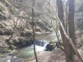
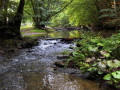
The long-distance hiking trail winds its way through the almost untouched valley along the middle slope upstream for quite a while. Next to the cheerfully babbling Hahnenbach stream, we also come across relics of the abandoned mining tradition.
(5) We pass a biotope pond and the Soonwaldsteig trail branches off to the right, leaving the Hahnenbach valley behind us. We hike uphill for a long time and then emerge into open fields.
(6) After leaving the forest, we follow the Soonwaldsteig trail to the left, then to the right. The trail then bends to the left and continues across the fields.
(7) Near the village of Schneppenbach, we cross the L184 and follow the route back into the forest.
(8) At the Alte Teufelsfelshütte, we turn left and shortly afterwards reach the Teufelsfels (9). This is a huge quartzite block that rises up in the middle of the Lützelsoon forest at an altitude of 569 metres.
Right next to it is a viewing tower, and from the top you have a view of the Idarwald and the Donnersberg in the North Palatinate Highlands.
Now we cross rocky scree and quartzite blocks lying wildly next to and on top of each other. Sure-footedness is essential here. Often, there is hardly any trace of a path. Only the numerous signposts ensure that you can find the route without any doubt.
(10) On the path leading straight ahead over the ridge, we pass the 596-metre-high Womrather Höhe and then reach the Blickenstein, which offers a great view and is located on the right-hand side.
We go back and follow the route straight ahead, then left, right at the crossroads and right again at the next one.
(11) After a while, we come to a crossroads, turn left and then right at the next junction. Then we go straight ahead across the next junction and take the next right.
(12) In the Simmerbach Valley, we cross the L 421 and the Simmerbach via a footbridge. We walk downstream along the stream for a short time. Then the long-distance hiking trail climbs very steeply up forest paths and steps into the slope.
(13) Above an old quarry, we come to a crossroads. From here, we enjoy a beautiful view of the Langenstein towering above the valley.
Then our path leads slightly to the right and climbs steeply once again, this time over quartzite blocks, into the mountainside.
(14) On the hilltop high above the Henau quarry, we are rewarded for our strenuous climb. From a bench, we can enjoy a sweeping view of the Kellenbach Valley, which separates the Lützelsoon from the Großer Soon.
We turn right and then keep left, and it is not far to Koppenstein Castle.
(15) It rises up in the middle of the forest and has a pentagonal keep that can be climbed. We climb up to the viewing platform. From a height of twenty metres, we can enjoy magnificent views of the Soonwald forest.
From the Koppenstein ruins, we descend to the district road that leads to Henau (E)
From here, the hotel's shuttle bus takes us to our accommodation in Gemünden.
 Visorando Member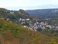
 Moderate