Country:
 City:
City:


Start: Koppenstein hiking car park on the K63
(S) From the Koppenstein hiking car park on the K63, turn left onto a narrow path into the mountain forest. Cross an open area and then follow the Soonwaldsteig trail to the left, gently sloping down into the Asbach valley.
(1) At the next crossroads, turn right and cross the Asbach stream on a narrow wooden footbridge. Then turn left along the water, then right and immediately left again uphill.
(2) After crossing the L229, the trail alternates between forest plots and meadows with a few detours up to the Alteburg.
(3) In ancient times, there was a Celtic rampart from the La Tène period on the 620-metre-high hill. There is now a 20-metre-high observation tower here. On a clear day, you can see the highest mountain in Rhineland-Palatinate, the 816-metre-high Erbeskopf, from the Alteburg tower. The North Palatinate mountain range and even parts of the Eifel can also be seen from here.
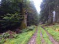
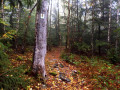
Now we enter the majestic beech forests of the Mittelsoon. The Soonwaldsteig trail runs along paths at ground level between the towering beech trunks and under the wide-spreading tree crowns. But we also pass through healthy coniferous forests, whose rich green branches reach down to the ground.
(4) We finally pass the "Runde Tanne" crossroads and turn right, then left at the next junction.
(5) From the hiking car park on the L108, the trail initially continues straight ahead over bumpy quartzite rock, then branches off to the left and climbs up to the highest point in the Soonwald forest.
(6) You have reached the 658-metre-high Ellerspring. At the summit is a 107-metre-high telecommunications tower.
From the Ellerspring, the Soonwaldsteig trail descends into the headwaters of the Gräfenbach and Lametbach streams. At the next crossroads, turn right and cross the Gräfenbach stream.
(7) The hiking trail now runs along soft paths through marshy wet meadows along the Gräfenbach. As a 26-kilometre-long tributary of the Ellerbach, the Gräfenbach rises near the Ellerspring and then flows between two large ridges of the Soonwald into the Glashütter Wiesen nature reserve.
(8) We turn left and pass the sprawling Alberteiche oak tree before entering the nature reserve. At the next crossroads, we turn left and then right at the next intersection.
(9) The trail leads through the Schwabbelbruch nature reserve. Since 1982, the forest has been left to its own devices. Hornbeams, birches and black alders have been thriving in the damp Schwabbelbruch under jungle-like conditions ever since. We follow the Soonwaldsteig trail to the left and then turn right at the second intersection.
(E) We then reach the L242, the end of today's stage.
 Visorando Member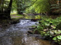
 Difficult