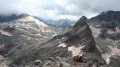
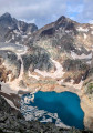
Pic des Spijeoles as seen from Les Granges d’Astau

A very long and demanding summer hike, taking you up to the Pic des Spijeoles, one of the most accessible 3,000-metre peaks in the Luchon area, offering a magnificent, sweeping panorama of the Pyrenees. It is possible to split the hike over two days by stopping to spend the night at the Espingo refuge near the (2).

Details

34462224
Creation:
Last update:
Last review:
  • Walking
    Activity: Walking
  • ↔
    Distance: 12.85 mi
  • ◔
    Duration according to the author: 10 hrs 
  • ▲
    Difficulty: Very difficult

  • ⚐
    Back to start: Yes
  • ↗
    Ascent: + 6,824 ft
  • ↘
    Descent: - 6,808 ft

  • ▲
    Highest point: 9,954 ft
  • ▼
    Lowest point: 3,737 ft

Photos

Description of the walk

Park at the large Granges d’Astau car park, which is the starting point for many hikes and therefore often fills up quite quickly.

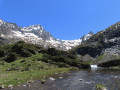
(S/E) Take the GR®10 straight ahead, heading towards Lac d’Oô. The climb to this lake, which is very popular with walkers and families, is a gentle one through the forest. You’ll reach the lake and the Refuge d’Oô.

(1) Continue along the GR® which climbs to the left above the lake, towards the Col d’Espingo. The climb becomes steeper towards the end, where you leave the GR®, which veers off to the left, and carry on straight ahead to the pass. You’ll then discover the Cirque d’Espingo, surrounded by numerous 3,000-metre peaks, including the Pic des Spijeoles.

(2) Continue straight on towards the back of the cirque, keeping Lac d’Espingo on your right. The path descends slightly at first to Lac Saussat.

(3) Go round it to the west, then head back up towards the Coume de l’Abesque. You’ll reach a point a few metres before the path crosses the torrent via a footbridge.

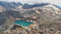
(4) Take the path on the right and follow the cairns. This marks the start of the challenging part of the hike: the ascent of Pic des Spijeoles. From here to the summit, keep an eye out for the cairns marking the path. Start in the mountain pastures, then tackle a more challenging and physically demanding section through the scree. Climb gradually, skirting the Spijeoles to the left, until you reach a flat area containing a small, unnamed lake, upstream of Lac Glacé.

(5) Turn right and continue to follow the cairns, carrying on across the scree and then over the rocks, where you may occasionally need to use your hands to reach the summit ridge of Pic des Spijeoles via an exposed path that veers to the right at the very end. Take in the view of the region’s peaks from here.

(6) Descend carefully, using downclimbing techniques if necessary, to the junction by the unnamed lake.

(5) Continue along the same route as on the way up, but in the opposite direction, to reach the Granges d’Astau car park (S/E)

Waypoints

  1. S/E : mi 0 - alt. 3,737 ft - Car park - Les Granges d’Astau
  2. 1 : mi 1.96 - alt. 4,938 ft - Mountain hut and - Lac d'Oo
  3. 2 : mi 3.44 - alt. 6,450 ft - Refuge d'Espingo
  4. 3 : mi 3.82 - alt. 6,309 ft - Lac Saussat
  5. 4 : mi 4.75 - alt. 6,844 ft - Footbridge
  6. 5 : mi 5.82 - alt. 9,009 ft - Small, unnamed lake
  7. 6 : mi 6.29 - alt. 9,941 ft - Pic des Spijeoles (3065 m)
  8. S/E : mi 12.85 - alt. 3,737 ft - Car park - Les Granges d’Astau

Notes

A demanding, very long and physically challenging hike. It requires excellent physical fitness and should only be undertaken in summer (wait until the end of June) to avoid snow. Make sure you take plenty of water.

There are no particular technical difficulties in good weather, but it should be avoided if rain is forecast for the day.

Always be cautious and plan ahead when you're outdoors. Visorando and the author of this route cannot be held responsible for any accidents occurring on this route.

The GR® and PR® markings are the intellectual property of the Fédération Française de Randonnée Pédestre.

Reviews and comments

4.3 / 5
Based on 2 reviews

Reliability of the description
4.5 / 5
Ease of following the route
4 / 5
Route interest
4.5 / 5
EstelleKbs
EstelleKbs

Overall rating : 4.7 / 5

Date of your route : Oct 19, 2025
Reliability of the description : ★★★★★ Very good
Ease of following the route : ★★★★☆ Good
Route interest : ★★★★★ Very good
Very busy route : No

We did the hike yesterday and it took us 11 hours. It took us longer than expected to get through the scree before the frozen lake because it was a bit icy. There's a slightly exposed section in the chimney and before reaching the summit, so it's best not to be prone to vertigo, but with your hands it's fine.
The view from the summit is incredible and all that hard climbing is well worth it!

Machine-translated

Lynda-Fabien
Lynda-Fabien

Overall rating : 4 / 5

Date of your route : Sep 09, 2025
Reliability of the description : ★★★★☆ Good
Ease of following the route : ★★★★☆ Good
Route interest : ★★★★☆ Good
Very busy route : No

A very beautiful route, completed in early September. The estimated time is quite generous (I personally completed it in 8.5 hours). The only place where you need to be careful is the final climb. You should not head towards a very visible gap, but stay to the right and follow the cairns, which are sometimes difficult to see on the climb.

Machine-translated

Other walks in the area

For more walks, use our search engine .

The GPS track and description are the property of this route's author. Please do not copy them without permission.