


Refine your search for walks in Sommet de Batailler (2748m)
Sommet de Batailler (2748m) walks


 Visorando Member
Walks near Sommet de Batailler (2748m)
 The balcony path between Aiguilles and Ville-Vieille
 6.59 mi
 +1,591 ft
 -1,854 ft
 4h 25
4h 25
 Moderate
 Departure from Aiguilles (Hautes-Alpes)
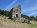
The walk mostly follows a ridge above the Guil valley between Aiguilles and Ville-Vieille. We recommend returning via the free shuttle bus, which runs between Château-Queyras and L’Échalp.
Saint Véran – Refuge de la Blanche
 10.15 mi
+4,537 ft
-3,035 ft
8h 35
10.15 mi
+4,537 ft
-3,035 ft
8h 35
 Difficult
Departure from Saint-Véran (Hautes-Alpes)
Difficult
Departure from Saint-Véran (Hautes-Alpes)
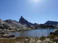
This serves as an introduction to a cross-border trek between Saint-Véran and Larche. We set off from the mountain pastures for a gentle approach to the border, through a rocky and colourful landscape that can at times be quite disorientating. There are no real difficulties, but a good understanding of how to read the terrain is sometimes necessary to avoid losing your way.
From Saint-Véran to Larche: Ubaye Transfrontière
49.21 mi
+20,728 ft
-21,916 ft
5 days
 Very difficult
Departure from Saint-Véran (Hautes-Alpes)
Very difficult
Departure from Saint-Véran (Hautes-Alpes)
A fantastic Franco-Italian ride between Saint-Véran and Larche! It will take you through strange places, from the solitary, green rocky landscapes of Saint-Véran to the fantastical, almost Dolomite-like terrain of the massif between Chambeyron and Orrenaye.
Saint Véran - Col Agnel
 8.02 mi
+3,468 ft
-1,683 ft
6h 45
Difficult
Departure from Saint-Véran (Hautes-Alpes)
8.02 mi
+3,468 ft
-1,683 ft
6h 45
Difficult
Departure from Saint-Véran (Hautes-Alpes)
The fourth stage takes you towards the Italian border, offering beautiful views of Mont Viso.
Saint-Véran – Agnel Mountain Hut
 9.64 mi
+3,963 ft
-2,103 ft
7h 55
Difficult
Departure from Saint-Véran (Hautes-Alpes)
9.64 mi
+3,963 ft
-2,103 ft
7h 55
Difficult
Departure from Saint-Véran (Hautes-Alpes)
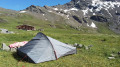
This is the second stage ofthe GR®®58, but it takes a variant route via the Col de Saint-Véran or the Col de la Cavale and includes an ascent to an altitude of 3,000 metres at the Pic de Caramantran. There’s a magnificent view of Mount Viso at the highest point of this route. At the start of the season, there were still plenty of snowfields. This is a very wild route, which I recommend as an alternative to the Col de Chamoussière path, which tends to be quite busy.
The Refuge de la Blanche, starting from Saint-Véran
 8.69 mi
+1,814 ft
-945 ft
5h 35
Moderate
Departure from Saint-Véran (Hautes-Alpes)
8.69 mi
+1,814 ft
-945 ft
5h 35
Moderate
Departure from Saint-Véran (Hautes-Alpes)
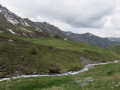
Via the Grand Canal, now completely disused, a long crossing opposite the Grande Tête des Toillies, ending at the Refuge de la Blanche and then at the observatory car park.
Le Cros - Refuge de la Blanche
6.63 mi
+2,943 ft
-906 ft
5h 35
Difficult
Departure from Saint-Véran (Hautes-Alpes)
This is the first stage of this journey, half in Queyras and half in Ubaye. Follow the right bank of the Aigue Blanche, then continue along the Col de Saint-Véran trail, before enjoying a beautiful descent that leads to the lake and the Refuge de la Blanche.
Abriés - Aiguilles
 8.56 mi
+3,501 ft
-3,793 ft
7h 00
Moderate
Departure from Abriès (Hautes-Alpes)
8.56 mi
+3,501 ft
-3,793 ft
7h 00
Moderate
Departure from Abriès (Hautes-Alpes)
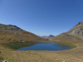
The seventh and final stage takes you past the Malrif lakes under the ridge separating Queyras and Briançonnais.
Tour du Queyras
56.34 mi
+22,976 ft
-22,575 ft
7 days
Moderate
Departure from Château-Ville-Vieille (Hautes-Alpes)
The Tour du Queyras, labelledGR®58, is adaptable. The route described, starting from Château Queyras and completed in a group in September 2008, will take you through this natural park, skirting and climbing some 3,000 metres. You will discover the beautiful villages of this park with their well-known names: Ceillac, Saint Véran, Abriés... What's more, in summer the weather is almost always fine. The bright blue sky the next day will quickly make you forget the storm of the previous evening.
Chateau Queyras - Montbardon
 5.97 mi
+2,717 ft
-2,169 ft
5h 05
Moderate
Departure from Château-Ville-Vieille (Hautes-Alpes)
5.97 mi
+2,717 ft
-2,169 ft
5h 05
Moderate
Departure from Château-Ville-Vieille (Hautes-Alpes)
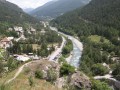
This is the first stage of the tour and is an adaptation as the route is not on theGR®58, but it allows you to visit the castle that dominates the Guil pass.
(Please note) The Montbardon stopover lodge (Le Cadran Solaire) has been closed since 2018, so the best option from Château Queyras is to go directly to Ceillac via the Col Fromage.
(Important note): See this website mentioning the reopening of this lodge for summer 2023.