Along the Guil d’Aiguilles to Ristolas

A walk starting from the town hall in Aiguilles, following the River Guil to Ristolas and finishing in Abries.

Details

n°39185106
Creation:
Last update:
Last review:
  • Walking
    Activity: Walking
  • ↔
    Distance: 7.81 mi
  • ◔
    Average duration: 4h 15 
  • ▲
    Difficulty: Moderate

  • ⚐
    Back to start: No
  • ↗
    Ascent: + 797 ft
  • ↘
    Descent: - 528 ft

  • ▲
    Highest point: 5,367 ft
  • ▼
    Lowest point: 4,780 ft

Description of the walk

Start from Aiguilles Town Hall.

(S) Cross Rue du Pied de la Ville and head opposite along Rue du Moulin, then cross the Guil bridge.

(1) Turn left onto the Route de Chabataron. Please note: the path leading towards Abries no longer exists due to a landslide on the left-hand side of the Pas de l’Ours; a new path is planned; take this if it has been completed, otherwise take the new, winding road for approximately 1 km.

(2) Return to the main route, leave the bridge on your left and carry on straight ahead. Pass the Le Gouret campsite, walk right through it and then, a little further on, pass the Azak Mushing dog-sledding centre, still following the Guil on your left. Keep going straight on, ignoring the paths on your right. As you approach Abriès, the path narrows and runs as close as possible to the river.

(3) Carry on straight ahead, following the River Guil; do not take the bridge, but cross the Torrent de la Combette, then the Torrent de Peyrasse, and arrive at Ristolas on the Chemin des Maisons Neuves. At the end, turn right, cross the bridge over the Torrent de Ségure and turn left to reach Place Saint-Roch. Turn right onto Rue des Écoles, then left onto Rue du Sparvetre. Pass the Ristolas town hall; at the end of this street, turn left onto Rue du Buc des Cournailles and cross the bridge.

(4) Turn right immediately and follow the Torrent de Ségure, then the Guil. Further on, cross the river to the right and turn left straight away to reach a road. Follow it carefully to the left, then, further on, at the Fork in the road, leave the road and turn left. Stay on this path, ignoring the side tracks, and continue to follow the Guil until you reach the bridge on the left.

(5) Do not cross the bridge; instead, turn right onto the Chemin de Marassan. At the crossroads, turn left onto Rue Ventrale, which leads to Abries Town Hall (E).


Waypoints

  1. S : mi 0 - alt. 4,810 ft - Aiguilles Town Hall
  2. 1 : mi 0.15 - alt. 4,783 ft - Turn left onto Rue Chabataron
  3. 2 : mi 1.03 - alt. 4,921 ft - Leave the bridge on your left
  4. 3 : mi 3.35 - alt. 5,062 ft - Bridge over the - Guil (rivière)
  5. 4 : mi 5.74 - alt. 5,292 ft - Follow the river
  6. 5 : mi 7.61 - alt. 5,056 ft - Bridge over the - Guil (rivière)
  7. E : mi 7.81 - alt. 5,079 ft - Abries Town Hall

Notes

Arrange for a second car to be waiting at the end of the route to take you back to the starting point, or return via the reverse route of the outward journey, taking the bridge at (5).
You’ll find a few drinking water sources along the way
Shops in Abries and Aiguilles
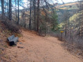
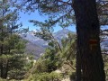
The route is mostly shaded.

Worth a visit

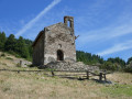
E very beautiful church in Abries, with its streets and shops.
Ristolas with its mountain atmosphere.

Reviews and comments

5 / 5
Based on 1 review

Reliability of the description
5 / 5
Ease of following the route
5 / 5
Route interest
5 / 5
fdigne
fdigne

There is indeed a path leading from Aiguilles on the left bank of the Guil, which was created following the rockfall at the Pas de l’Ours and which avoids the need to climb up and down the hairpin bends of the road.

Machine-translated

Alain DARMUZEY
Alain DARMUZEY

Overall rating : 5 / 5

Date of your route : Aug 27, 2024
Reliability of the description : ★★★★★ Very good
Ease of following the route : ★★★★★ Very good
Route interest : ★★★★★ Very good
Very busy route : Yes

We actually set off from the Gouret campsite. A lovely walk to get fit. There weren’t many people about as it was the end of the season.

Machine-translated

Other walks in the area

For more walks, use our search engine .

The GPS track and description are the property of this route's author. Please do not copy them without permission.