


 Country:
 City:
City:


To get there, from Nemours head towards the Museum of Prehistory and take thefirst road on the right (the road from Nemours to Poligny). After 1.8 km, you’ll see the entrance to the Monastery of Bethlehem on your right; drive past it, and immediately afterwards take the path on the left (which leads to the ‘mer de sable’) – the Chemin de Vallée aux Moutons – and park your car right at the entrance.
(S/E) From the car park, return to the road via a path branching off to the left of the ‘Chemin de la Vallée aux Moutons’. Cross the road and follow the path opposite; you’ll come to another cross-path that runs along the perimeter of the monastery grounds. Take this to the left, heading straight down to the next junction.
(1) Ignore the return route straight ahead; head up to the right along a path leading to the top of the hill, then turn right. The path heads north and then reaches a junction after a long bend to the left. Continue to the right and you’ll reach a crossroads at a place called Poligny (IGN map). Turn left at a 90° angle and follow the path to reach the Grotte du Troglodyte. Enjoy the panoramic view of the surrounding countryside (Gros Monts viewpoint).
(2) Walk behind the cave and follow the winding path between rocks and trees. At the first Y-junction, turn left, and do the same at the second Y-junction; you’ll pass in front of the Bois des Beauregards. Carry on and keep left again at the next Y-junction. You’ll reach the viewpoint at the bend in the path.
(3) Continue along the path heading north until you reach the next Y-junction, where you take the path running along the hillside to the left (along the slope). It descends gently to a four-way junction with movable wooden barriers.
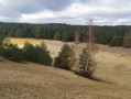
(4) Turn left onto the path which climbs the slope, skirting the quarry, which remains on your right. Once you reach the ridge, take a moment to admire the sand quarry – it’s a great spot for a break. This is the Pierre-le-Sault site; see Practical Information.
(5) Continue along the ridge path heading south until you reach a Fork in the road; turn left again to head down the slope. Once at the bottom, you’ll come to a T-junction.
(6) Turn left, walk uphill for a few hundred metres and you’ll reach the junction you passed on the way there.
(1) Heading back, continue along the route you took on the way there; follow the monastery fence for about fifty metres and turn onto the first path on the right. After about 400 metres, the path turns left, heading due east, and some 300 metres further on, it curves to the right.
(7) At this right-hand bend, leave the curve and take the first path on the left, which descends towards the road (Rue des Sables). Cross the road and continue straight ahead on the ascending path, which immediately forks into a Fork in the road. Take the left-hand fork until you reach the next junction.
(8) Turn right and stay on this path; ignore any side paths (particularly on the right) and keep to the left to reach the top of the Mer de Sable.
(9) Cross the Mer de Sable slowly to avoid falling into the dune (there are hidden stones). You will then reach a T-junction. Turn left; after 200 m you will join the (S/E).
 Visorando Member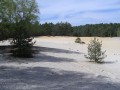

 Easy
Easy 
