Country:
 City:
City:



The route starts at Bagneaux-sur-Loing station (Transilien line R, on the section between Paris-Lyon and Montargis). Exit at the northern end of the platform, at the rear of the train when arriving from Paris.
(S/E) On leaving the station, turn right (eastwards) onto Rue de la Gare. Walk past the beautiful town hall on your left and cross the junction. Then turn left onto Rue de la Poste and immediately left again onto the narrow Chemin des Amoureux. At the end, turn right onto Rue de la Ballastière and follow it to the Canal du Loing.
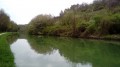
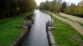
(1) Turn left and walk along the canal on your right-hand side. Pass a lock, continue along the canal and note the sports grounds on the opposite bank, followed by a campsite.
(2) At the boundary between the campsite and a woodland, go down a few steps on the left. Continue straight ahead, cross the D40 and then the railway line at the level crossing. Take the first left onto Rue de la Cabone.
(3) After about a hundred metres, turn right between two boundary walls. Head up a path (closed to cars by a barrier) which leads into the forest. Further on, you’ll come out onto a small road at the edge of the forest.
(4) Follow the road to the right (caution: there is no hard shoulder for about a hundred metres of the descent, but very little traffic).
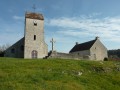
(5) Cross the D118 at a place called Le Petit-Bagnaux and carry on straight ahead towards the castle. At the T-junction, turn left and go straight on until you reach the interesting Church of Saint-Sulpice (13th–14th centuries).
(6) Go round the church on the left and head up to the right through the green space to join a small road.
(7) Follow the road to the left and go round the castle on the right via Rue du Château. At a Fork in the road, keep to the right.
(8) At the T-junction, turn right onto a good path that climbs between a large estate on the left and the forest on the right. Pass a pile of rocks (marked as a cave on the map) and enter the forest.
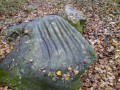
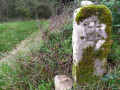
(9) At the crossroads, take the path furthest to the left and continue to polishing stone no. 8.
(10) Turn slightly left and you’ll soon reach a junction.
(11) Turn left at polishing stone no. 7, which is clearly signposted by signposts at the side of the path. Retrace your steps.
(11) Continue left (south-west) along the main path. At the junction (elevation 110), go straight on to polishing stone no. 6, situated amongst a group of large boulders.
(12) Continue south-west along the sunken path (do not turn back as suggested by the ‘official’ route). After about 75 m, follow a path on the right for just under 100 metres until you reach a wild boar feeding area. Just before entering this area, take one of the tracks (barely visible: almost entirely easy going) on the left which climbs up the embankment to rejoin a good path at the top.
(13) Follow this yellow-marked path to the left. You’ll emerge onto Rue des Roches; follow it to the right as it climbs. At a cross, leave the road and take a path that climbs to the left (still marked in yellow). After about 500 m, you’ll reach a junction (a picnic area in the shade of the oak trees).
(14) First turn right then left to reach polishing stone no. 5, one of the most notable in the series.
(15) Retrace your steps.
(14) Continue south-east. Climb slightly and then descend to the hamlet of Laveaux. At the crossroads, continue straight ahead along the tarmac road (dead end) and cross through the hamlet. Pass a riding centre and enter the woods.
(16) Leave the main track and take a path branching off to the right. After about 400 m, the path climbs onto the plateau and continues along the edge of the woods.
(17) At a fork in the road, turn right and enter the woods. Cross the woods heading south-west (yellow markings).
(18) At the crossroads, turn right. At the end of the path, first turn right then left (marker no. 2) then proceed to marker no. 3, both clearly signposted. Continue to marker no. 4.
(19) Retrace your steps.
(18) Take the path opposite and cross the woodland, heading due east, following the yellow markings. Leave the woodland, ignore a path on the right and continue between the fields. Climb slightly, ignoring a path on the left and then one on the right.
(20) At the junction at the top of the (gentle) slope, turn left. At the edge of the woodland, turn left then right to enter the woodland. When the main path turns left, take a well-marked path on the right.
A few steps after leaving the woodland, note the fine coat-of-arms marker on the left.
(21) Carry on straight ahead along the edge of the woodland. Ignore a path branching off to the right and enter the woodland. Return to the edge of the woodland and head for the pair of polishing stones no. 1 (without grooves, just a hollow).
(22) Continue along the path at the edge of the field, which turns into a very pleasant path as it enters the woods. Walk downhill to a tarmac road. Follow this road to the right and uphill.
(23) Just before the highest point, take the first path on the left. Walk alongside Bois Lorin on your right, then enter the woods. At the T-junction, turn left.
(24) Shortly afterwards, take the first path on the right, at the edge of the woods. Enter the woods again, leave them shortly afterwards, then enter them once more. Continue straight ahead until you descend past the cemetery.
(25) Turn right and follow Rue Grande to its end at the junction with the D118. Follow this road to the left and you’ll come to a junction you passed on the way there at Petit Bagneaux.
(5) Turn right to head back up the road you came down on the way there.
(4) At the edge of the forest, carry on straight ahead along the small road between the fields. Pass by the base of the masts and turn right with the road.
(26) Shortly after the masts, take the sharp left-hand bend on the road. At the next junction, go straight on and you’ll soon come to Bagneaux-sur-Loing station on your right (S/E).

 Visorando Member