Erdeven village trail

A hike along small roads and country lanes that will allow you to discover the maritime countryside of Erdeven. Discover the heritage of the area with a few chapels, springs and megaliths.

Details

3225262
Creation:
Last update:
Last review:
  • Walking
    Activity: Walking
  • ↔
    Distance: 7.71 mi
  • ◔
    Average duration: 3h 35 
  • ▲
    Difficulty: Moderate

  • ⚐
    Back to start: Yes
  • ↗
    Ascent: + 66 ft
  • ↘
    Descent: - 75 ft

  • ▲
    Highest point: 62 ft
  • ▼
    Lowest point: 10 ft
  • ⚐ Country: France
  • ⚐ City: Erdeven (56410)
  • ⚑
    Start/End: N 47.641586° / W 3.156833°
  • ❏
    IGN map(s): Ref. 0821OT
  • Hour-by-hour weather

Photos

Description of the walk

Go to Erdeven, to the car park either in front of or behind the Town Hall. The walk starts just behind the Town Hall, near the Tourist Office. The route is signposted, with a few variations.

(S/E) At the signpost for the start of the walks, turn your back on the Town Hall building and cross Place Saint-Margen, where you can park your car. Turn right onto Rue Vachter Lenn, then left onto Rue Soeur Maurice to leave the village.

(1) Before leaving the village, turn left onto Avenue des Îles, then immediately right onto a good path. A little further on, this path joins a carriage road, which you should follow. When you reach an intersection with a small road, turn right and continue north.

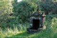
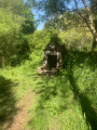
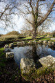
(2) Cross the D105 and continue straight ahead to reach the small hamlet of Sept Saints, pass by the small chapel and continue straight ahead. At the end of the road, turn right to make a round trip to the Fontaine des Sept Saints (Fountain of the Seven Saints). To do this, turn left at the first fork. Return to the hamlet and take the small path between two walls along a property at the start. This path will take you to Kerihuel.

(3) In Kerihuel, turn left to see a ruined burial mound about 150 metres away (the mound is on the left-hand side).

(4) Retrace your steps.

(3) Back in Kerihuel, turn left. Join the D105.

(5) Cross it and head towards the hamlet of Saint-Germain (dead end), passing between the various houses of varying ages. At a small intersection, continue straight ahead to the hamlet's chapel. To do this, ignore the first intersection and turn right along a wall onto a small path that leads you straight to the chapel.

(6) At the chapel, join the small road that you ignored just before and retrace your steps. At the intersection, turn right onto the tarmac road, continue on the tarmac in the bend that follows and continue on the carriage road through the fields.

(7) At the bend in the field and on a large path, turn right. This leads to a new hamlet to cross. Continue straight ahead at the intersection and cross another small hamlet. Turn left at the next intersection to reach Kergavat.

(8) Turn right twice to reach a wide path that runs through the fields. At the next crossroads, turn left, then why not make a return trip to see the Étang de Keravéon, although it is not very visible. Otherwise, turn left onto the small street. In the centre of the hamlet, go as far as possible along a small road that quickly turns into a farm track.

(9) At the first intersection with another farm track, continue straight ahead towards Erdeven, then continue straight ahead on a narrow path. Join a small road and turn left/right to rejoin a main road. Turn right and head towards Kervazic and its mobile homes.

(10) Follow the road and, at an electricity pylon, turn left onto a wide track that leads to a new housing estate. Continue straight ahead on Rue des Pierres Noires and go to the end.

(11) At the end of the street, turn right, then take the first left to reach the town centre. With the bell tower in your sights, continue along Rue de l'Océan. Just before the church, turn left, pass in front of the Tourist Office and turn right to return to your starting point (S/E).

Waypoints

  1. S/E : mi 0 - alt. 59 ft - Place Saint Margen
  2. 1 : mi 0.4 - alt. 52 ft - Intersection at the exit of Le Bourg
  3. 2 : mi 1.45 - alt. 52 ft - Crossing the D105
  4. 3 : mi 2.28 - alt. 43 ft - Kerihuel
  5. 4 : mi 2.39 - alt. 62 ft - Tumulus de Run-er-Sinzen
  6. 5 : mi 2.85 - alt. 23 ft - Crossing the D105
  7. 6 : mi 3.24 - alt. 49 ft - Chapel of Saint-Germain
  8. 7 : mi 3.85 - alt. 52 ft - Intersection of wide paths
  9. 8 : mi 4.85 - alt. 39 ft - Kergavat
  10. 9 : mi 6.02 - alt. 36 ft - Intersection to return to the village
  11. 10 : mi 6.74 - alt. 49 ft - Hamlet of Kervazic
  12. 11 : mi 7.35 - alt. 49 ft - T-junction
  13. S/E : mi 7.71 - alt. 59 ft - Place Saint Margen

Notes

Toilets are available at the starting point. The Tourist Office is also close to the starting point.
At point (9), it is possible to continue the hike along a section slightly further east.

Worth a visit

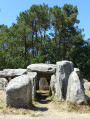
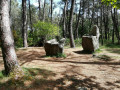
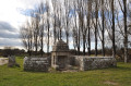
A short detour to an ancient burial mound (4).
There are other megaliths a little further away from the route. There are also a few chapels.

The Kerzerho alignments.

Reviews and comments

4.1 / 5
Based on 8 reviews

Reliability of the description
4.4 / 5
Ease of following the route
4.3 / 5
Route interest
3.8 / 5
Le Carrer Sylvie
Le Carrer Sylvie

Overall rating : 4.7 / 5

Date of your route : Nov 11, 2025
Reliability of the description : ★★★★★ Very good
Ease of following the route : ★★★★★ Very good
Route interest : ★★★★☆ Good
Very busy route : No

A very beautiful walk through the countryside of Erdeven, which allowed us to discover pretty villages and beautiful old houses. The weather was ideal for walking and enjoying the scenery. For those who only like flat terrain, I recommend this walk.

Machine-translated

Periode Kara
Periode Kara

Overall rating : 3.7 / 5

Date of your route : Nov 27, 2023
Reliability of the description : ★★★★☆ Good
Ease of following the route : ★★★☆☆ Average
Route interest : ★★★★☆ Good
Very busy route : No

A bit of confusion at the start: we couldn't find the signpost for the start of the walks.
Once underway, you need the map and directions at certain junctions, because the signs are far away or misplaced.
The villages we passed through were interesting.
At point 9, the "narrow little path" had become a stream after all the rain.
On a very positive note: after the November storm, this was one of the very few routes to be completely cleared of the numerous trees and branches that must have blocked it.
A route with no difficulty whatsoever.

Machine-translated

Daoulagadglaz
Daoulagadglaz

Overall rating : 4 / 5

Date of your route : Jul 24, 2022
Reliability of the description : ★★★★☆ Good
Ease of following the route : ★★★★☆ Good
Route interest : ★★★★☆ Good
Very busy route : No

We were with children and only did half of it because it was a bit long, even though they were on bikes.

Machine-translated

Patrick Lucas
Patrick Lucas

Overall rating : 4.3 / 5

Date of your route : May 02, 2022
Reliability of the description : ★★★★☆ Good
Ease of following the route : ★★★★☆ Good
Route interest : ★★★★★ Very good
Very busy route : Yes

This hike is very interesting but should be done outside of the summer season as the beaches are very crowded.

Machine-translated

Elyane Norvez
Elyane Norvez

Overall rating : 5 / 5

Date of your route : Aug 24, 2021
Reliability of the description : ★★★★★ Very good
Ease of following the route : ★★★★★ Very good
Route interest : ★★★★★ Very good
Very busy route : Yes

This walk offers several points of interest: nature, heritage...

Machine-translated

Bernes29
Bernes29

Overall rating : 2.7 / 5

Date of your route : Jun 15, 2021
Reliability of the description : ★★★☆☆ Average
Ease of following the route : ★★★☆☆ Average
Route interest : ★★☆☆☆ Disappointing
Very busy route : No

Not much to discover or see
Flat, easy route suitable only for walking

Machine-translated

Phasme91
Phasme91

Overall rating : 4.3 / 5

Date of your route : Sep 10, 2020
Reliability of the description : ★★★★★ Very good
Ease of following the route : ★★★★★ Very good
Route interest : ★★★☆☆ Average
Very busy route : No

A pleasant hike, but a bit long and monotonous.

Machine-translated

brendan3
brendan3

Overall rating : 4.3 / 5

Date of your route : May 29, 2020
Reliability of the description : ★★★★★ Very good
Ease of following the route : ★★★★★ Very good
Route interest : ★★★☆☆ Average
Very busy route : No

It's a shame there's so much tarmac.
For a photographer, it's not particularly interesting.
The route has little shade, so it's best to do it early in the morning when the weather is hot and sunny.

Machine-translated

Other walks in the area

For more walks, use our search engine .

The GPS track and description are the property of this route's author. Please do not copy them without permission.